MapElevation |
Rockies :: Kananaskis :: Mt. Fortune |
GPS Track |
|
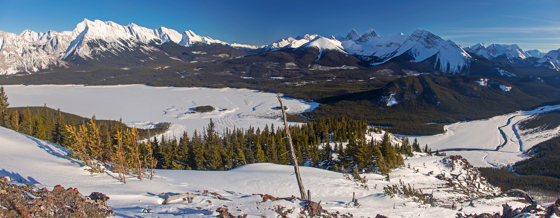 
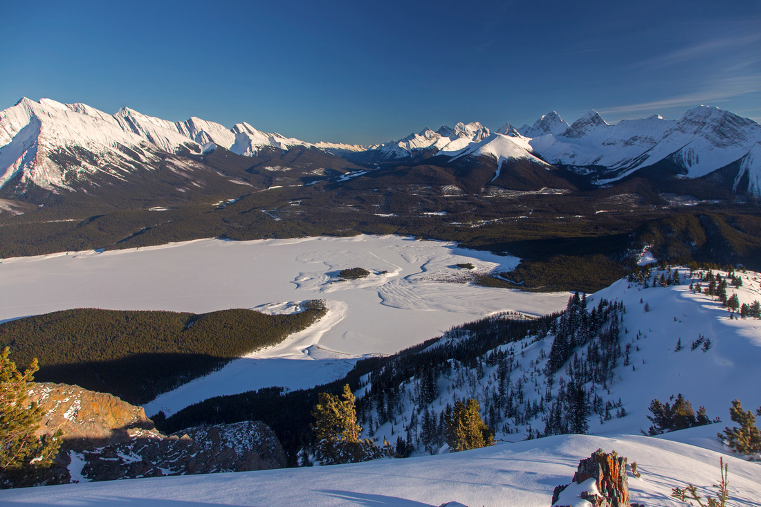
Upper ascent ridge near the summit with view of Spray Lakes and many distant K-country peaks |
|||
| Trip Summary | |||
March 18, 2016Mt. Fortune is relatively tame looking summit at west end of Spray Reservoir that boasts fabulous views. Since most direct approach involves crossing of the lake, this is a winter trip with optimal time window January - April. It is possible to ascend Mt. Fortune in summer too, but approach would involve rather circuitous trip via Bryant creek (as for Mt. Assiniboine), then what is probably pretty bad bushwhack through old burn on steep south slopes. Area is near continental divide and as such bluebird, calm days don't come too often. As the views are magnificent, save it for the clear day -- you'll be glad you did! This is also trip #23 in Nugara snowshoe guide. Mt. Fortulent is feasible extension, but much more involved affair that involves travel in high-risk avalanche terrain and some class 3 terrain near the summit. Drive to Mt. Shark parking lot and follow main X-country artery (heading for Watridge lake) for about 10 minutes to first major junction, then go right. Any direction will do from here and within 20-25 minutes from leaving the car you emerge at south end of Spray reservoir. The objective is visible across the lake on the left side. Any direction will do from here, but perhaps the most logical is to stay fairly close to south shore, cross couple of islands then aim directly towards left skyline ridge of Mt. Fortune. Don't go too far left as you might have to cross inlet of Bryant creek! Old logging road hugs the base of the peak; turn left and follow for few minutes, then head up through old burn trying to pick the least steep line. Depending on conditions snow might be hard packed and you will be able to boot up -- or it might be soft and sugary that will make you sink to your waist even with snowshoes! This part is the crux -- steep and awkward hour or two till you intersect the upper ridge. Here all difficulties are behind, and remainder is pure joy -- gently angled ascent in grand environment with spectacular 360 views. Upper ridge is often windblown, so if you are not going for Mt. Fortulent you can ditch the snowshoes and proceed in boots only. This ridge is very popular with mountain goats and their tracks typically lead in easiest direction! Final rise leads up to wide summit area with Alberta survey marker. Walk few minutes east to edge of drop off for even better views of Spray Lakes and peaks on east side of Smith-Dorrien corridor. If continuing to Mt. Fortulent, drop the obvious broad shoulder below Mt. Fortune then aim straight up. This ridge is steep and avalanche prone. Near the top there are couple of class 2-3 rock bands that can be either tackled directly of bypassed to the right. Beware of cornice that often hugs the ridge between twin summits of Mt. Fortulent. Return the same way. When snow conditions are stable and if you brought an ice-axe for self arrest, it is possible to speed up descent from Mt. Fortune by dropping to obvious avalanche gully on the west side of summit ridge. The hardest part is to get into this gully as it is fairly steep near the top. Remainder should be a memorable glissade and cut down descent time to north end of Spray Reservoir to less than half an hour. |
|
Gallery |
|||
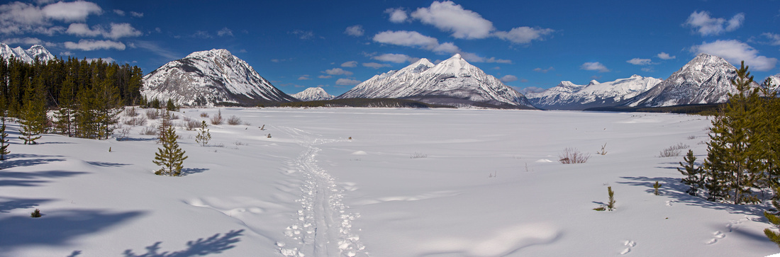 Panoramic view of Spray Reservoir from the south shore. Mt. Fortune left, Mt. Nestor in center
 |
|||
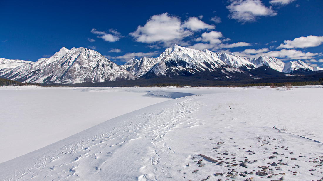 Mt. Engadine, Buller and Tower while crossing the reservoir
 |
|||
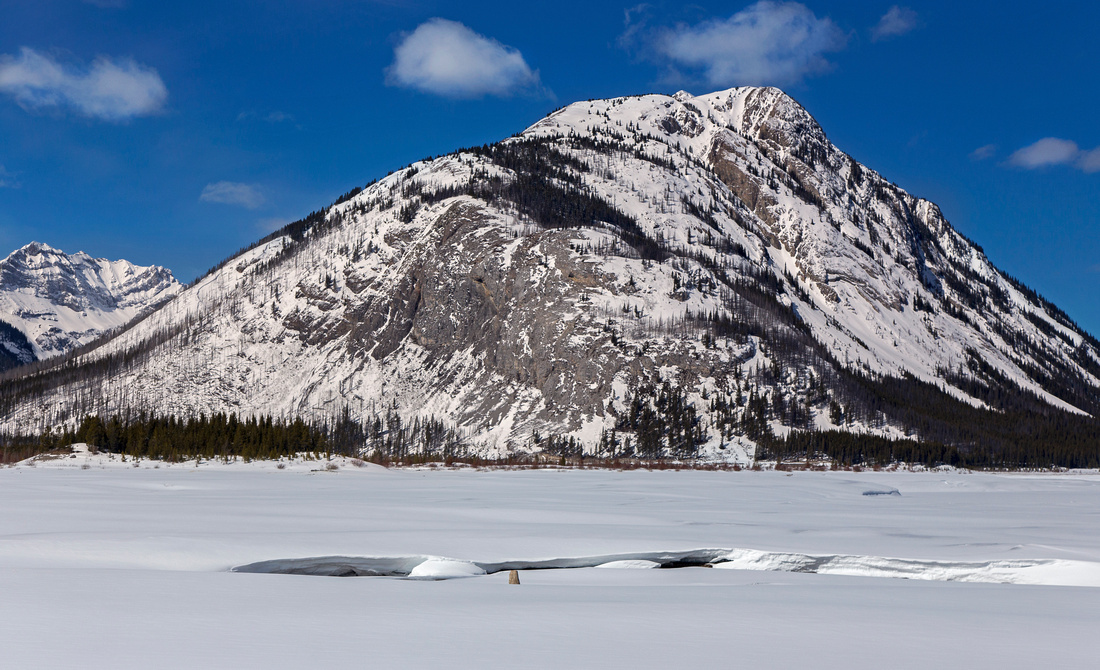
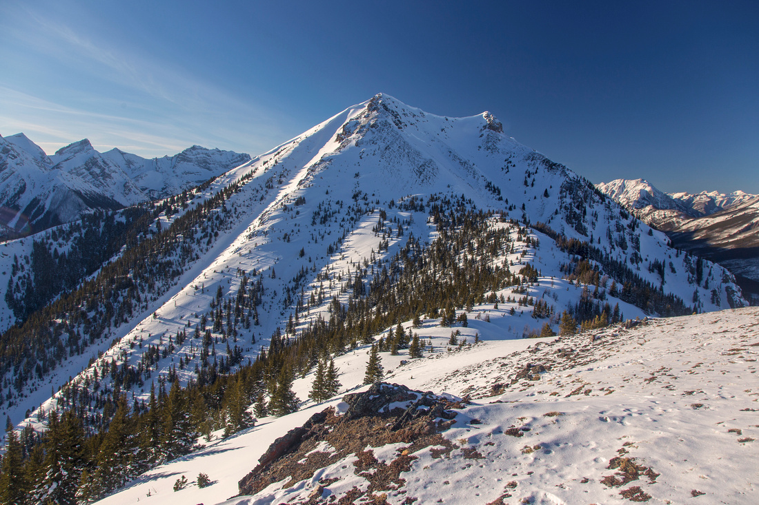
Mt. Fortune. Left skyline ridge is normal ascent line |
|||
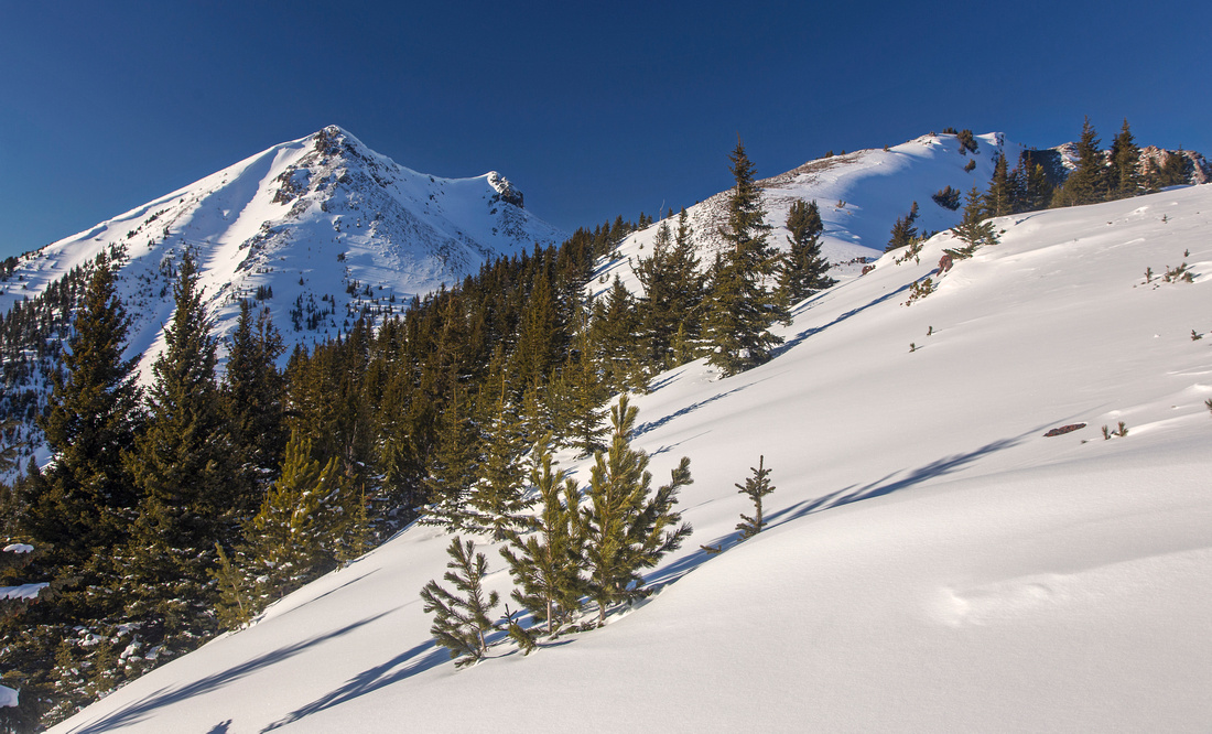 Upper ridge above the steep part. Mt. Fortulent left
 |
|||
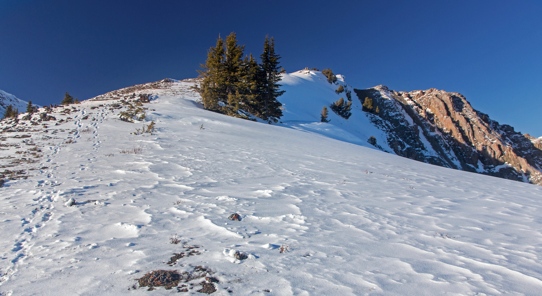 Final bit is gently angled and usually windblown
 |
|||
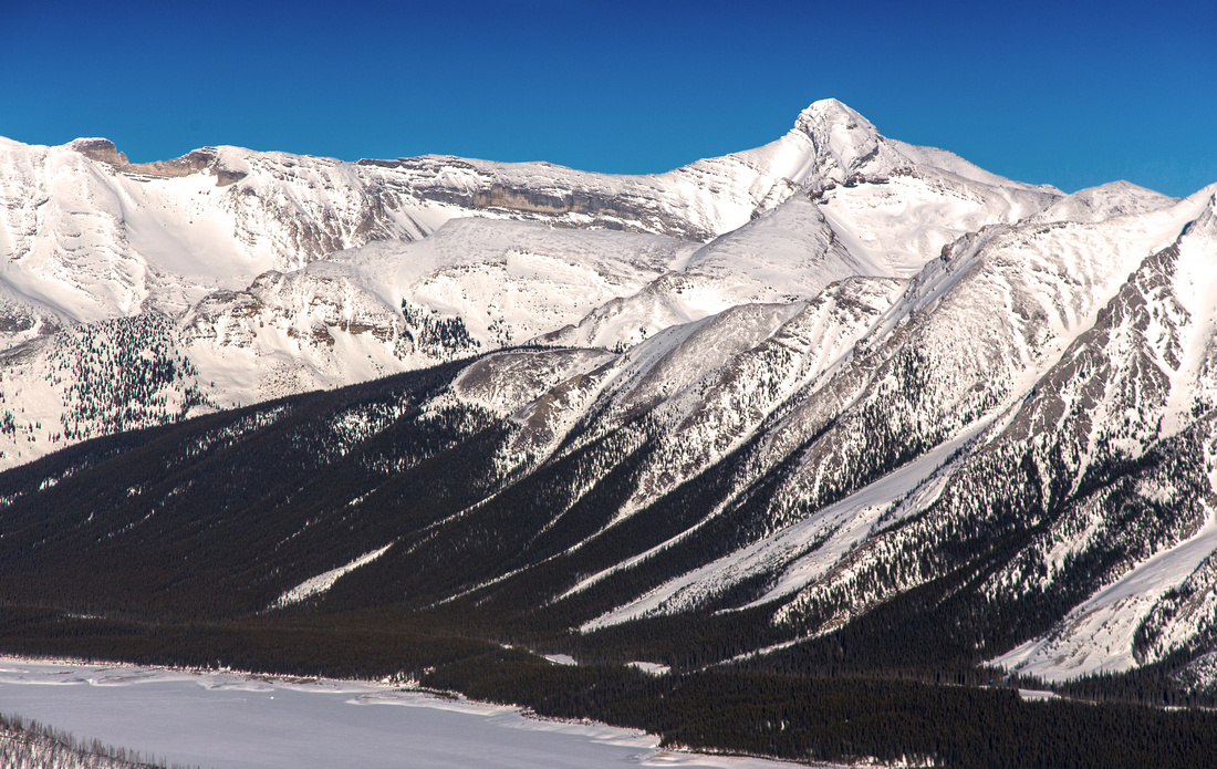 Zoom on Mt. Bogart and Red Ridge from the summit
 |
|||
 Mt. Fortulent from the summit of Mt. Fortune
 |
|||
 Spray Reservoir and upper ridge from the summit
 |
Abstract
| Overall Difficulty | D5 | Frozen lake crossing with possibility of open channels. Very steep slopes with deadfall. Strong, freezing winds on upper ridge sometimes make the final part very difficult. Considerably more difficult for Mt. Fortulent | |||
| Snow Factor | S4 | Steep ascent slope is in old burn that makes avalanche danger relatively low. Sugary and non-supportive snow. High avalanche danger for Mt. Fortulent | |||
| Scenery | Outstanding view of Spray Reservoir and many peaks along Smith-Dorrien corridor. Interesting ice formations on Spray reservoir (when not snow covered and ice is exposed) | ||||
| Trail/Marking | None | Network of cross-country skiing trails to south shore of Spray Reservoir only, but direction is generally obvious after that | |||
| Suggested Time | 7-8 hr | Return time for Mt. Fortune. Add 3 hours if continuing to Mt. Fortulent. | |||
| Elevation | Start: 1740 m Max: 2350 m Total: ~830 m (Mt. Fortune only) | Round Trip: ~14 km (Mt. Fortune only) | |||
| Gear | Snowshoes with gaitors and poles. Avalanche gear and ice-axe for Mt. Fortulent | ||||
| Water | Water can sometimes be found in open channels on Spray Reservoir. Snow melt. Carry 2L | ||||
| Dog Friendly | Yes | With bad snow conditions steep part of ascent might prove troublesome | |||