Google Map |
Rockies :: Icefields :: The Onion |
GPS Track |
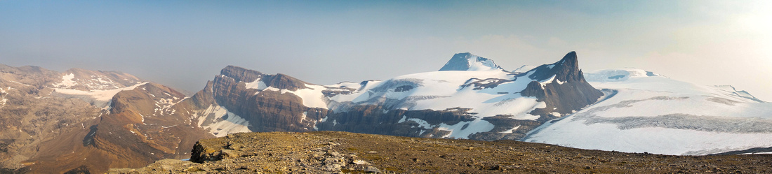 
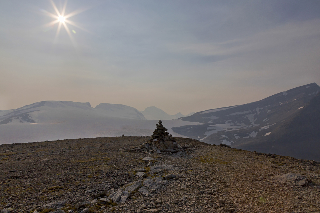
Panoramic View from Onion summit plateau. Wapta Icefield, St. Nick and Olive right, Crowfoot Mtn. far left |
|||
| Trip Summary | |||
August 3, 2017"The Onion" is unofficial name for high point of rocky ridge separating ACC Bow Hut and Iceberg Lake at edge of Wapta Icefield. The name probably comes due to its rounded shape when seen from popular Bow Falls trail, as well as "peeling" rock formations that were until recently under the glacial ice. According to some sources, alternate name is "Polaris Peak" -- most likely invented as catchy name by independent mountain guides for out of country visitors.
Wapta objectives are mainly in domain of winter mountaineering. However Onion route just manages to stay off the glacier and thus presents pleasant summer scramble. It can be done either as day trip from Bow Lake, or from overnight base at the Hut. Third option is camping on rocky plateau below the Onion -- illegal, but quite popular. While trip extensions (such as Mount Thompson) in summer require glacier crossing and thus fall into domain of mountaineering, pleasant option is return (or hike-in!) via Iceberg Lake.
Follow standard Bow Falls trail from parking by Num-Ti-Jah lodge on Icefields Parkway. This is the same approach as for Mt Jimmy Simpson, Iceberg Lake, and Crowfoot Tarn. Cross the wedged boulder on marked junction ~45min from trailhead and continue on more rough but still well defined Bow Hut trail. In summer this trail stays above the canyon and crosses several rock slides below Crowfoot Mountain. In winter follow ski tracks through the canyon, noting high avalanche risk due to closed terrain. Past the canyon there are couple of non-bridged glacial stream crossings (easy rock hop in middle and late summer). Trail swings right below the cliffs of Vulture Peak and steeply switchbacks up talus slope under the Hut. Last creek crossing just before the Hut is the most demanding, but should still be manageable without taking the boots off.
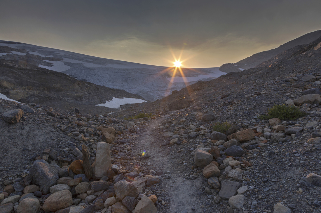
From the Hut trail continues up and reaches toe of Wapta Icefield in 15-20 minutes. Ascent route is now directly in front. There are several options, but easiest is to stay directly next to edge of glacier in lower part and when going becomes too difficult transfer over couple of rocky ribs to the right. Cairns provide assurance but are not always indicating the easiest way; micro-terrain route finding skills are important to keep the ascent in domain of easy scramble. Terrain is very interesting with many peeling rock slabs and small water pools seeping from glacial ice. Near the top angle right and trash up talus to vast summit plateau and hike up to enormous summit cairn. Views are phenomenal in all directions; walk few minutes north for bird-eye view of Iceberg Lake and snout of Bow glacier is a must! Also note easy drop to Wapta icefield west of Onion; it can be used as approach route for Mount Thompson and - besides 30 minutes spent on the glacier - would be entirely non-technical (This is also normal winter ski route).
Return is the same way, but for variety it is possible to traverse grassy shelf below the Onion to Iceberg Lake, then descend standard Iceberg Scramble route. After descending the talus slope below the Hut to valley floor turn right and simply follow obvious direction towards the lake. It takes about 30 minutes of super pleasant off-trail hiking with no difficulties along the way. This return is longer but more scenic as it extends the time in spectacular alpine.
|
|
Gallery |
|||
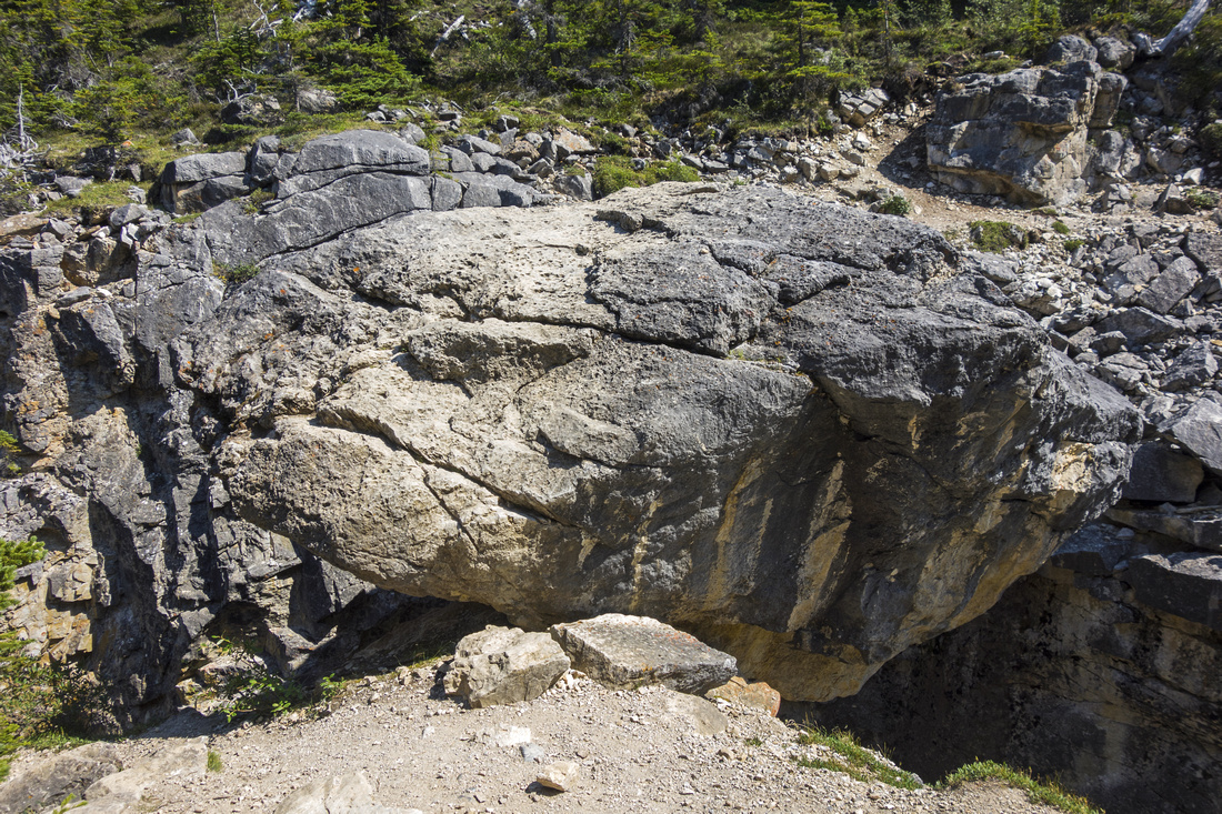 Wedged boulder on ACC Bow Hut junction
 |
|||
 Summer trail crossing large rock slide above the canyon
 |
|||
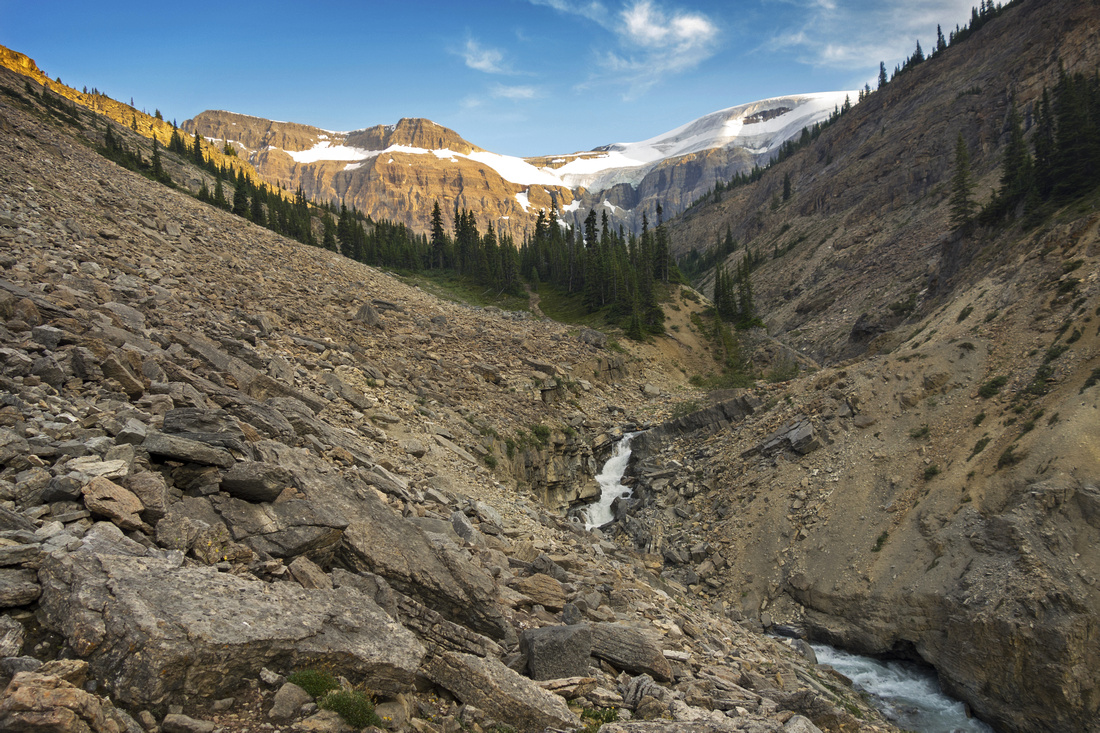
 Upper basin beyond the Canyon; St. Nicholas upper right
 |
|||
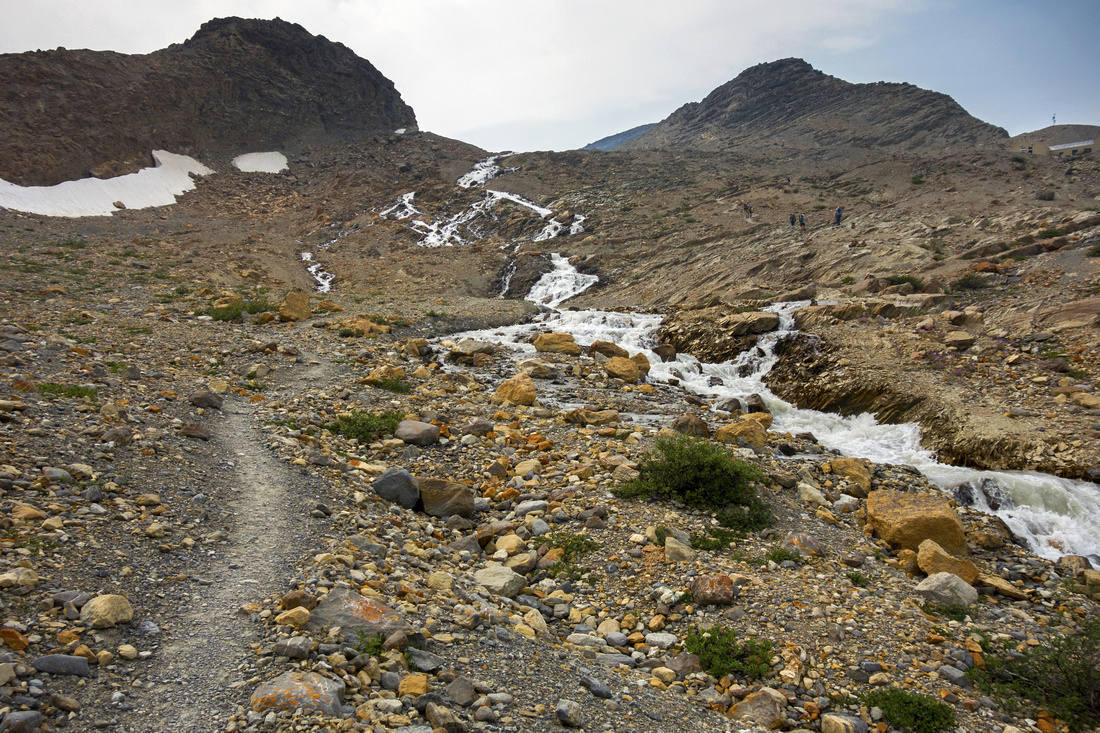 Crossing glacial creeks below Bow Hut (upper right)
 |
|||
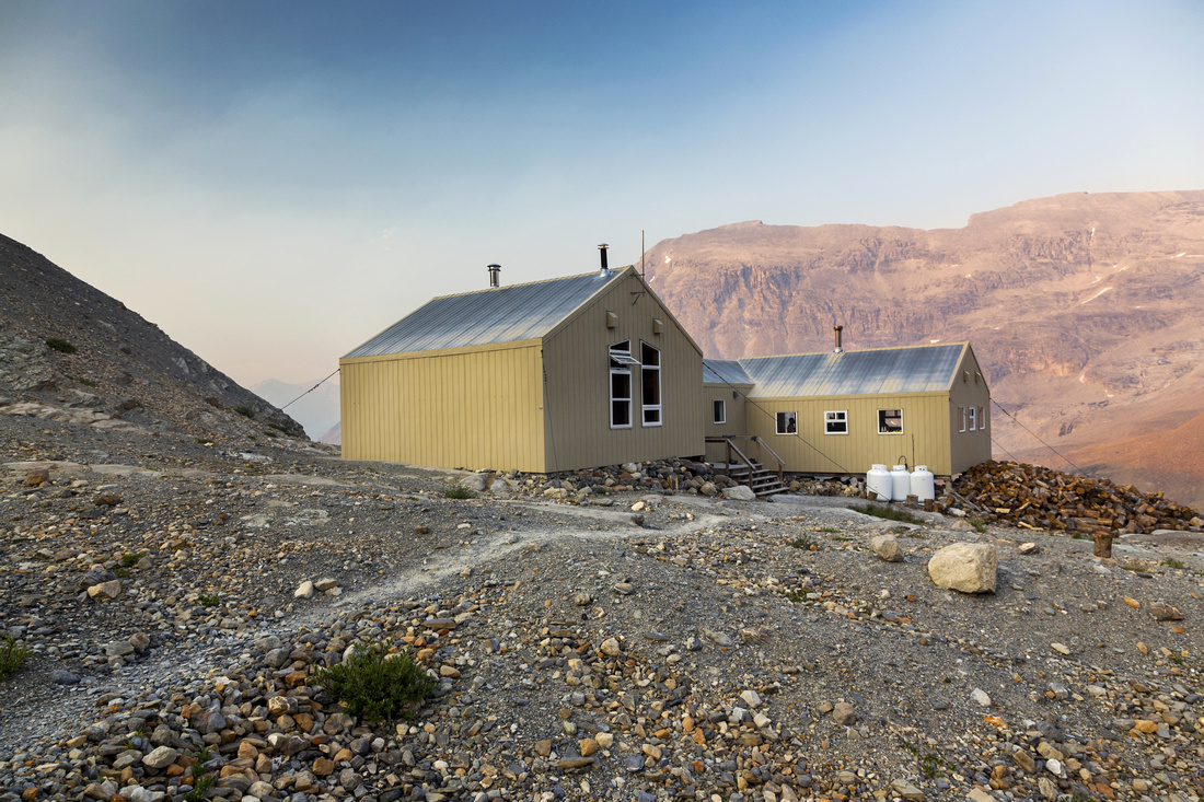 ACC Bow Hut ~3 hrs of moderate pace from Bow Lake
 |
|||
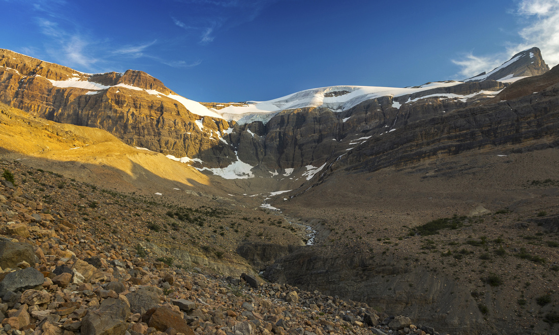
 Glacial melt at Wapta toe and start of scrambling route
 |
|||
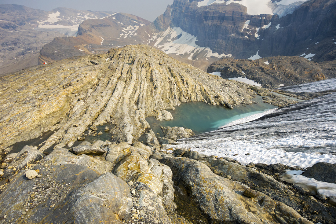 View down the scramble route at edge of Wapta Icefield
 |
|||
 Summit cairn and hazy views NW. Mt. Thompson far right
 |
|||
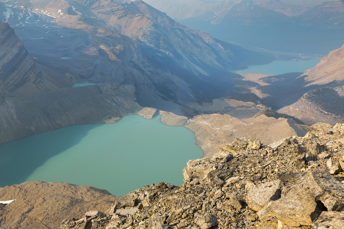 Summit view down to Iceberg Lake; Bow Lake upper right
 |
|||
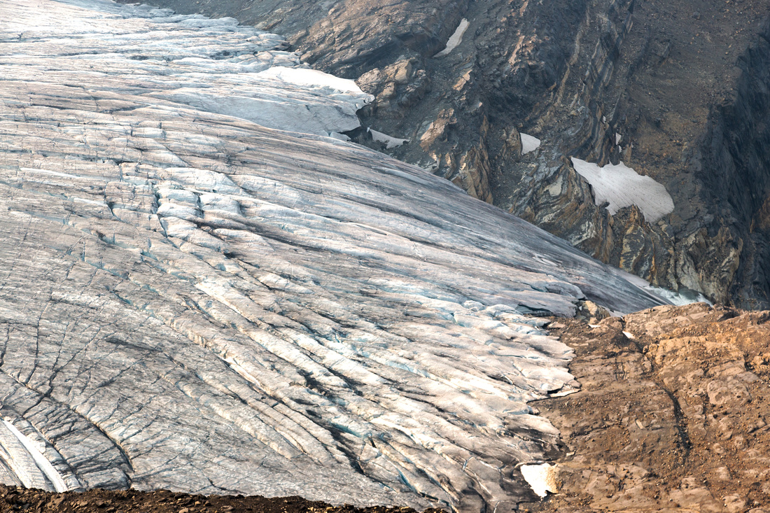 Bow Glacier cracked snout feeding Iceberg Lake
 |
|||
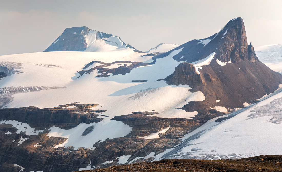 Winter mountaineering objectives: St. Nick right, Olive left
 |
|||
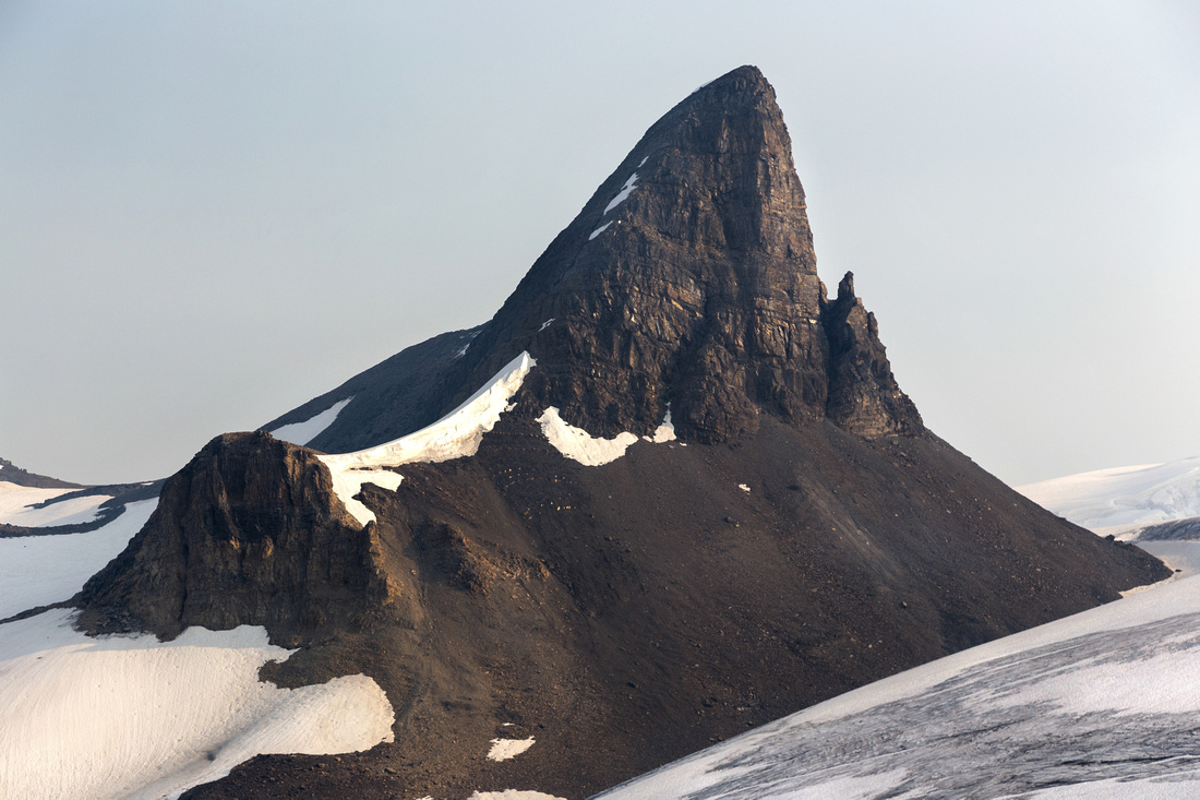 St. Nick telephoto; reminiscent of Black Tusk in Garibaldi Provincial Park on BC Coast
 |
|||
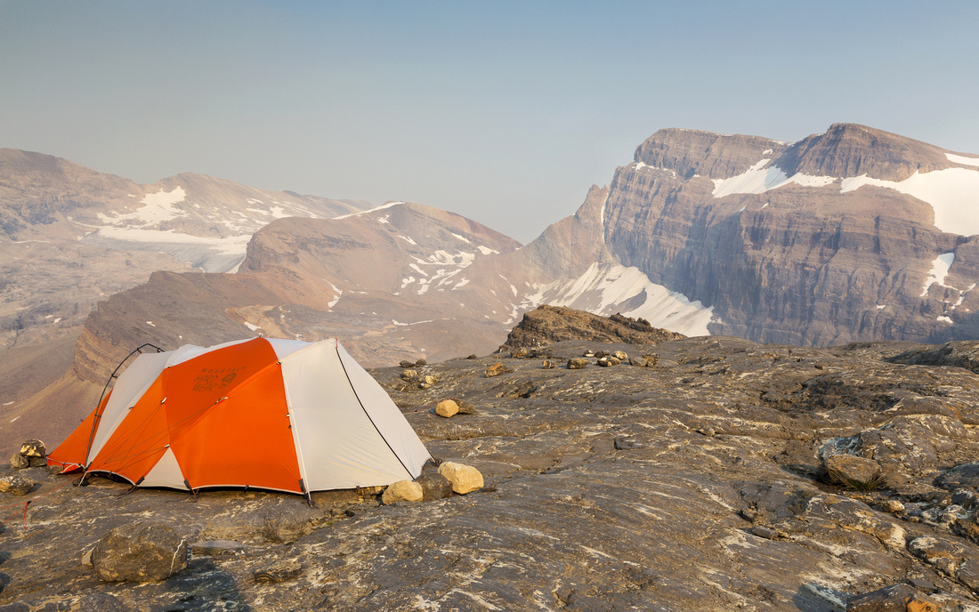
 Illegal "Tent City" on rocky plateau above Bow Hut
 |
|||
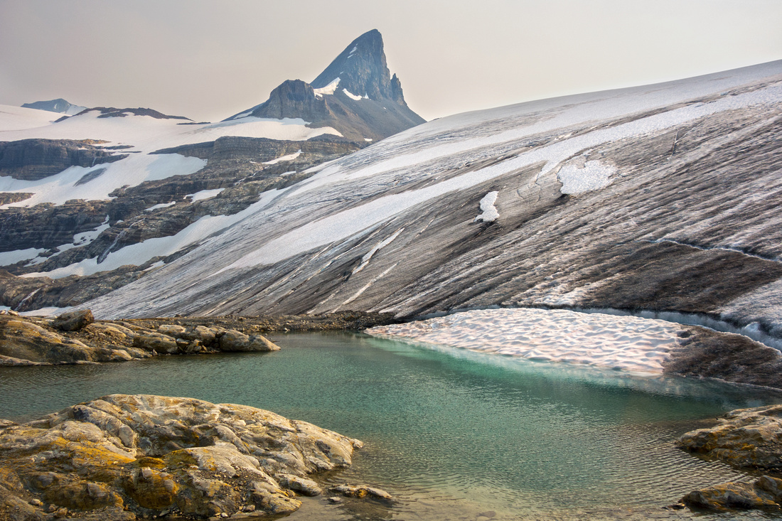
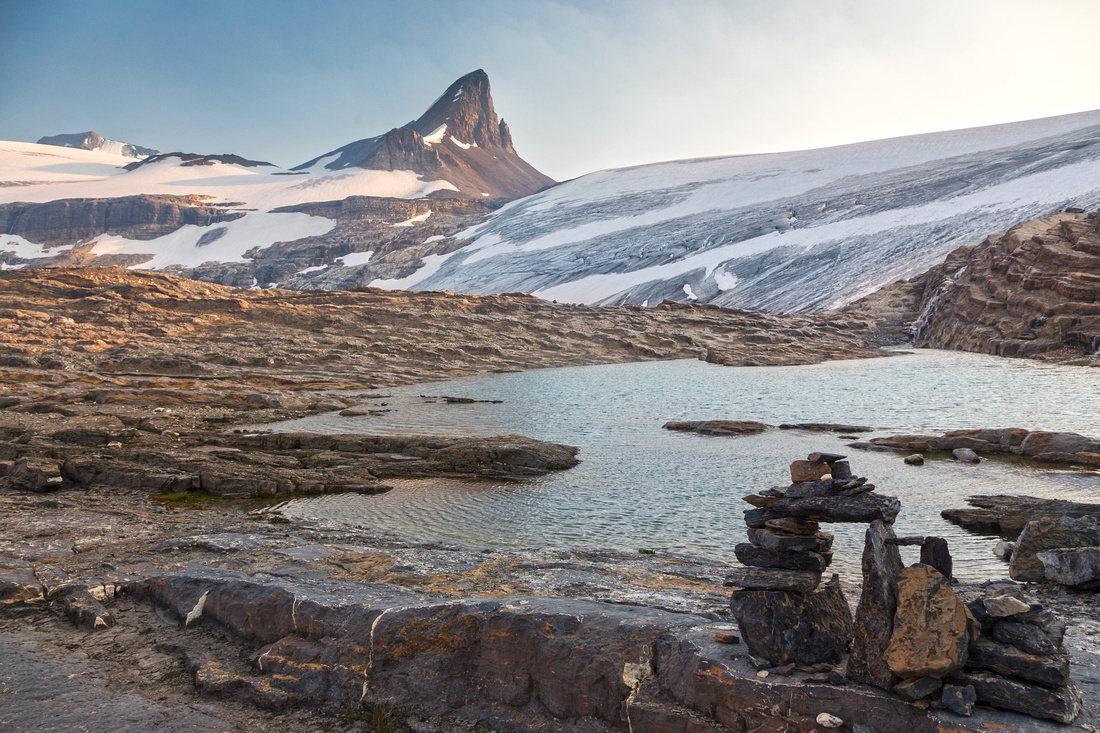 Another tarn below the Onion near the "Tent City"
 |
|||
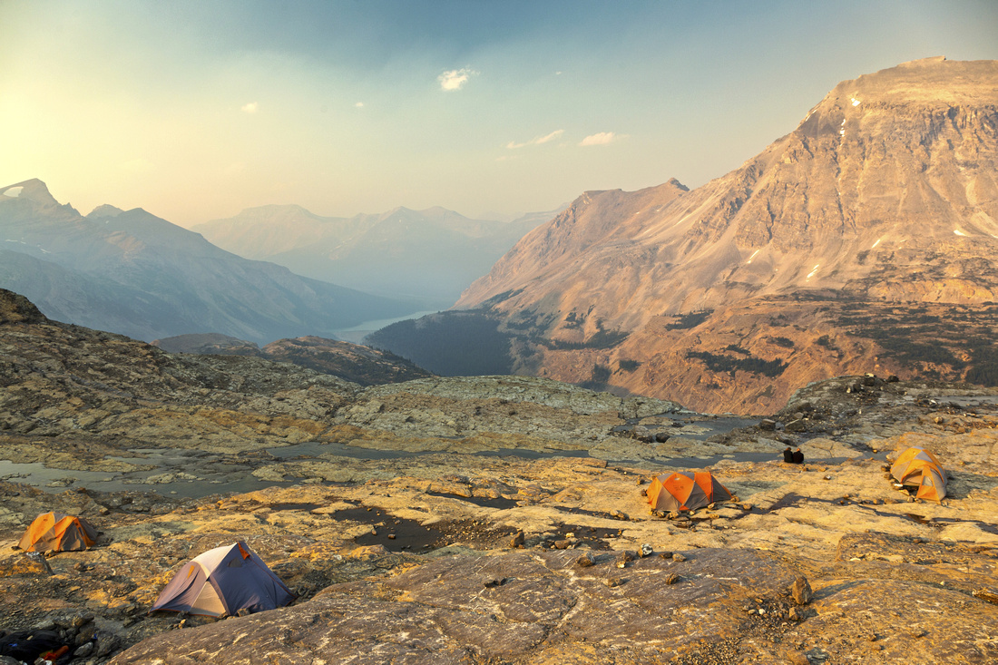
 Illegal camping in its prime. Crowfoot upper left, Balfour Ramparts right
 |
|||
 Hazy Sunset on Wapta. Onion slope upper right
 |
Abstract
|
Overall Difficulty |
Non-bridged glacial stream crossings and rough sections on Bow Hut trail. One brief class 3 step crossing the wedged boulder over canyon draining Bow Glacier. Class 2 scrambling at edge of Wapta Icefield above Bow Hut with micro-terrain route finding |
||||
|
Snow Factor |
Bow Hut trail well traveled in winter. Avalanche danger in canyon (winter route). Moderate angled snow slopes above valley floor. With solid glacier coverage it is recommended easy ski or snowshoe from overnight base at Bow Hut. Feasible as long day trip from Icefields Parkway. |
||||
|
Scenery |
Spectacular hike around Bow Lake. Magnificent waterfall draining Iceberg Lake. Picturesque canyon draining Wapta Icefield followed by amazing glacial landscape above Bow Hut. Bird eye view of Iceberg Lake and vast Wapta Icefield with many mountaineering peaks including St. Nicholas, Olive, Balfour, Crowfoot, Mt. Thompson and several others. |
||||
|
Trail/Marking |
Very Good / None |
Well-defined, marked trail to Bow Hut and toe of Wapta glacier followed by off-trail scrambling route (cairns) |
|||
|
Suggested Time |
8 hr |
Return the same way; add 1 hour if returning via Iceberg Lake |
|||
|
Elevation |
Start: 1940 m Max: 2680m Total: ~900m |
Round Trip: ~21km | |||
|
Gear |
Full hiking boots. Poles essential, gaiters recommended. Old sandals could be helpful for creek crossings, but not essential. Skis or snowshoes in winter |
||||
|
Water |
Several glacial creeks and melt of Wapta Icefield. Carry no more than 1L |
||||
|
Dog Friendly |
Yes |
Standard back-country travel precautions |
|||
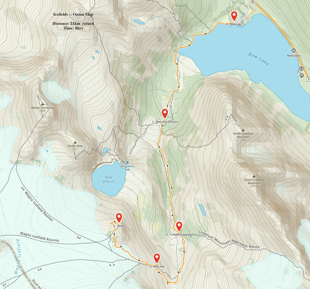 Onion GAIA Map
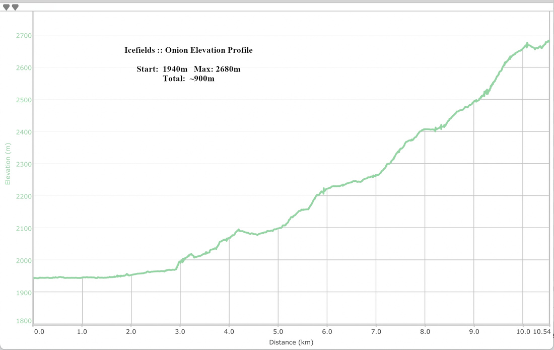 Onion Elevation Profile