Google Map |
Rockies :: Icefields :: Iceberg Lake |
GPS Track |
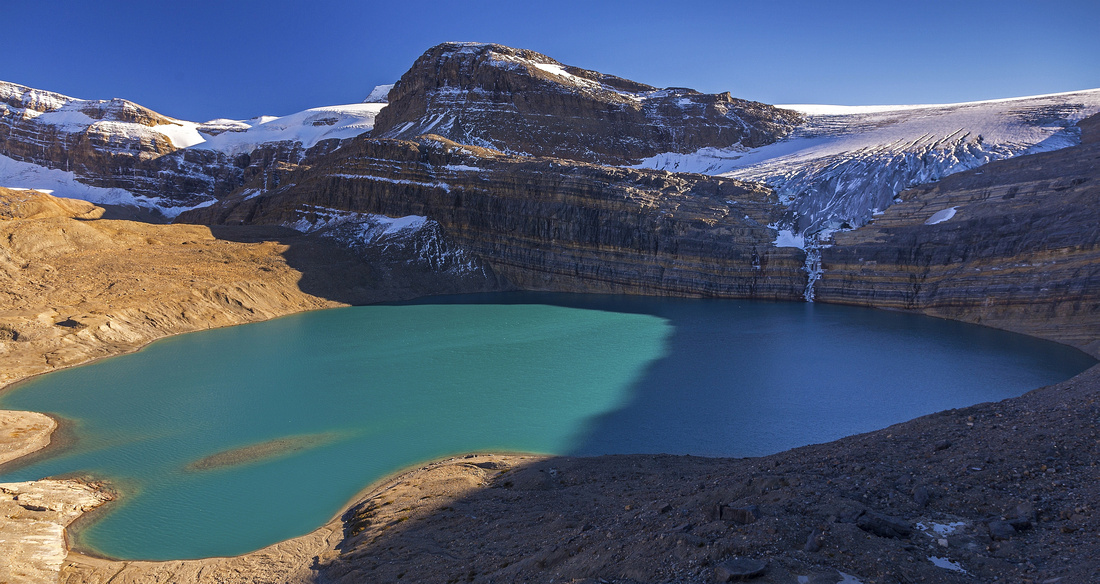 
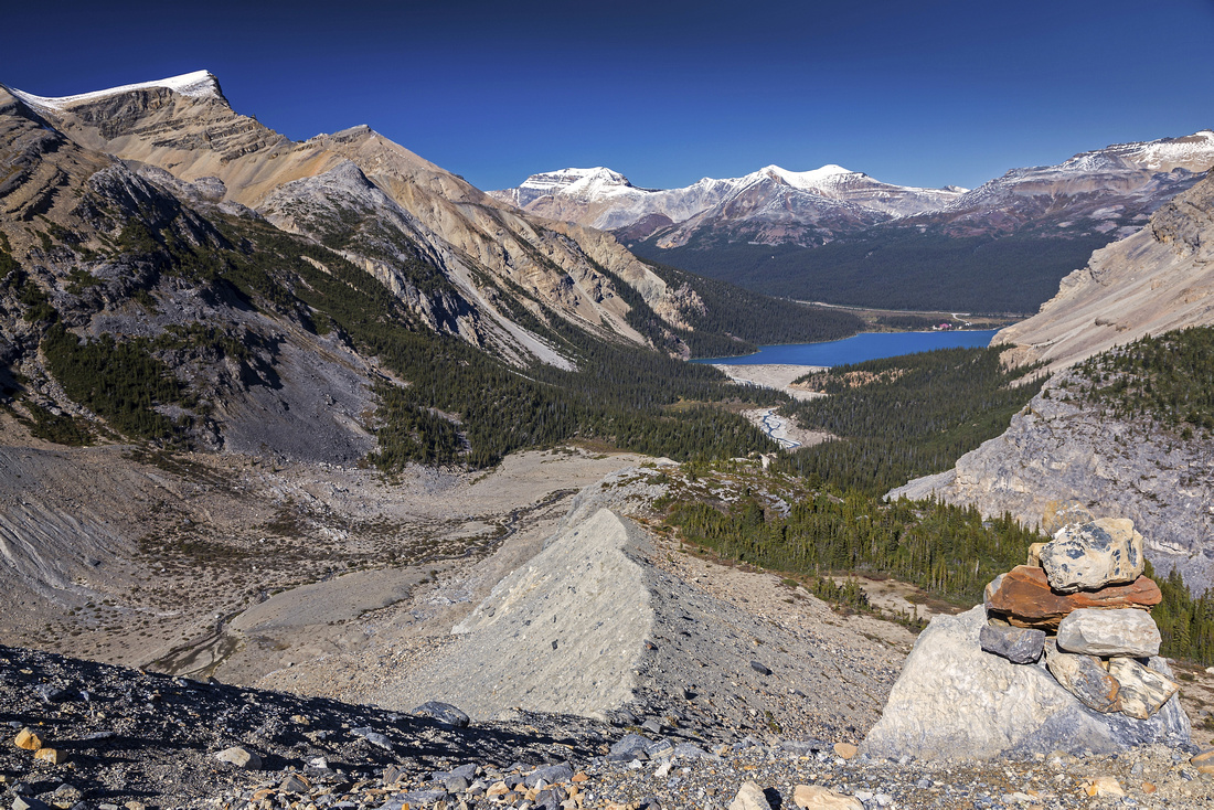
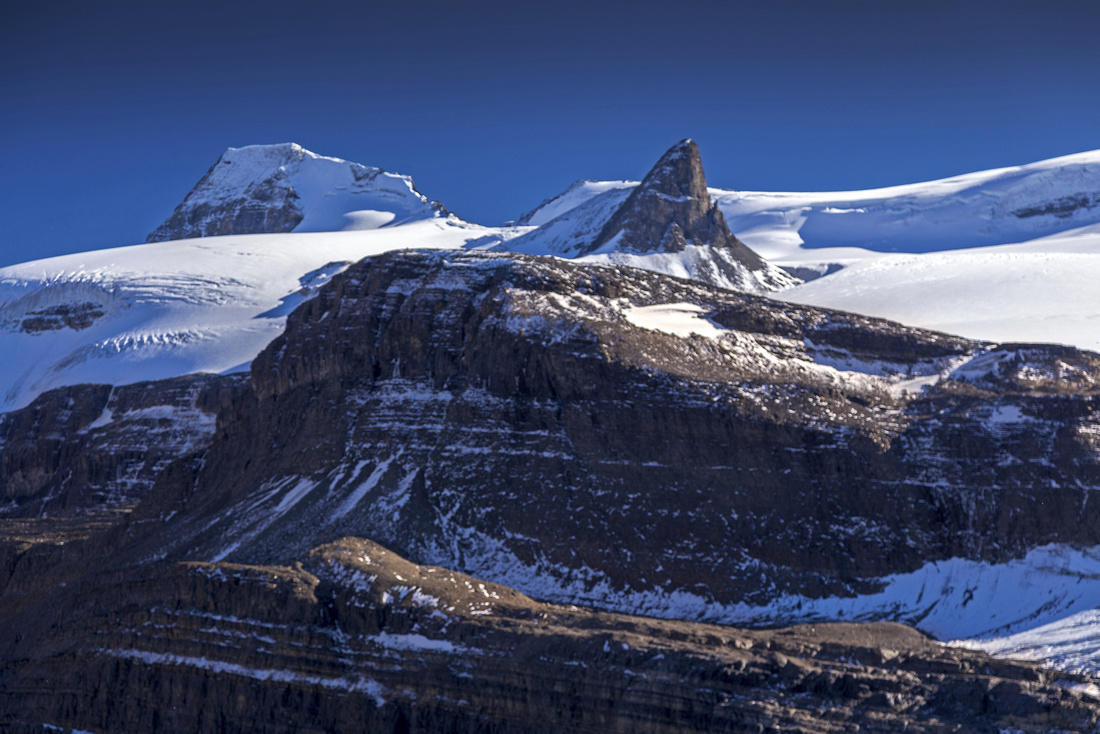
Afternoon shadows advancing across Iceberg Lake. Onion and toe of Wapta Icefield above |
|||
| Trip Summary | |||
September 15, 2014Off the beaten track exploratory scramble in spectacular alpine environments. Most people who visit the area only hike the popular trail to Bow Falls as easy half-day trip. The objective is to reach high alpine basin and lake above the falls. No trails exist, and careful route-finding is essential. However if staying on easiest path much of the trip is just off-trail hiking with only 1 or 2 mild scrambling steps. Couple of steep moraines must also be negotiated, and this is key reason why trip is suitable for experienced hikers only. Iceberg Lake is also the base of Portal Peak (difficult and loose ascent, suitable only for capable scramblers). Many other options for further exploration exist. Ridge on north side can be traversed leading to high-point with exceptional views. Linking with normal scramble route of Mt. Jimmy Simpson is feasible option. Drive Icefields Parkway to north end of Bow Lake, 36 km from junction with Trans-Canada at Lake Louise. Park at second (hiker) parking, past red-roofed Num-Ti-Jah lodge. Wide and flat hikers trail leads around Bow Lake in about 30 minutes. When water is low it is easier to stay in gravel flats in next part; otherwise follow forest trail on the right side. Past second flats trail ascends steeply on north side of the canyon. On top leave the trail and carefully scramble across large boulder - natural bridge over the canyon. Trail continues on the other side and soon descends to glacial flats granting good views of ascent route. It is also possible to continue along main trail to Bow Falls, thus avoiding the tricky boulder crossing - but several braided water channels must be crossed further on in order to reach large scree cone leading to first rockband. This rockband looks quite tricky from the distance, but near the top of scree cone there is wide boulder covered ledge that slices to the left. This ledge is not obvious, and path in scree continues to the top of scree cone. Although it is possible to scramble from there as well, this is very difficult and not necessary. Past the ledge bits of trail and cairns lead over several short cliff-bands. It is very important to look back on occasion to recognize terrain for return. Nice meadow on top is good spot for the break. Final part is ascent of second scree cone; going up it is easiest to stay on the crest; coming down simply trash rivers of scree. Cairn on top is important landmark to recognize on return. Final part is to the lake is gradual descent over much boulders and talus.
If time allows, it is recommended to cross lake outlet and ascend ridge below Portal Peak. Sandals could be useful here but late in season rock-hop should be possible. Follow path of least resistance up talus slope for amazing viewpoint of Iceberg Basin. Meadows continue north towards Mt. Jimmy Simpson. Highpoint is reached in about 30 minutes from start of the ridge; cairn on top testifies it has been visited before. There are fantastic views of St. Nicholas and Onion on Wapta from here. Continuing towards Mt. Jimmy Simpson is feasible, but loop is better done in other direction as descent from Portal Plateau is not so obvious. Check my Jimmy Simpson page for more details. |
|
Gallery |
|||
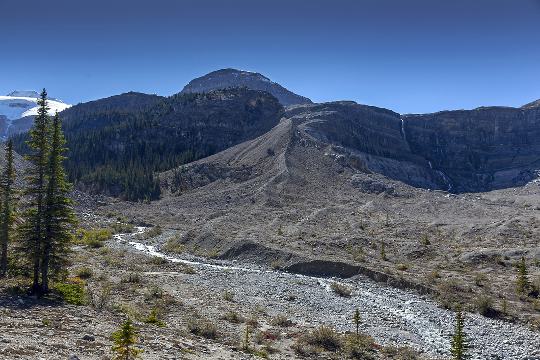 Glacial flats and ascent moraine 10 min past natural bridge crossing. Onion above
 |
|||
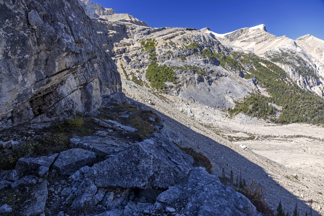 Mildly exposed but wide ledge traverse below the rockband
 |
|||
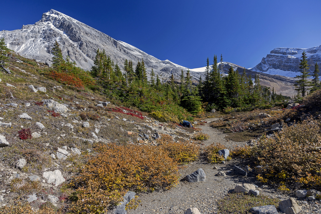 Meadows above the rockband. Crowfoot Mtn upper left
 |
|||
 View back to Bow Lake from edge of Iceberg Lake basin
 |
|||
 Hiking around small bays on east shore of Iceberg Lake. Onion upper left
 |
|||
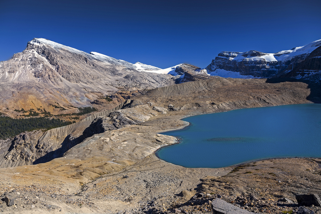 Iceberg lake and Crowfoot Mtn. from Portal Peak plateau
 |
|||
 Highpoint with small cairn indicating spot where one could descend right and connect with normal Mt. Jimmy Simpson scramble route
 |
|||
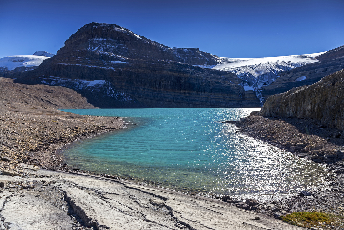
 St Nicholas and Olive popular mountaineering objectives above Bow Hut on Wapta Icefield
 |
|||
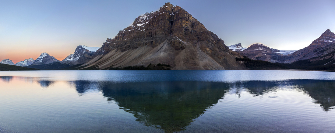 Bow Lake Sunset on return. Crowfoot mountain in center, Portal peak far right
 |
Abstract
|
Overall Difficulty |
Non-bridged glacial outflows. Tricky, but avoidable natural bridge over deep canyon. Steep scree slopes and several class 2 scramble steps. One slightly exposed, but wide ledge traverse. Routefinding. |
||||
|
Snow Factor |
Steep slopes with avalanche potential. Not a popular winter objective; most traffic heads for Bow Hut and Wapta traverse. |
||||
|
Scenery |
Spectacular hike around Bow Lake. Magnificent waterfall draining Iceberg Lake. Glacially fed alpine lake and outstanding ridgewalk |
||||
|
Trail/Marking |
None |
Marked and well-traveled trail for first hour to flats below Bow Falls, none after. Occasional cairns. |
|||
|
Suggested Time |
5-6 hr |
Return time for Iceberg Lake. Add couple of hours for traverse of ridge below Portal Peak. |
|||
|
Elevation |
Start: 1940 m Max: 2500m Total: ~700m (Iceberg Ridge) |
Round Trip: 16km (Iceberg Ridge) | |||
|
Gear |
Hiking boots and poles; skis or snowshoes in winter. Gaiters essential for scree slopes. If water is high, old sandals for creek crossing |
||||
|
Water |
Wapta outflow and Bow Falls. Outlet of Iceberg Lake. Carry 1-2L |
||||
|
Dog Friendly |
No |
Not recommended for canine travel due to scramble steps, scree slopes and creek crossings |
|||
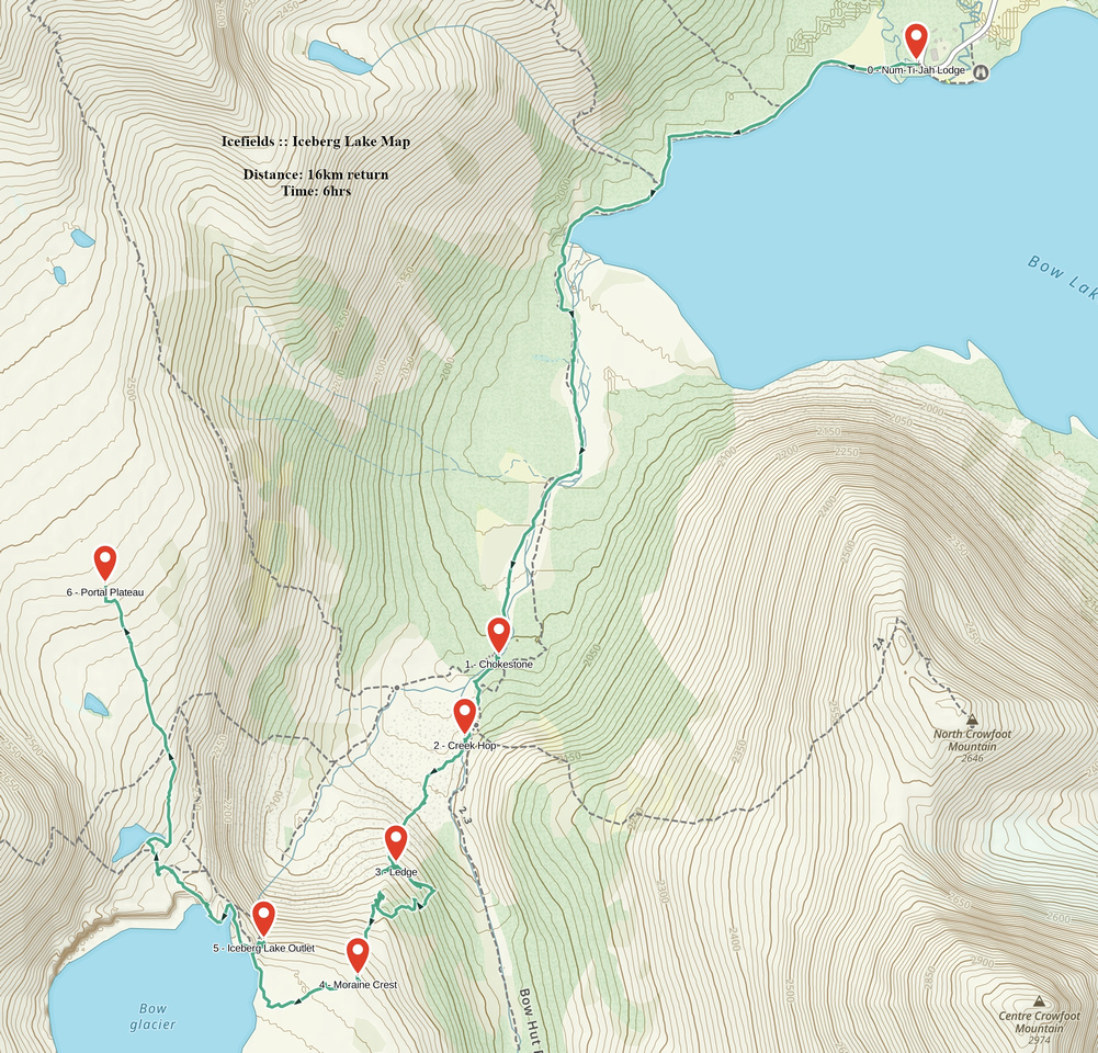 Iceberg Lake GAIA Map
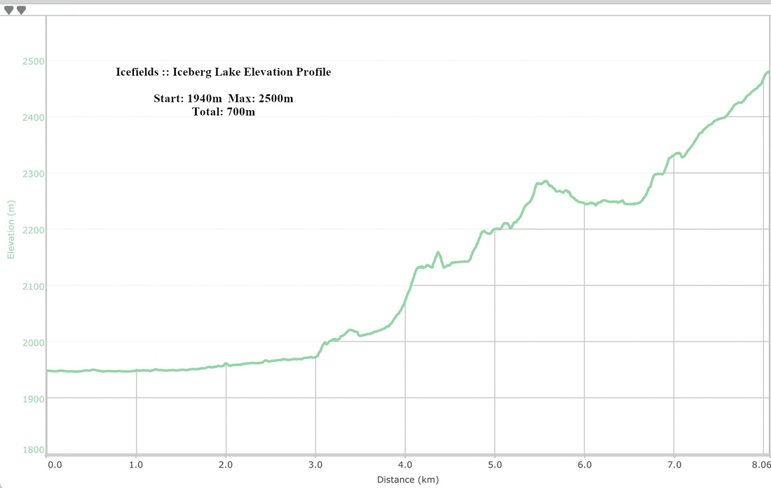 Iceberg Lake Elevation Profile