Google Map |
Rockies :: Canmore and Bow Valley ::Echo Canyon |
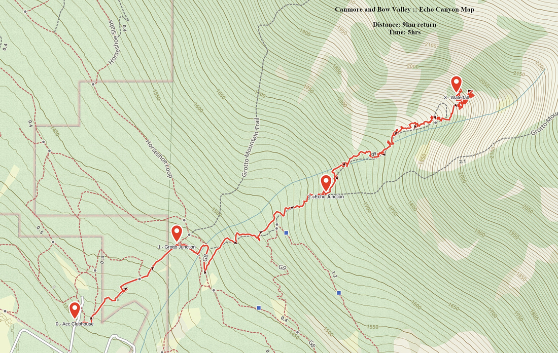
GPS Track |
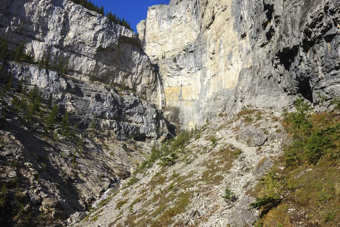
Seasonal Waterfall at top of Echo Canyon and base of several world class climbing routes |
|||
| Trip Summary | |||
May 14, 2018
Where is Echo Canyon? It is a "Big Gully" separating two Kane scrambling routes to Grotto mountain on north side of Canmore I learned about it from local website. It is a hidden gem and still nowhere as busy as other nearby trails (Lady Mac, Cougar Creek, Grotto Mountain, etc.) Even Gill Daffern that seemingly hiked every possible trail in Kananaskis doesn't mention it! Upper Echo Canyon hosts series of hard world-class sport climbing routes frequented by local climbing community and as such is of primary interest to technical climbers. Hikers can still enjoy exploring the canyon utilizing climber access route, but there are several challenging parts. For comparison it is much harder than ascent of Grotto Mountain (Kane scramble). Optimal time for visit is in spring when melting snow creates beautiful and quite high waterfall in upper canyon; later in the summer it will not be flowing.
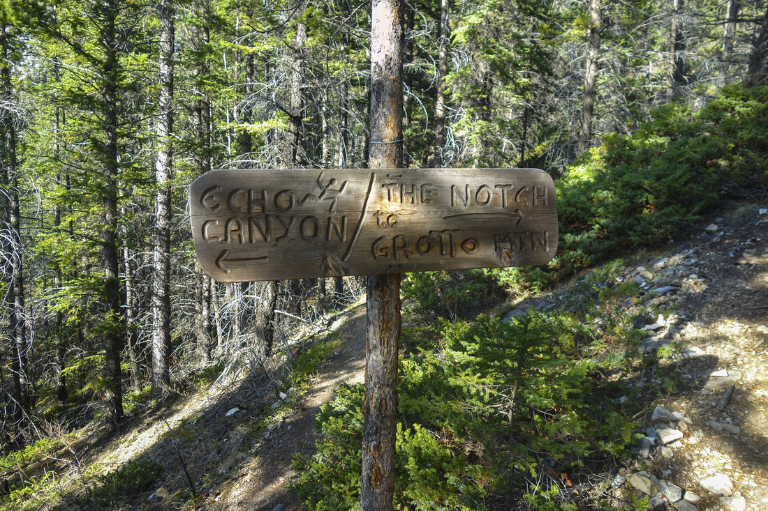
Access is from ACC Clubhouse at Indian Flats above Canmore. Park as you would for standard Grotto Mountain trail. Follow trail for ~15 minutes, then at marked junction with upper Horseshoe Trail loop descend right and cross the creek. Turn left on the other side and go up (straight is Horse Meadows trail network, seasonally closed till mid-May). This the same as Kane "Big Gully" direct route up Grotto Mountain. Well defined moderately steep trail gains switchbacks up for another 20 minutes before reaching signed junction (See gallery). Turn left and descend to Echo canyon. Almost immediately is first obstacle; exposed cliff where attached rope is quite appreciated on descent. Followed is another scrambly step with fixed chain, not as difficult. After dropping to the creek trail disappears. Simply head up the creek following path of lesser resistance; some cairns indicate the easiest path. In spring when Echo Canyon creek is flowing it will be necessary to rock-hop across the creek several times. Depending on creek height it might not be passable during high spring runoffs -- use caution. Final part is the most exciting -- steep wall on climber right in order to bypass narrow section of the creek-bed. Climbers have bolted re-bar ladder in the rock and it is quite appreciated; otherwise this part would be more than scrambling! Good stability and caution is still required. Some steps might be lose -- climbing rope helps. Above the ladder route mellows and you can see the end of the canyon. Good trail rises above the canyon on climber right to Echo Canyon Waterfall and base of several climbing routes. This is also the turnaround point.
Return the same way. Highly recommended half-day trip in Canmore area, but not for beginners.
|
|
Gallery |
|||
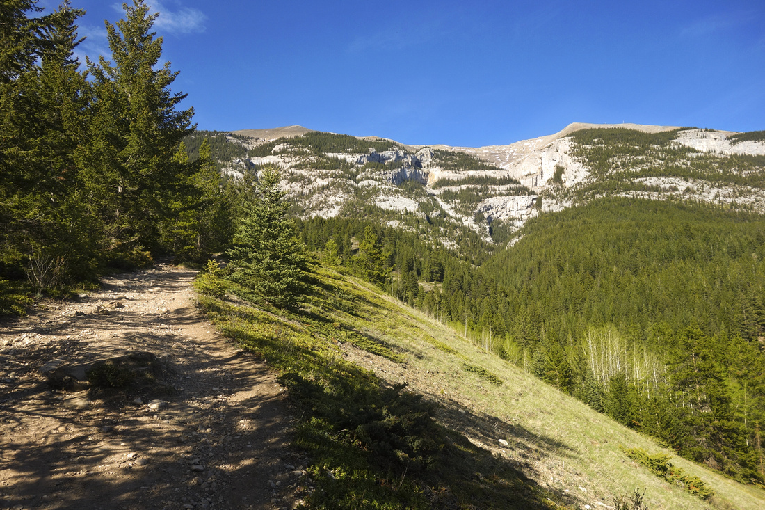 Grotto Mountain hiking trail above ACC Clubhouse. Echo Canyon ("Big Gully") right of upper center
 |
|||
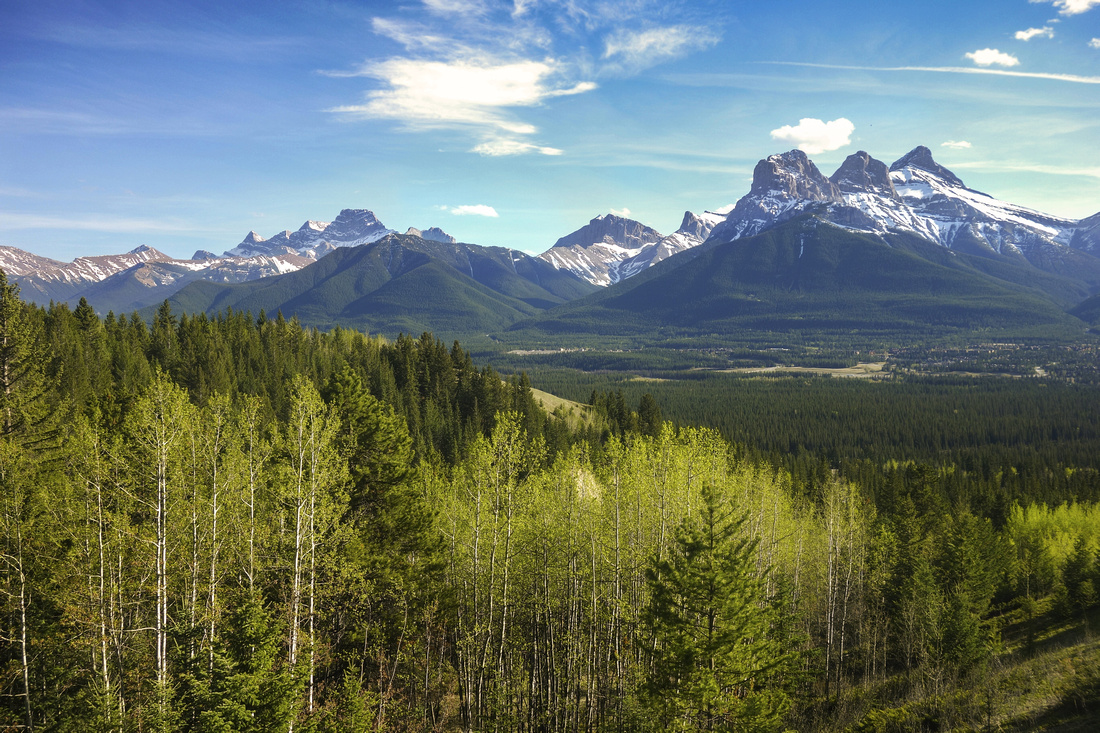 View back across Bow Valley to Three Sisters; Wind Ridge, Lougheed Towers and Centennial Ridge to Mt. Allan upper left
 |
|||
|
|
|||
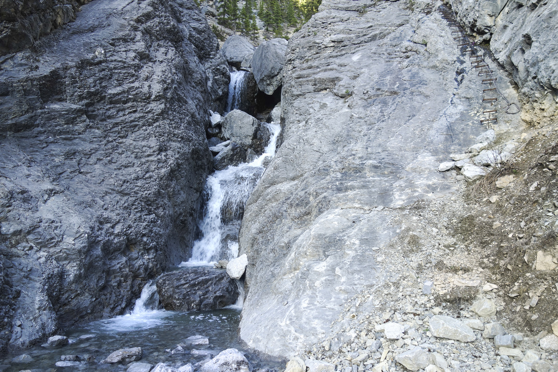 Seasonal cascades of Echo Canyon Creek in upper part, bypassed on the right side via re-bar ladder
 |
|||
 Closer look at the ladder, courtesy of climber community. Good balance required!
 |
|||
 Final part of the trail above the ladder. Climbing routes are on right hand-side wall
 |
|||
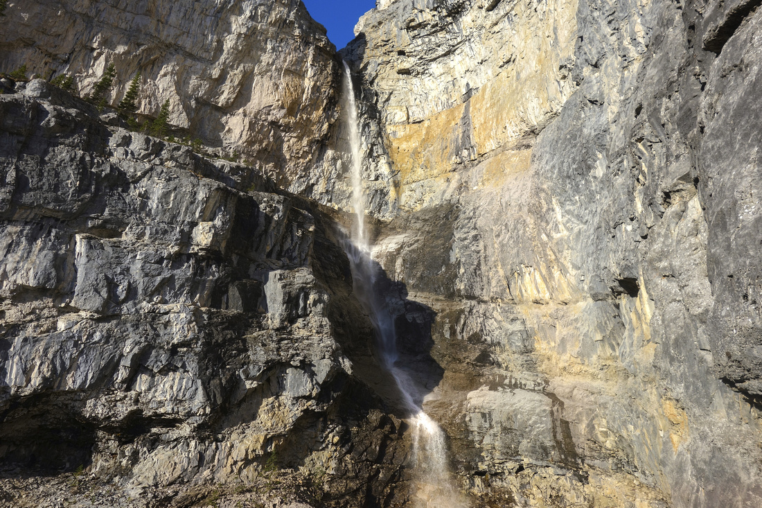
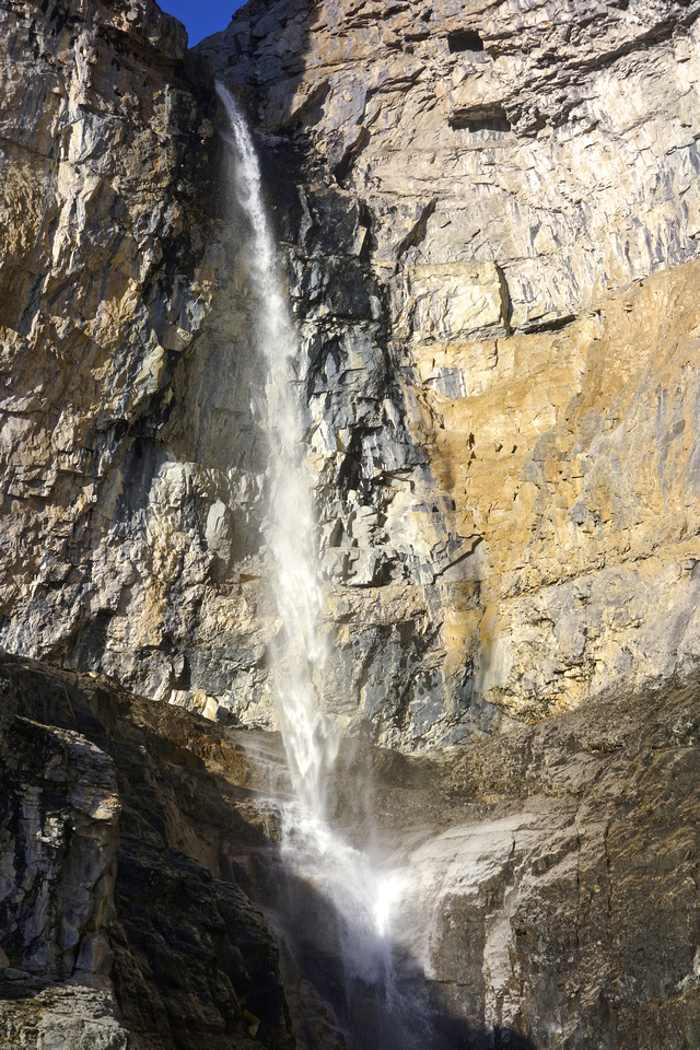 Seasonal Waterfall at top of Echo Canyon
 |
Abstract
| Overall Difficulty | D5 | Trail hiking to junction, scramble afterwards. Couple of narrow exposed steps (ropes, chain). Rock wall with iron re-bar ladder and fixed rope in upper canyon requiring good stability | |||
| Snow Factor | S5 | Not recommended in winter conditions; creek bed will be icy and steep canyon walls avalanche prone | |||
| Scenery | Views across Bow Valley near the start. Steep canyon walls with climbing routes and impressive seasonal waterfall | ||||
| Trail/Marking | Very Good/None | Well defined trail to the canyon with marked junction; some cairns afterwards. Micro-terrain route finding | |||
| Suggested Time | 4-5hr | Return time to top of the canyon | |||
| Elevation |
Start: 1330m Max: 1930m Total: ~640m |
Round Trip: ~9.5km (top of canyon) | |||
| Gear | Day Hikers with good ankle coverage. Big boots are not good choice for this kind of terrain | ||||
| Water | Seasonal Echo Canyon Creek (flowing in spring). Carry 2L otherwise | ||||
| Dog Friendly | No | Dogs will have problems ascending the wall with re-bar ladder. Standard back-country travel precautions | |||
 Echo Canyon GAIA Map
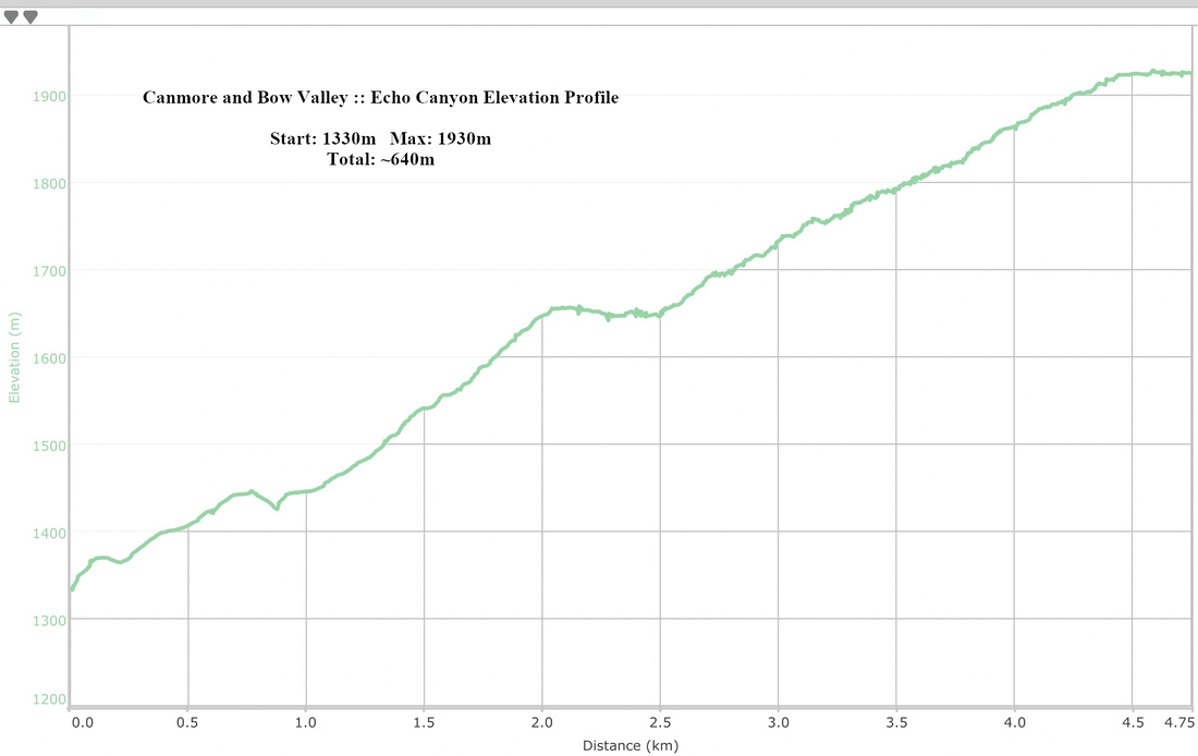 Echo Canyon Elevation Profile