Lake Minnewanka To Devils Gap |
|
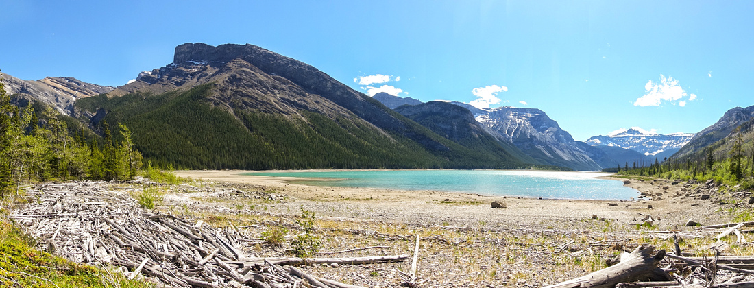 
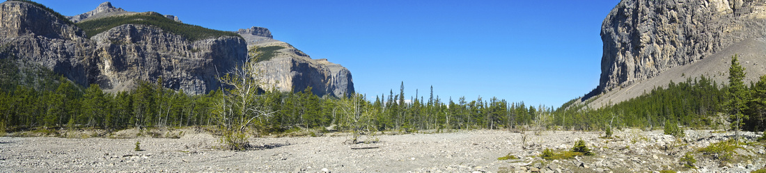
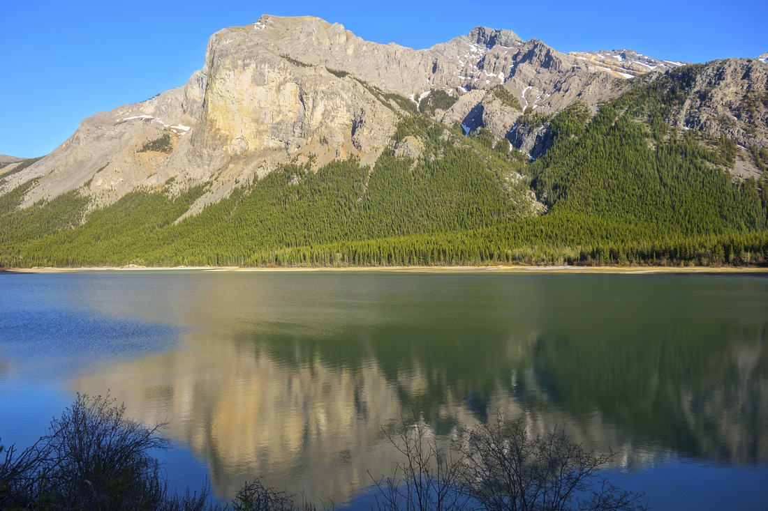
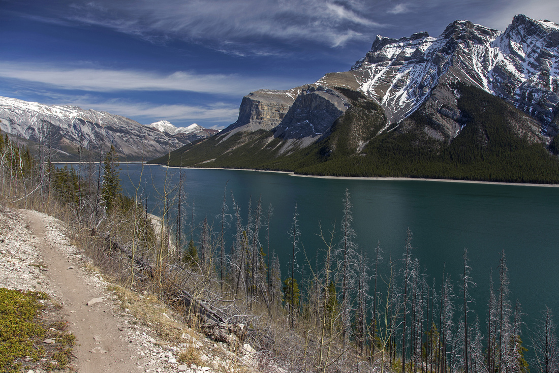
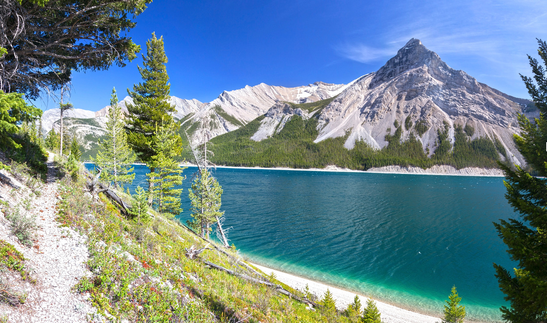
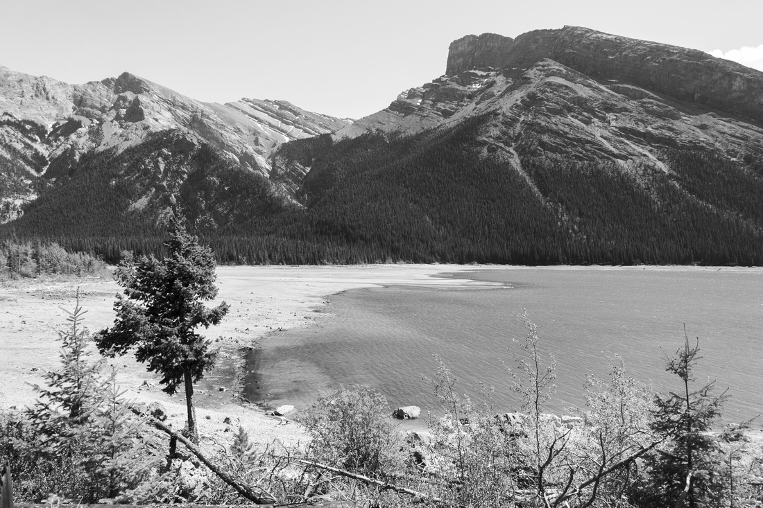
East end of Lake Minnewanka among scattered driftwood looking towards the "Narrows" (lower center right). Carrot Peak above, Mt. Peechee to its right in the distance. Saddle Peak upper left |
|||
|
Journey along north shore of Lake Minnewanka to BNP Boundary at Devils Gap is personal favorite. All beauty of front ranges can be savored here: beautiful lake, rugged snowcapped peaks of Fairholme range, Aspen trees, cliffs, lakes and Montane meadows. Lying in dry eastern slopes snowpack melts considerably earlier and since elevation is relatively low it can also be hiked when many other areas are still deep under snow cover. Logistics are main problem: total out-and-back distance ~60km so trip is not feasible as day hike without prearranged transportation. In addition, accessing Ghost area is fairly time consuming and on bad roads. Several official Parks Canada back-country campgrounds scattered along Minnewanka shoreline alleviate the problem, and backpacking is the best option. These campgrounds are very good in beautiful setting right by the beach, and even if not making all the journey, this is excellent early season backpack! Mountain bikes are allowed along Minnewanka shoreline but ride has technical parts and is not for everyone. Some people trail run in-and-out, but this is downright wasteful as it does not allow full enjoyment of the area.
Not being big fan of rushing things, I did this crossover in 2 parts. In 2018 I dayhiked to Lake Minnewanka via Devil's Gap and Ghost Lakes, and then in 2021 I backpacked from the west to LM9 campground, then dayhiked to Ghost Lakes from there. Thus report presented on this page consists of following two parts, while narratives reflect different points of time:
Stats in Abstract are given as return trip for each part (total distance one way, Minnewanka Parking Lot - Devils Gap is ~30km, with ~300m vertical cummulative). Note that area is significant wildlife corridor; bears and cougars are frequently spotted. There have been incidents around LM20 (Mount Costigan) campground, and Parks Canada restricts Minnewanka Shoreline to groups of 4 July 10 - Sep 15 and dogs are prohibited. Particularly Aylmer area from LM8 to LM11 has seasonal grizzly bear migration during bear season - take standard back-country travel precautions. |
Google Map |
Rockies :: Alberta Foothills :: Ghost Lakes |
GPS Track |
|
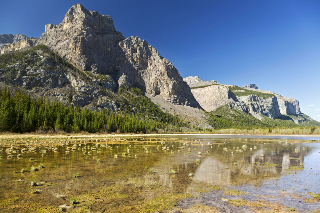
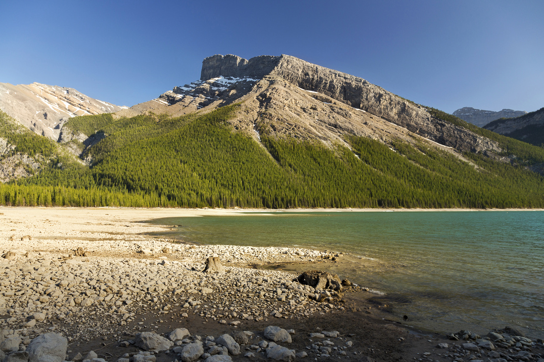
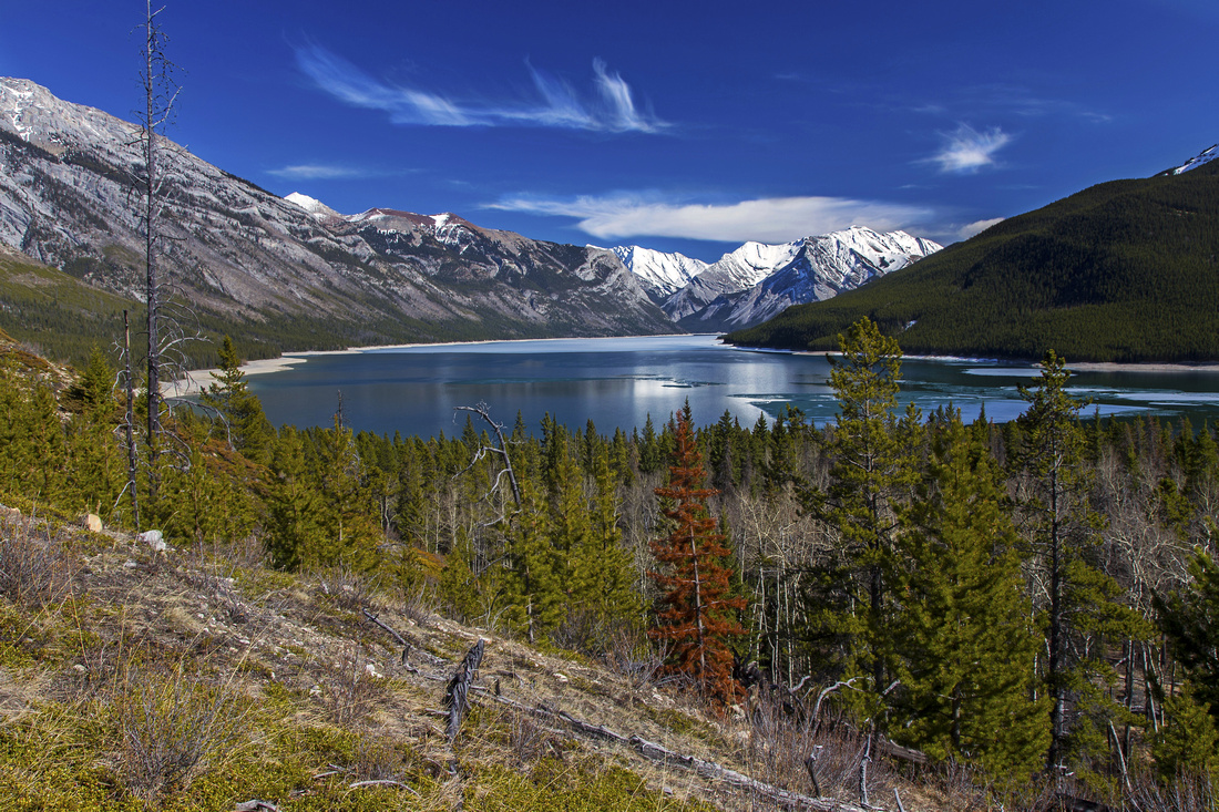
View north across second Ghost Lake. Costigan E3 upper left, Phantom Crag and Devil's Gap far right |
|||
| Trip Summary | |||
May 15, 2018
First epic trip of 2018 Rockies Hiking season. Not in terms of difficulty, but in sense of finally visiting the area I wanted for a long time. Each spring means Aylmer Lookout tradition trip, starting from west end of Lake Minnewanka. Leaving the main trail at LM8 campground I always wondered how it would be to visit the far side of the lake and continue over Ghost Lakes to east boundary of Banff National Park. I almost backpacked -- but it is fairly long (~50km return and likely 3 day trip); I opted for day hike instead, starting from Ghost area in Alberta Foothills. Up until now, the only time I've been to Ghost before was Black Rock mountain hike > 10 years ago and memories have sufficiently faded to provide additional interest.
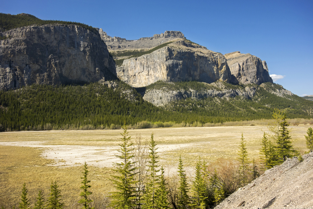
Problem with Ghost is access. Without 4x4 usual parking is top of "Big Hill" -- just before the road plunges towards Ghost River flats. High clearance trucks are able to continue for another 3.5km to Banff National Park boundary and official trailhead - although during spring runoffs crossing of Ghost River might be tricky and vehicles often get stuck. For further details see lead Ghost Wilderness Page in Alberta Foothills section.
On this occasion I parked on Big Hill and continued on foot, without bicycle. Ghost River, that usually dries out later in the summer, was flowing quite fast. Ford was only 8-10m long and mid-calf deep, but I forgot the sandals and had to do it in hiking boots which meant having wet feet right from the start. After crossing the flats through piles of gun shells left by people that consider firearm shooting form of recreation, I climbed the berm then turned right and soon reached BNP boundary (several nice campsites). No motorized vehicles are allowed past this point. First Ghost lake is ~30 minutes away. Main trail skirts on the left (south) side and stays mostly in the forest, while the "Dunes trail" splits to the right and rejoins the main trail after crossing Devil's Gap and usually dried out flats of the first lake. Second Ghost Lake is about 4km from BNP trailhead. There are no good views from the trail, so I dropped to the beach and had lunch break in company of 2 wild geese feeding in the shallow pools. Beyond second lake the journey becomes very scenic. Carrot creek junction is reached soon after. Old weathered park table is still here but is falling apart and won't likely be around for much longer. Third Ghost lake is just ahead; I left the trail and walked on the beach, before rejoining on the north side. Third lake was the most beautiful, deep blue color with nice reflections of Saddle peak in still water. Set of cairns marks the way through washout just past third Ghost Lake. Trail becomes very scenic approaching Lake Minnewanka, winding its way through typical Montane environment. In many ways this section is what front ranges and BNP are all about to me!
I dropped to the beach on Minnewanka east end before turning back. Narrows could be seen and LM22 campground was ~2km away; I regretted for not taking overnight gear as I could have had this great area to myself. Return was fast with tricky ford of Ghost river that has risen and became faster and murky due to rising temperatures. It was fairly tricky with depth over the knee at one point but I made it without losing balance. Be weary of this bit if you plan on visiting Ghost in the spring! Also note that entire length of Minnewanka trail has seasonal grizzly bear restrictions (July 10 - September 15); it extends all the way to Park Boundary and is posted at park table on east end. |
|
Gallery |
|||
 Ghost River
 crossing below "Big Hill" in spring -- faster and deeper in the evening! Black Rock upper center right, Devil's Head left Ghost River
Ghost River crossing below "Big Hill" in spring -- faster and deeper in the evening! Black Rock upper center right, Devil's Head left |
|||
 BNP Boundary
Banff National Park Boundary and official end/start of Lake Minnewanka trail (~3.5 km from Big Hill 1 way). Phantom Crag above BNP Boundary
Banff National Park Boundary and official end/start of Lake Minnewanka trail (~3.5 km from Big Hill 1 way). Phantom Crag above |
|||
|
|
|||
 Devil's Gap
Panoramic view back towards Devil's Gap from washout between First and Second Ghost Lake Devil's Gap
Panoramic view back towards Devil's Gap from washout between First and Second Ghost Lake |
|||
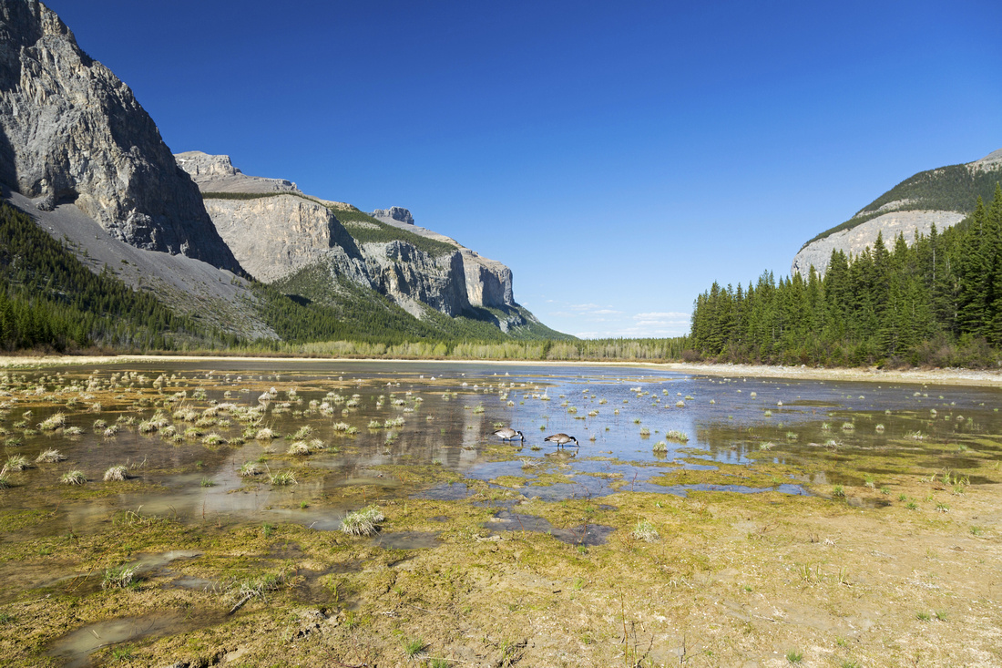 Second Ghost Lake
Canadian Wild Geese feeding in drying marsh at west side of second Ghost Lake Second Ghost Lake
Canadian Wild Geese feeding in drying marsh at west side of second Ghost Lake |
|||
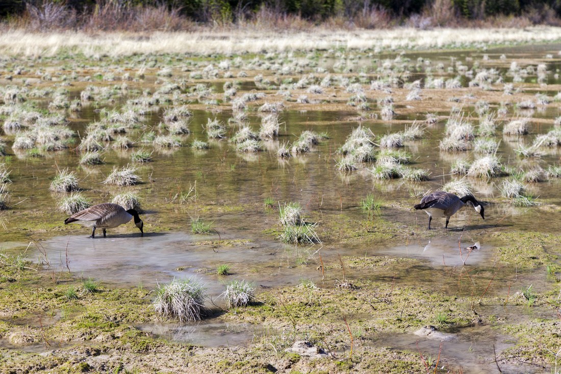 Wild Geese
Closer look at Wild Geese population; they could be heard on third lake as well Wild Geese
Closer look at Wild Geese population; they could be heard on third lake as well |
|||
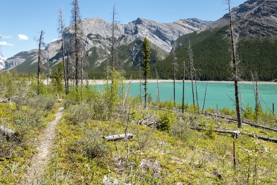
 Third Ghost Lake
Drying out flats at east side of Third Ghost Lake just past Carrot junction looking west Third Ghost Lake
Drying out flats at east side of Third Ghost Lake just past Carrot junction looking west |
|||
 Orient Point
 reflected in third Ghost Lake -- the largest and beautiful blue color Orient Point
Orient Point reflected in third Ghost Lake -- the largest and beautiful blue color |
|||
 Beautiful Trail
Section of trail around third Ghost Lake in typical Montane environment. Orient Point above Beautiful Trail
Section of trail around third Ghost Lake in typical Montane environment. Orient Point above |
|||
 East Beach
East shore of Lake Minnewanka. Narrows campground (LM 22) is ~2km from here. Saddle Peak above East Beach
East shore of Lake Minnewanka. Narrows campground (LM 22) is ~2km from here. Saddle Peak above |
|||
 East Shore
Looking west across Lake Minnewanka towards the Narrows; Mount Peechee just right of center East Shore
Looking west across Lake Minnewanka towards the Narrows; Mount Peechee just right of center |
Abstract
| Overall Difficulty | D3 | Trail hiking with minor elevation gain/loss. Possible ford of Ghost river near the start depending on season and vehicle | |||
| Snow Factor | S1 | Forested valley floor with no avalanche danger. Ghost lakes are frozen marsh in winter. Trail used as approach to several ice climbs in the area | |||
| Scenery | Front ranges and distant Alberta Foothills. Three Ghost Lakes and Lake Minnewanka. Devil's Gap, Phantom Crag and Mt. Costigan | ||||
| Trail/Marking | Very Good | Official Parks Trail. All junctions are marked. Some deadfall and washed out sections | |||
| Suggested Time | 7-8hr | Return time estimate to east end of Lake Minnewanka starting from "Big Hill", less if able to drive to BNP Boundary (4x4) | |||
| Elevation |
Start(Max): 1600m Min: 1460m Total: ~200 m (Big Hill start) |
Round Trip: ~24km (Big Hill start) | |||
| Gear | Day Hikers with good ankle coverage. Sandals for Ghost River ford (seasonal). Bicycles are allowed | ||||
| Water | Ghost River near the start and creek feeding third Ghost Lake (seasonal). Lake Minnewanka (treatment required). Carry 1L | ||||
| Dog Friendly | Yes | Standard back-country travel precautions. Note seasonal restriction July 10 - Sep 15 for Minnewanka shoreline | |||
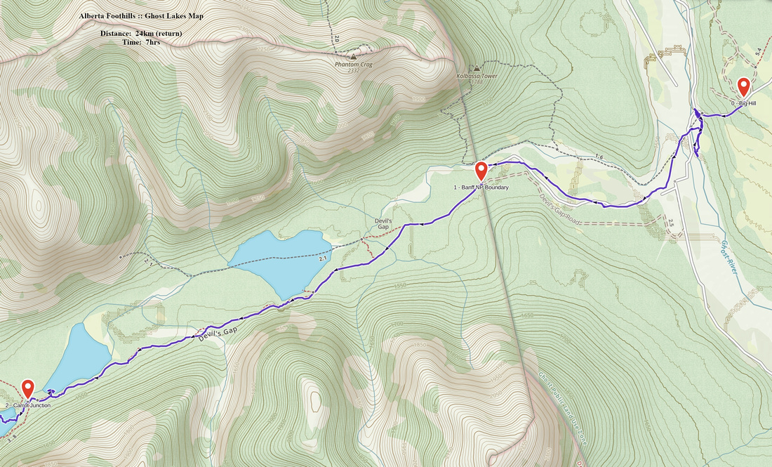 Ghost Lakes GAIA Map
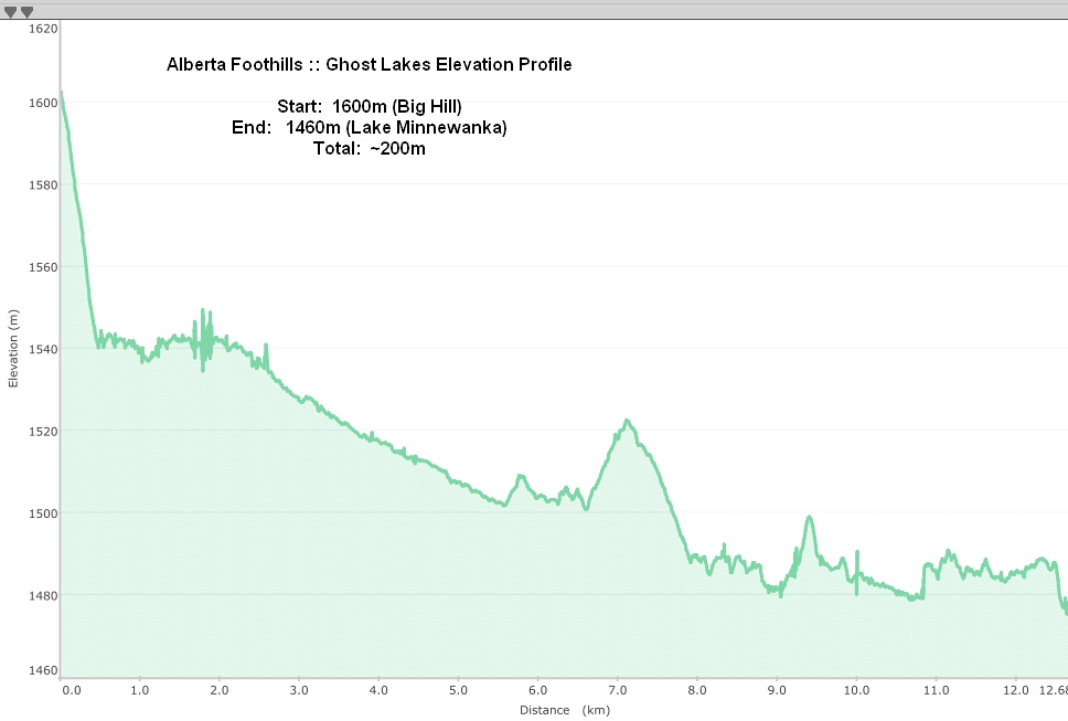 Ghost Lakes Elevation Profile
Rockies :: Banff-Louise :: Lake Minnewanka Shoreline |
|
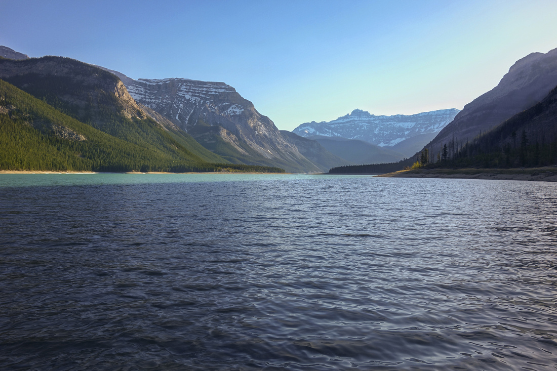
Beautiful springtime panorama from little rise above LM8 / Aylmer junction looking east towards snowy Carrot peak. Shoreline trail follows curling left side |
|||
| Trip Summary | |||
June 3, 4 2021
This was first backpack trip of 2021. Since original hike to Minnewanka east end via Devils Gap I've been plotting return from the west; but total distance was worrying me. I considered cycling as well as speed day-hiking, but at the end as several day heat wave over Bow Valley in early June made sleeping very difficult I figured temps would be much cooler by the lake, while semi-open canopy along the shoreline would provide shelter during the day. So I simply backpacked to LM9; it is smaller than LM8 (only 5 pads) and very nicely laid down. All Minnewanka campgrounds also have large watercraft storage bins, so after packing up the camp on 2nd day I simply left all overnight gear in one of these, then hiked with light pack to east end of the lake and back.
First part to Aylmer junction @ LM8 on day 1 has been traveled many times, yet I still enjoyed it. Views from Sheep Point ~1km past Stewart Canyon bridge always brings huge smile to my face & I sat at highest point -- which is incidentally highest point of entire shoreline trail -- for few minutes reflecting with amazing views of Inglismaldie and Girouard across the lake. Upon setting up camp I simply spent rest of the day at lakeshore, drinking beer in total solitude and enjoying scenery. Overnight it rained and it further refreshed the air, confirming validity of my strategy. Section of trail between LM9 and LM11 is very scenic, but there was significant drainage just past LM11 with water flowing quite good. I trashed up upslope, but this was not necessary as downstream log jam crossing was easier option, as discovered on return. Next highlight was Ranger Cabin ~17km; I love BNP Ranger Cabins, always on such a pretty place that makes you wish you could live right there. While enjoying views for few minutes sitting on porch in stand of Aspen Trees I got a visitor - couple of red-headed North American woodpeckers! I regretted not bringing zoom lens along (image in gallery is cropped).
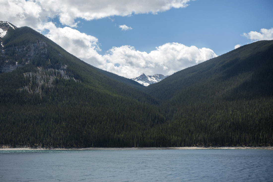
Beyond Ranger Cabin trail gets a bit more rough, crossing several rockslides before LM20. I also passed by fresh bear scat & started making noise, but no sightings occurred. Views across the lake to Mt. Peechee were spectacular with several booming avalanches thundering down northern slopes. Specially intriguing was Carrot Creek drainage; there is trail there leading to South Ghost Pass, but reportedly quite overgrown and tedious. One of my projects is 1-way Banff - Canmore traverse via Minnewanka - South Ghost Pass - Stenton Lake and finally down via Cougar Creek; overnight on 1st day for such trip would likely be LM20 or LM22. LM20 (aka Mount Costigan campground) is probably the prettiest; great shoreline views and I almost abandoned rest of the journey in favor of sitting right there in calm and peace. Drinking water was larger problem than anticipated as I found no drinking water past LM11; just as I thought I'd have to drink from Minnewanka, I found clear stream just past LM22 (The Narrows) crossing large outwash flats, where cairns helped find easiest way across. Final part of the trail to East End had overgrown parts with some deadfall, but nothing too dramatic. It was probably possible to walk on the beach instead as water level was quite low. Finally, after connecting with endpoint of 2018 trip, I sat happily for half an hour on same rock among scattered driftwood enjoying one of very special places in Banff National Park, before turning back.
Overall distance on 2nd day was ~40km of which 9km with overnight pack on return from LM9 and I was quite hosed at the end. But I did connect with 2018 trip and had stellar overall adventure. Highly recommended springtime trip!
|
|
Gallery |
|||
 Sheep Point
 and Highest Point of Shoreline Trail ~1.5km from Stewart Canyon bridge Sheep Point
Sheep Point and Highest Point of Shoreline Trail ~1.5km from Stewart Canyon bridge |
|||
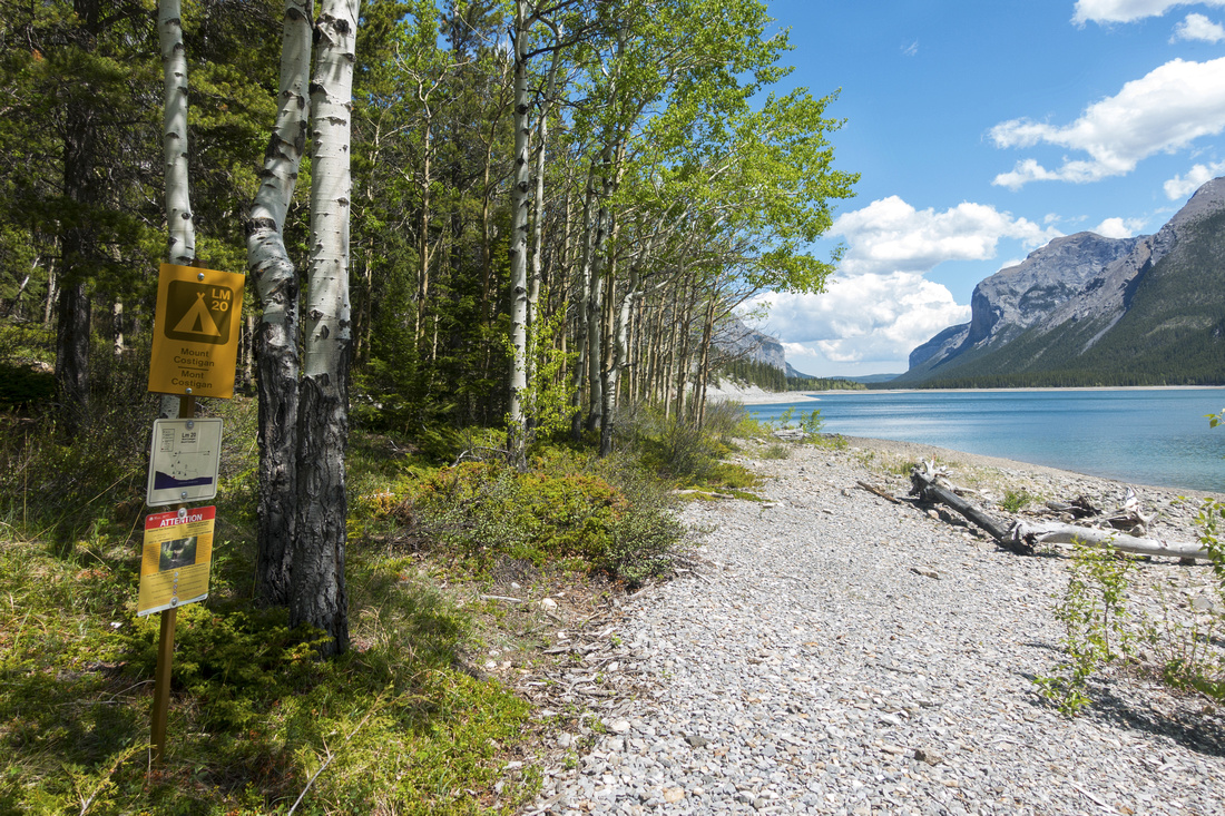
 Aylmer Junction
Signed Aylmer Pass / Lookout junction just past LM8 bridge: campground is few 100m to the right. Note seasonal restriction info Aylmer Junction
Signed Aylmer Pass / Lookout junction just past LM8 bridge: campground is few 100m to the right. Note seasonal restriction info |
|||
|
|
|||
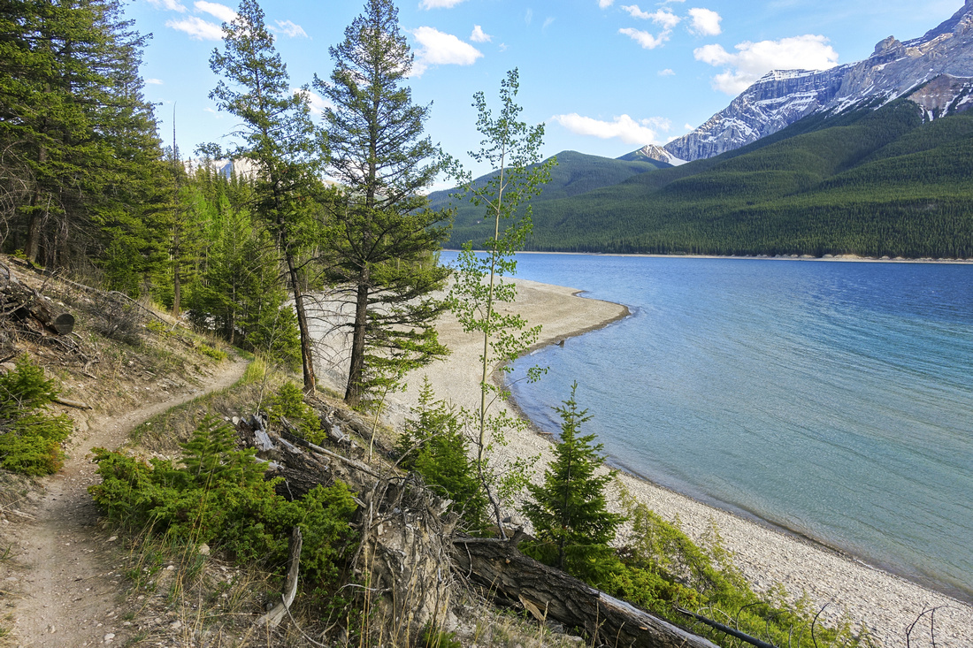 LM11 Beach
Beautiful section of trail approaching LM11 campground LM11 Beach
Beautiful section of trail approaching LM11 campground |
|||
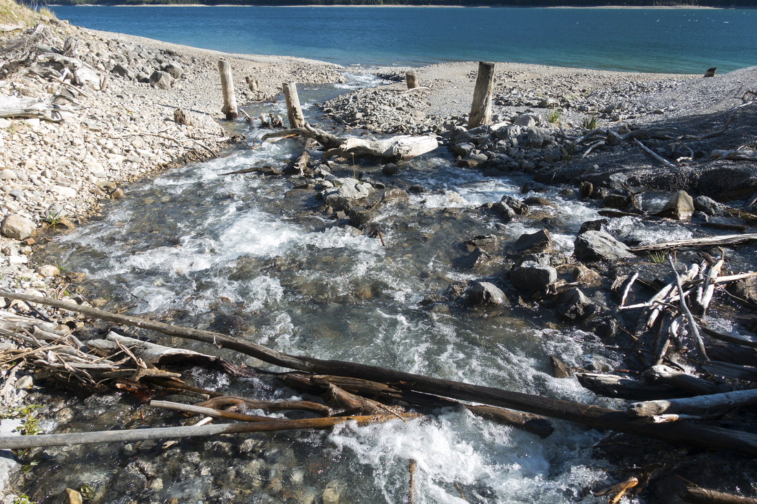 LM11 crossing
Tricky crossing just past LM11 during spring snow melts; use either downstream log jam, or trash upstream. LM11 crossing
Tricky crossing just past LM11 during spring snow melts; use either downstream log jam, or trash upstream. |
|||
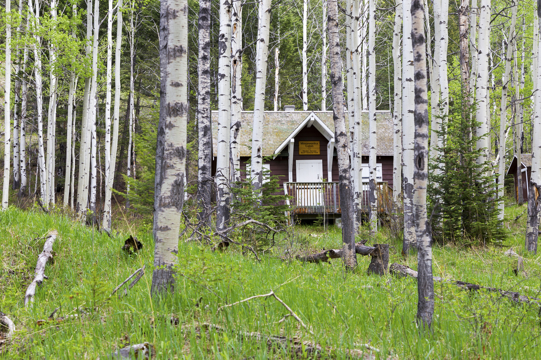 Ranger Cabin
Minnewanka ranger cabin ~17km mark in very atmospheric stand of Aspen trees Ranger Cabin
Minnewanka ranger cabin ~17km mark in very atmospheric stand of Aspen trees |
|||
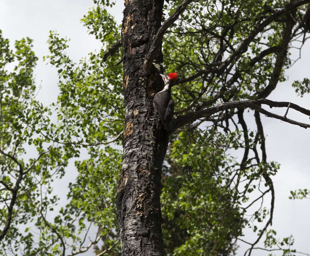 Red Headed Woodpecker
North American red-headed woodpecker near Ranger Cabin Red Headed Woodpecker
North American red-headed woodpecker near Ranger Cabin |
|||
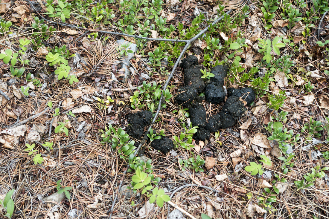 Bear Scat
Fresh Bear scat just past Ranger Cabin; make lots of noise Bear Scat
Fresh Bear scat just past Ranger Cabin; make lots of noise |
|||
 Carrot Drainage
 on east side. Overgrown and Bushy trail exists; it ends at Hwy1 few km west of Harvie Heights, but travel is very tedious Carrot Drainage
Carrot Drainage on east side. Overgrown and Bushy trail exists; it ends at Hwy1 few km west of Harvie Heights, but travel is very tedious |
|||
 Saddle Peak
Very scenic portion of Shoreline trail between Ranger Cabin and Mount Costigan campground (LM20); Saddle Peak across Saddle Peak
Very scenic portion of Shoreline trail between Ranger Cabin and Mount Costigan campground (LM20); Saddle Peak across |
|||
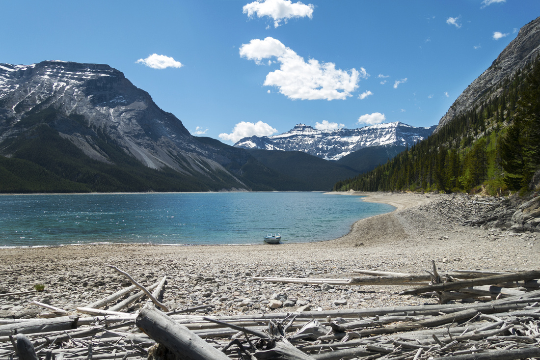
 LM20 beach
Beach just below food preparation area at Mt. Costigan (LM20) personally favorite Minnie campground. Narrows and Devils Gap in the distance LM20 beach
Beach just below food preparation area at Mt. Costigan (LM20) personally favorite Minnie campground. Narrows and Devils Gap in the distance |
|||
 LM22 beach
 by the Narrows. Snowy Mt. Peechee in the distance, Carrot Peak upper left LM22 beach
LM22 beach by the Narrows. Snowy Mt. Peechee in the distance, Carrot Peak upper left |
|||
 East End Approach
Somewhat overgrown trail approaching east end of the Lake. Orient Point above East End Approach
Somewhat overgrown trail approaching east end of the Lake. Orient Point above |
|||
 East Beach
Large beach at east end of Lake Minnewanka; finally linked up with Ghost trip 3 years ago! Third Ghost lake is ~2km away, LM31 is on the other side East Beach
Large beach at east end of Lake Minnewanka; finally linked up with Ghost trip 3 years ago! Third Ghost lake is ~2km away, LM31 is on the other side |
Abstract
| Overall Difficulty | D3 | Trail hiking with minor elevation gain/loss. Several rockslides and seasonal non-bridged stream crossings | |||
| Snow Factor | S1 | Trail often dry even in winter. Possibility of minor icy sections | |||
| Scenery | Lake Minnewanka throughout the journey, Fairholme Range on south side, Mount Aylmer on north side. Beautiful stretches of Aspen forest. | ||||
| Trail/Marking | Excellent | Official Parks Trail. All junctions are marked. Some deadfall and washed out sections | |||
| Suggested Time | 2 days | LM8/9/11 backpack recommended, with day hike from there. Very long day for single day out-and-back | |||
| Elevation |
Start: 1490m Max: ~1600m Total: ~400m (return) |
Distance: ~45km (Parking to East End return) | |||
| Gear | Day Hikers with good ankle coverage preferred to full hiking boots. Bicycles are allowed, but riding gets quite rough past ranger cabin ~17km mark. Overnight gear if backpacking | ||||
| Water | Several seasonal drainages (LM8, LM9, LM11, LM22). Lake Minnewanka (treatment required) | ||||
| Dog Friendly | Seasonal | Parks Canada prohibits dogs on Minnewanka shoreline trail July 10 - Sep 15 | |||