Google Map |
Rockies :: Alberta Foothills :: Powderface Ridge |
GPS Track |
|
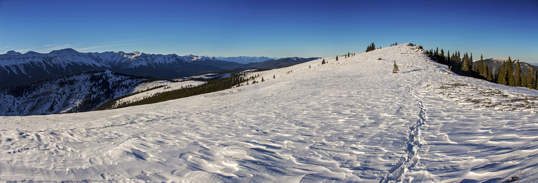 
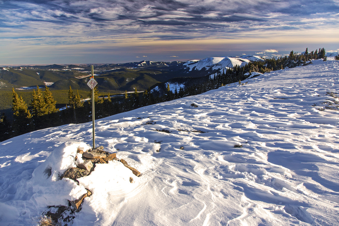
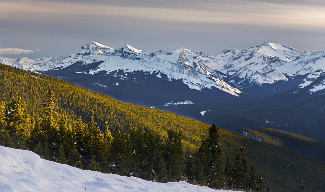
Panoramic Views north near junction of low and high trails on the south end. Nihahi transitioning to Compression Ridge center left |
|||
| Trip Summary | |||
October 30, 2016Powderface is Jumpingpound southerly neighbor. Although open ridgewalk above treeline is shorter, views are considerably better and include prairies, foothills as well as superb overview of peaks along Little/Big Elbow corridors. Normal access via Elbow Trail (Hwy 66) and relatively short driving distance from Calgary make it an excellent candidate for after-work outing during long summer days. Network of established trails at both end of the ridge provide different access options. With 2 vehicles (or a bicycle) 1-way traverse is excellent choice. Although steeper, south side is preferred for ascent as it provides quicker exit to treeline. If time is really short, even quick jaunt to Sunrise Hill (less than 2 hours return) is well worth the effort.
Park at end of Hwy 66 as it turns left towards Elbow area, just before Powderface road gate. Space is limited (~5-6 cars maybe), but more room can be found either on the side of the road or further south at Elbow picnic area before Forgetmenot Pond. Trail quickly rises through semi-open forest and within 35-40 minutes exits to treeline. Grassy sub-peak is well worth the visit; save it for return perhaps if coming back the same way. After brief stretch through forest leave main trail and climb right to aptly named Sunrise Hill; Sunsets are fabulous too! Here you have an option: Main trail continues below the ridge and dips in the forest again for fairly long stretch. It is possible to trash up, directly opposite Sunrise Hill. Sporadic trail and odd cairn lead around minor rock outcrops. Both options join further north along the ridge, by the obvious winter wand. Views here are simply spectacular and will trigger serious "ahhh" reaction on sunny and windless day. Continuing across several bumps trail eventually dips towards marked Three Trails Pass near the treeline; this is the end of Powderface ridgewalk. If coming back the same way, it is probably not worth coming down all the way to the pass as you will have to re-ascend about 100m vertical; turn back when trail dips into the forest just below the ridge.
For return there are 2 options. Going left (west) brings you quickly to Powderface Road, about 5km north from Hwy66. If without 2nd car or bike, this is good option for walk-back as it can be done in under 1 hour, and open views towards Nihahi Ridge are fantastic. Going right (east) will exit to Hwy 66 in about 1.5 hours from Three Trails Pass. Walking back this way is not feasible as it is simply too long. Other -longer- option is Prairie Link and eventual exit to Hwy66 at Prairie Mountain trailhead, further north. |
|
Gallery |
|||
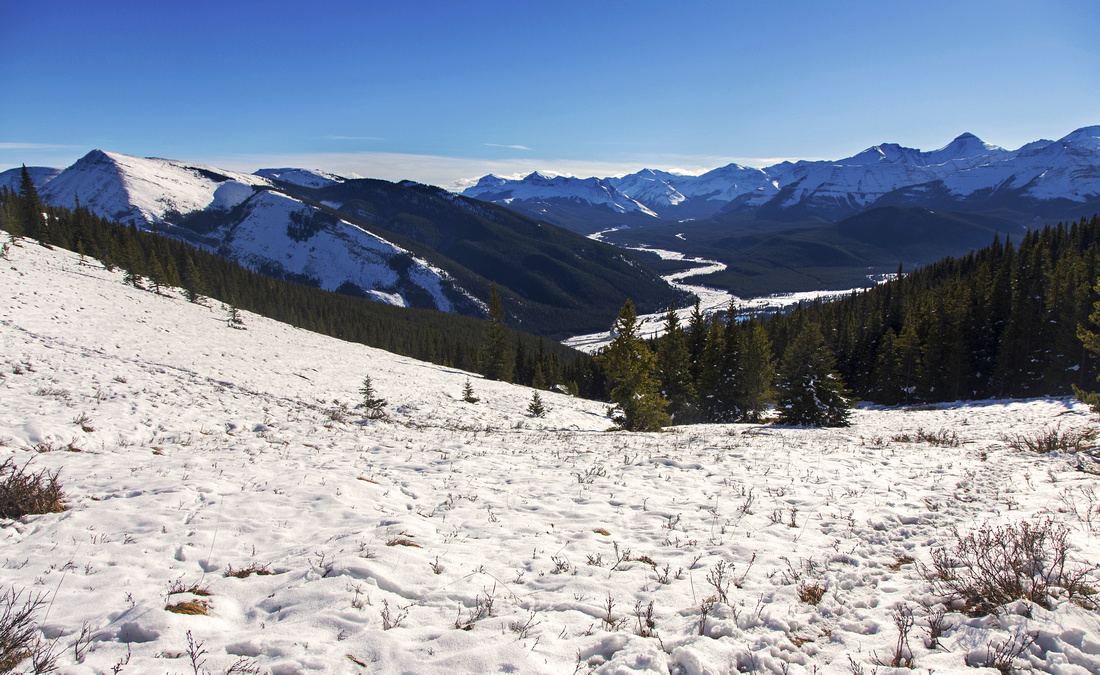 Big Elbow area as trail reaches treeline below Sunrise Hill
 |
|||
 Sunrise Hill. Forgetmenot ridge dead center; Big Elbow left
 |
|||
 Telephoto of Moose Mountain from Sunrise Hill
 |
|||
 Marked junction of high and low south end trails
 |
|||
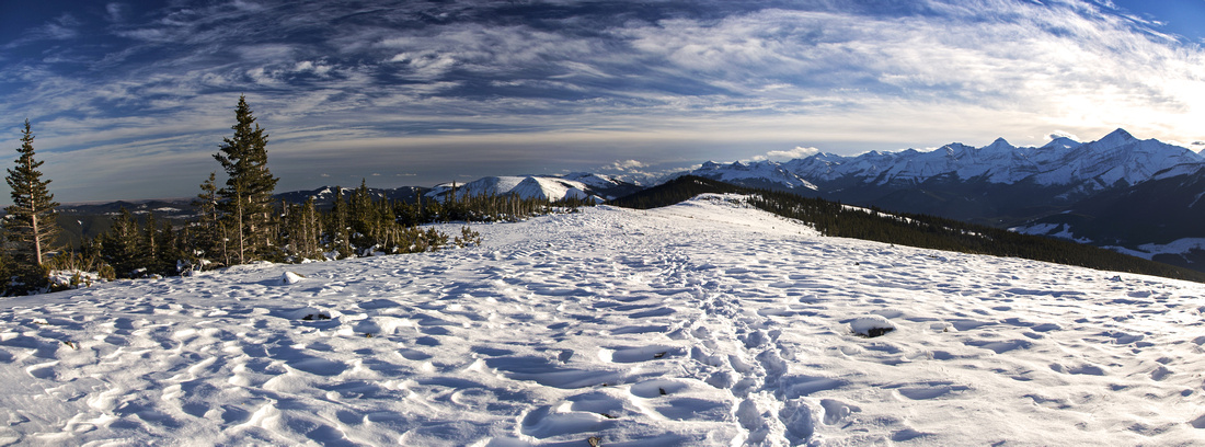 Panoramic view south along Powderface Ridge
 |
|||
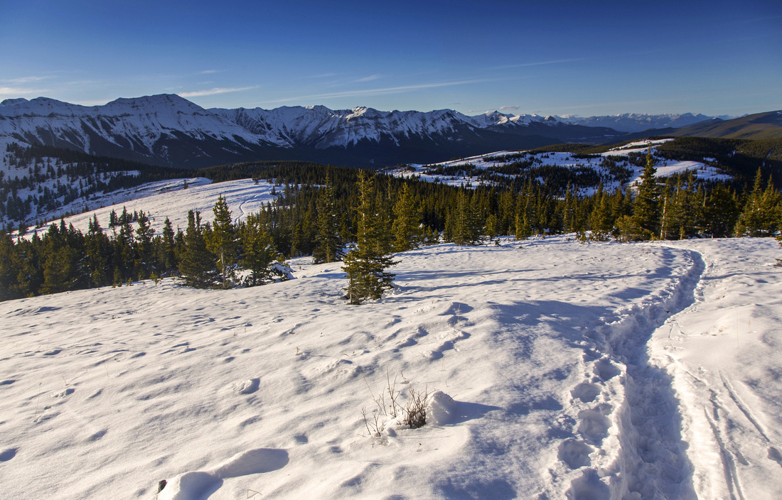 Descending north end towards Three Trails Pass
 |
|||
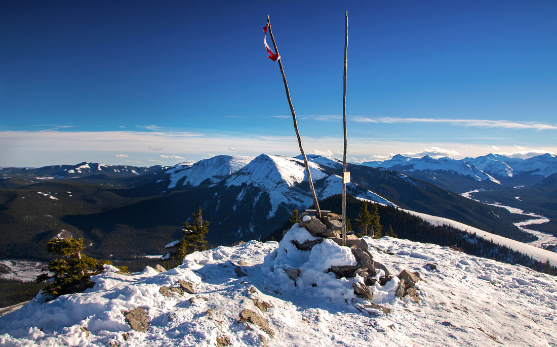
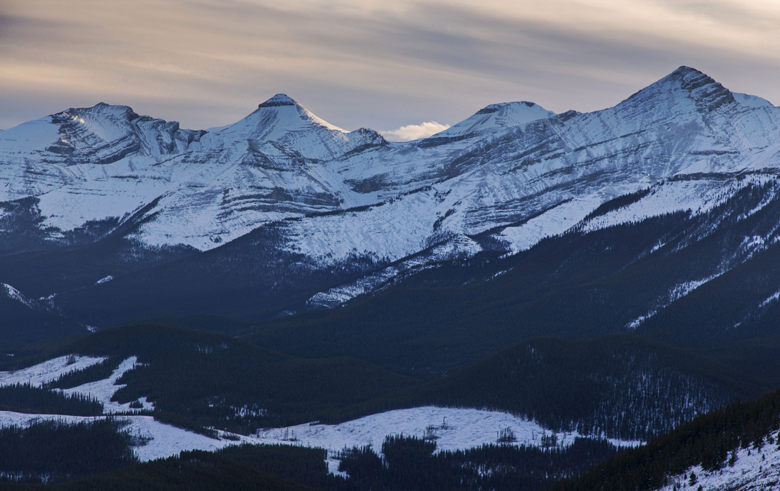 Elbow "Grand Slam" from Three Trails Pass
 |
|||
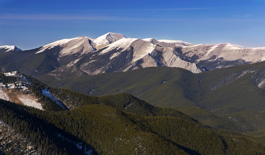
 Three Point Mountain as west side descent trail to Powderface Road plunges below treeline
 |
Abstract
| Overall Difficulty | D3 | Moderately steep south end (3km, 450m vertical), more gentle on the north side regardless of route. Off trail meandering on the ridge | |||
| Snow Factor | S2 | No avalanche danger. Possibility of strong freezing winds on open portion of the ridge. Both ends could have icy sections in shoulder season and require traction. | |||
| Scenery | Sweeping scenery of front ranges and foothills. Very good view of Forgetmenot ridge and peaks along Big/Little Elbow | ||||
| Trail/Marking | Very Good | Well defined trail throughout. Winter wands on the ridge. Junctions are marked | |||
| Suggested Time | 4-5 hrs | Time given for south-north 1-way traverse with west side descent to Powderface road; add 30 mins if descending east to Elbow Trail. Transport back (car, bike, foot) back to Powderface gate at Hwy66 junction not taken into account | |||
| Elevation | Start: 1600m Max: 2205m Total: ~730m | Distance: (S-N, descent to Powderface road): 9.5 km | |||
| Gear | Day hikers sufficient in summer conditions. Micro-spikes useful in shoulder season because of ice below treeline. Wind-breaker essential as ridge is wind-blown year round. Snowshoes in winter | ||||
| Water | Dry hike. Carry 1 - 1.5L | ||||
| Dog Friendly | Yes | Standard back-country travel precautions | |||
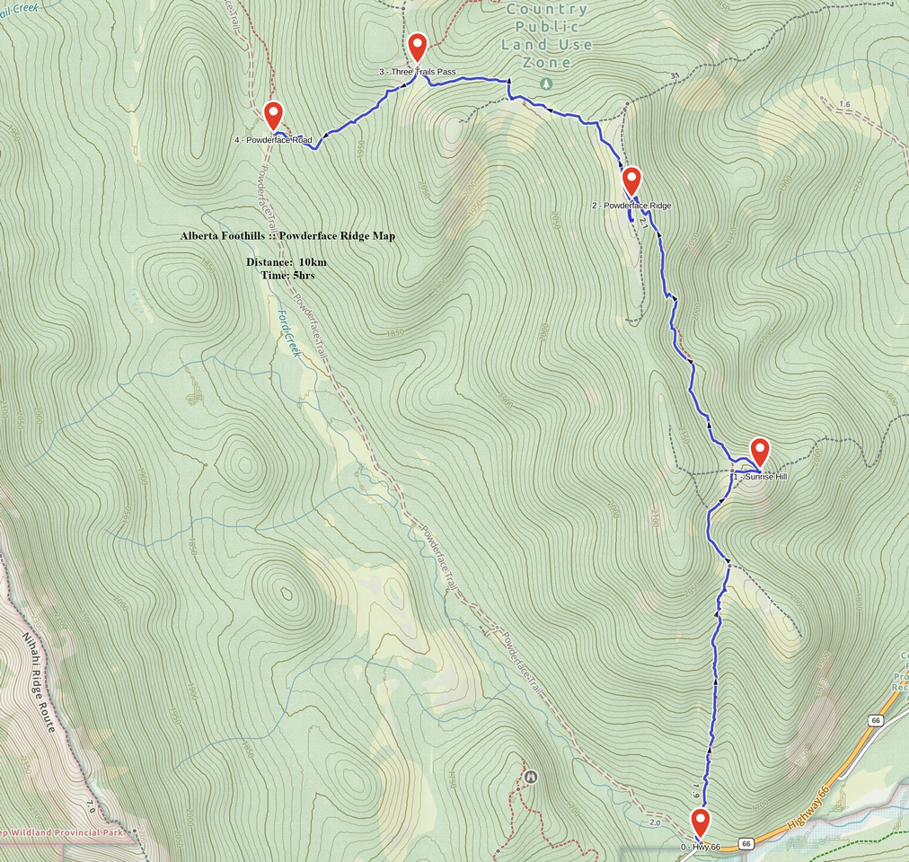 Powderface Ridge GAIA Map
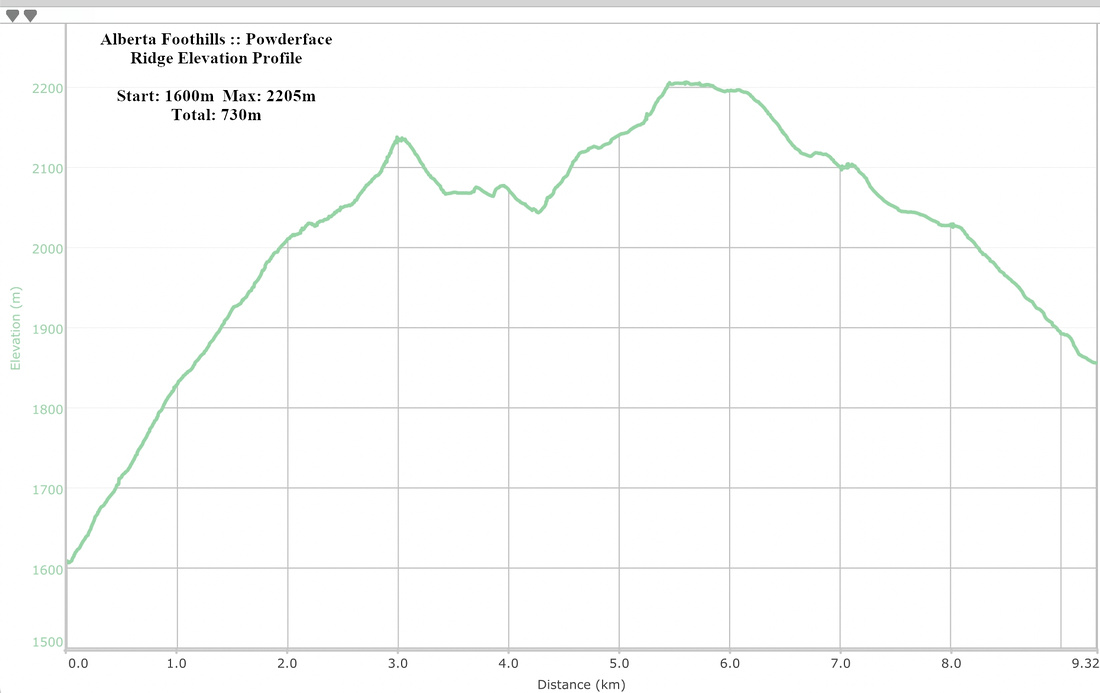 Powderface Ridge Elevation Profile