Google Map |
Rockies :: Canmore and Bow Valley ::Middle Sister |
GPS Track |
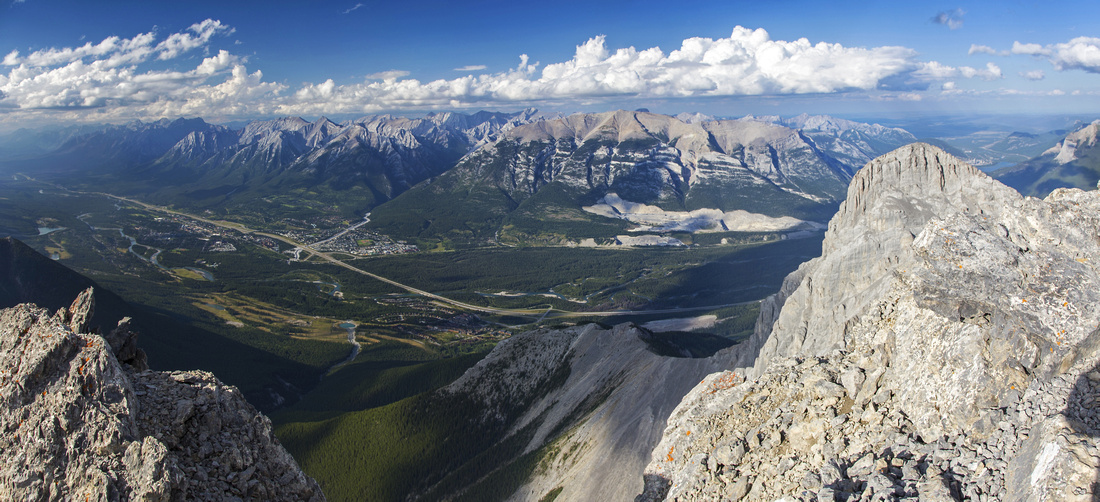 
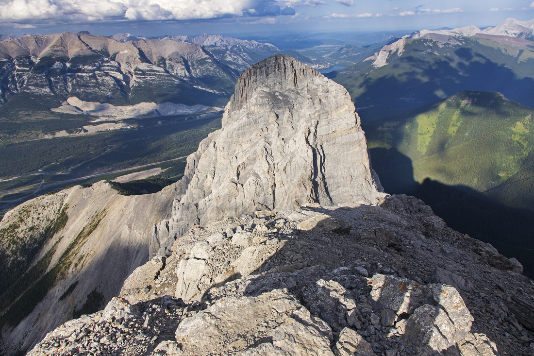
Panoramic views north Middle Sister summit. Bow Valley and Canmore center left; Little Sister right foreground |
|||
| Trip Summary | |||
August 5, 2016
Three Sisters -- originally called "Three Nuns" (Faith, Hope and Charity) -- are main Canmore landmark. Middle Sister (Hope Peak) is technically the easiest; mainly a walk-up from the backside. It is still not an easy trip as approach is quite long and elevation gain considerate. Good balance and micro-route finding in stony and dry Stewart Creek are otherwise the most difficult aspect of the trip. Wide summit offers bird-eye view of Canmore and peaks on north side of Bow Valley; climber rappel route from Little Sister can be studied as well. Overall location is quite wild, sandwiched between the other two Sisters. In thunderstorm (June/July) season Big Sister often hides stormy clouds approaching from Continental Divide - start early, and plan to be down before mid-afternoon as upper part is very exposed to weather conditions.
Due to never-ending residential development in Three Sisters mountain village there is plenty of confusion and non-accurate information in respect to trailhead. There is no need to drive to Stewart Creek golf course; instead simply park past the roundabout on east end of Three Sisters Drive. Descend to service road hidden in the forest between the greens of the golf course and walk east for about 20 minutes till the bridge over Stewart Creek. Bicycle could be taken, but it is not really necessary as it is fairly short. At the bridge leave the road and hike by the drainage on left (east) side, with brief detour to the forest when going gets rough. Soon after you arrive to old dam on Stewart Creek; this is generally considered "Middle Sister Trailhead". Cross to the right (west) side and find good trail heading up. This trail soon joins old forest exploration road; turn left. Road soon ends at washout; from here simply follow cairns mainly staying on the left (east) side. It pays off keeping an eye on the flags, as they indicate stretches of trail in the forest that has not been washed out in 2013 floods; going is much easier there. Keep right at both lower and upper forks. Past upper forks is the most difficult part of the trip; drainage gets steep and slick slabs bar the progress. Ascend on the left side with couple of steps on rock-hard shale; this bit is quite awkward on descent. Bits of trail lead to unexpected grassy meadow below the Orphan and large rocky basin at head of Stewart Creek. Rest of route climbs long talus slope angling right past the cliffband, then makes long diagonal ascent towards the col between Big and Middle Sister. Trickles of water can sometimes be found in orange colored scree gully bed. The position at the col is quite wild, with towering walls of Big Sister above you. From the col summit is an easy 10-15 minutes hands-in-your-pockets walk. Wide summit area has rock walls for wind shelter and sometimes register as well. Views of Little Sister are fantastic, while on the other side of Stewart creek drainage to the east length of Wind Ridge is equally impressive. Return the same way; descent time will be shorter, but not by much as care is required to keep balance and avoid sprained ankle in what will seem never ending Stewart Creek. |
|
Gallery |
|||
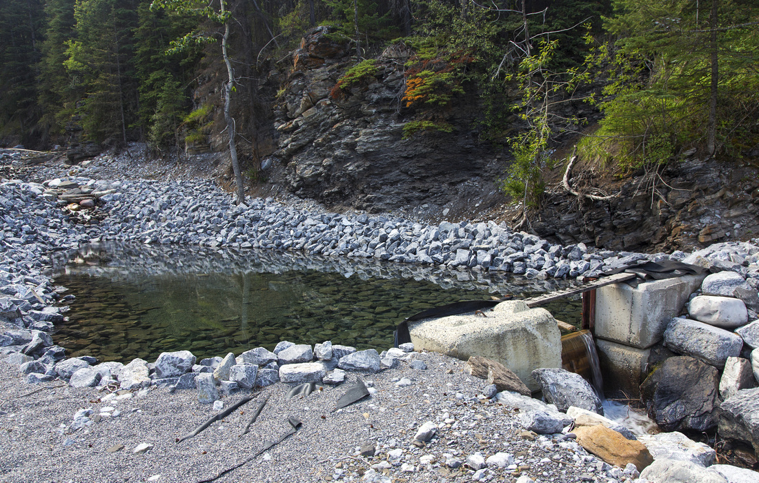 Old dam at Stewart Creek is "Middle Sister Trailhead"
 |
|||
 Little and Middle Sister from upper Stewart Creek
 |
|||
|
|
|||
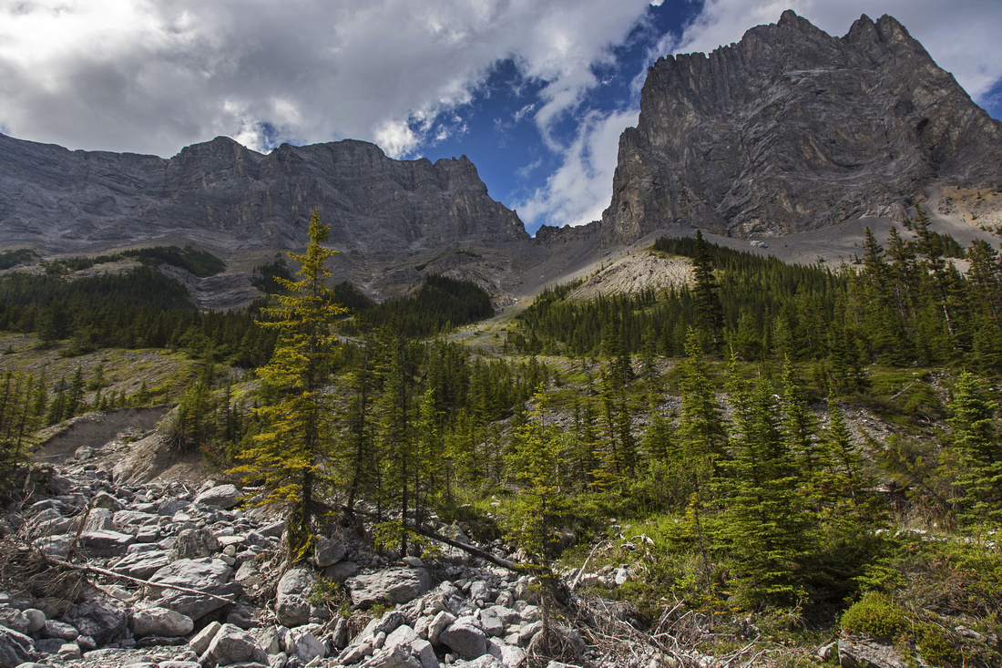
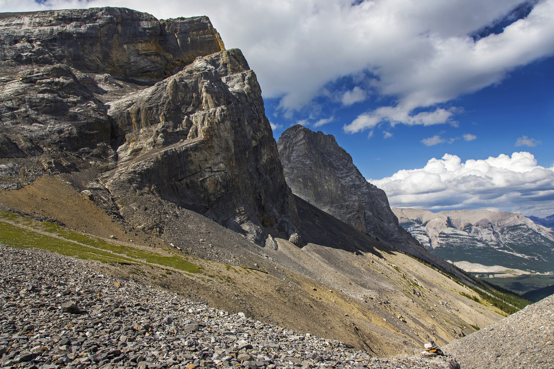
 Middle Sister ascent route from summit of the Orphan
 |
|||
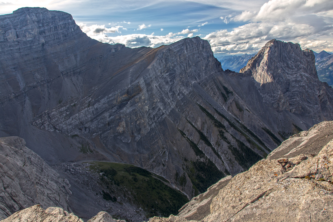
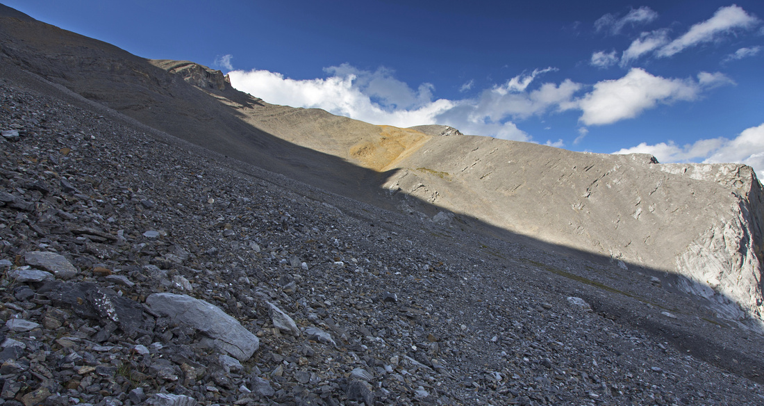 Long diagonal scree ascent towards Big/Middle col
 |
|||
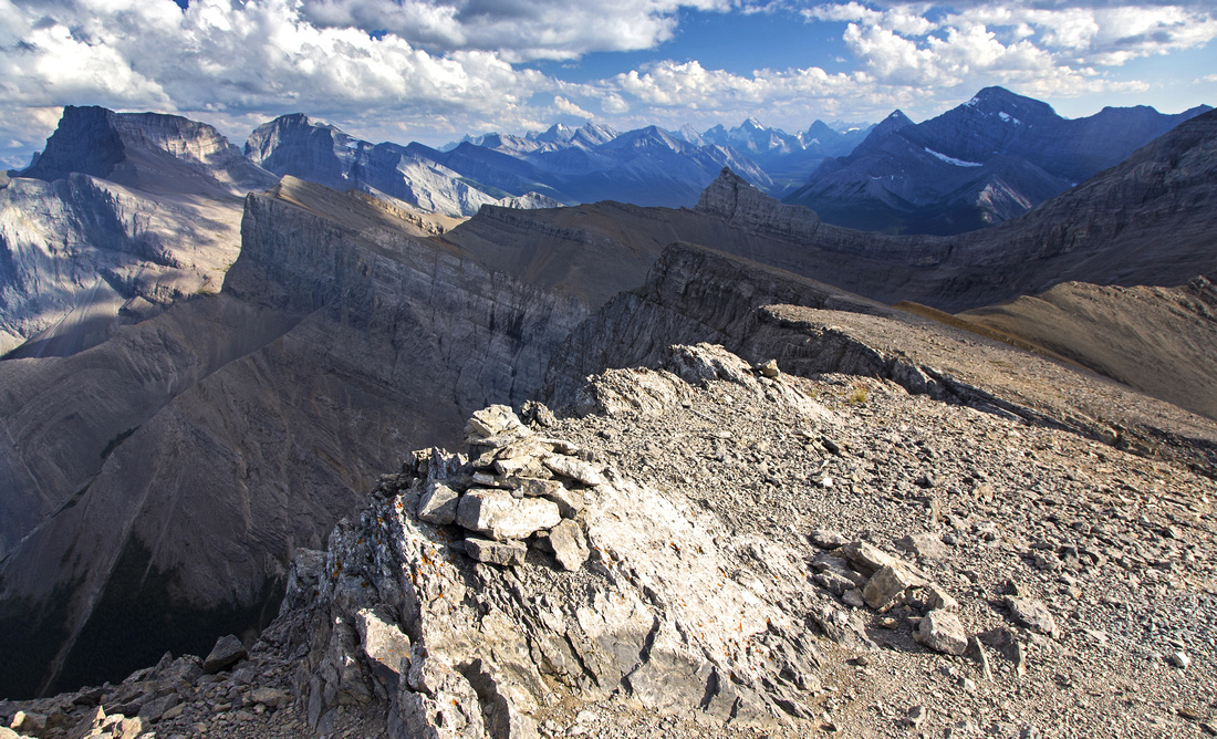 Views south from gentle ascent ramp above the col
 |
|||
 Summit view of Little Sister
 |
|||
|
|
Abstract
| Overall Difficulty | D5 | Easy rock-hops over Stewart creek in lower part. Tedious and long travel in stony creek bed. Awkward steep side-hilling in upper canyon. Moderately angled and long scree slopes. | |||
| Snow Factor | S4 | Considerable avalanche danger in upper Stewart Creek. However with right snow conditions, snow cover would make upper talus part considerably easier -- check avi conditions and use proper judgement | |||
| Scenery |
Bird-eye view of Bow Valley and Canmore. Summit view of Little Sister steals the show! |
||||
| Trail/Marking | Poor/good | Trail in Stewart Creek washed out. Good flagging and frequent cairns. Scree trails above the basin; way is obvious | |||
| Suggested Time | 8-9 hr | Return time from Three Sisters Village / Stewart Golf Course | |||
| Elevation | Start: 1360m Max: 2780m Total: 1420 m | Round Trip: 20km | |||
| Gear | Full hiking boots. Poles essential for stability and talus slopes. Helmet could be an asset in large group for upper part | ||||
| Water | Lower Stewart Creek, but canyon is dry above the forks. Carry 2-3L | ||||
| Dog Friendly | Yes | Standard back-country travel precautions. Lots of sharp rock - might hurt the paws | |||
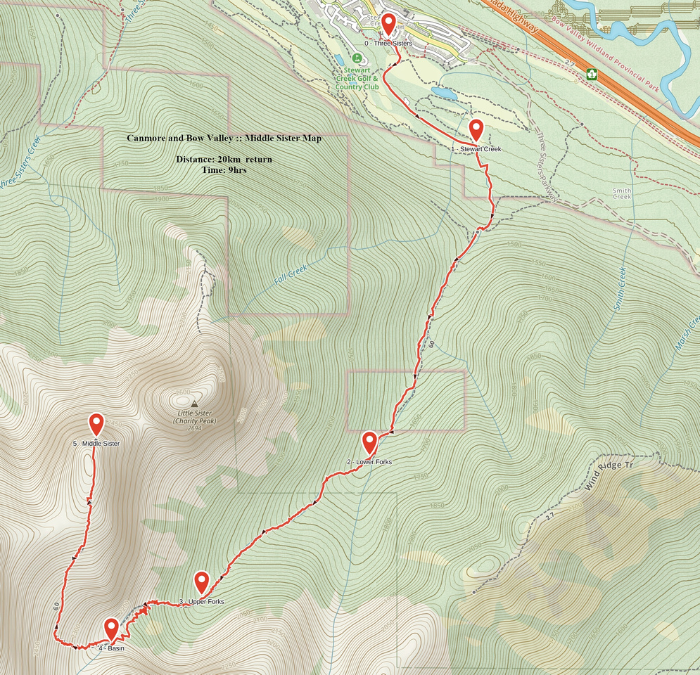 Middle Sister GAIA Map
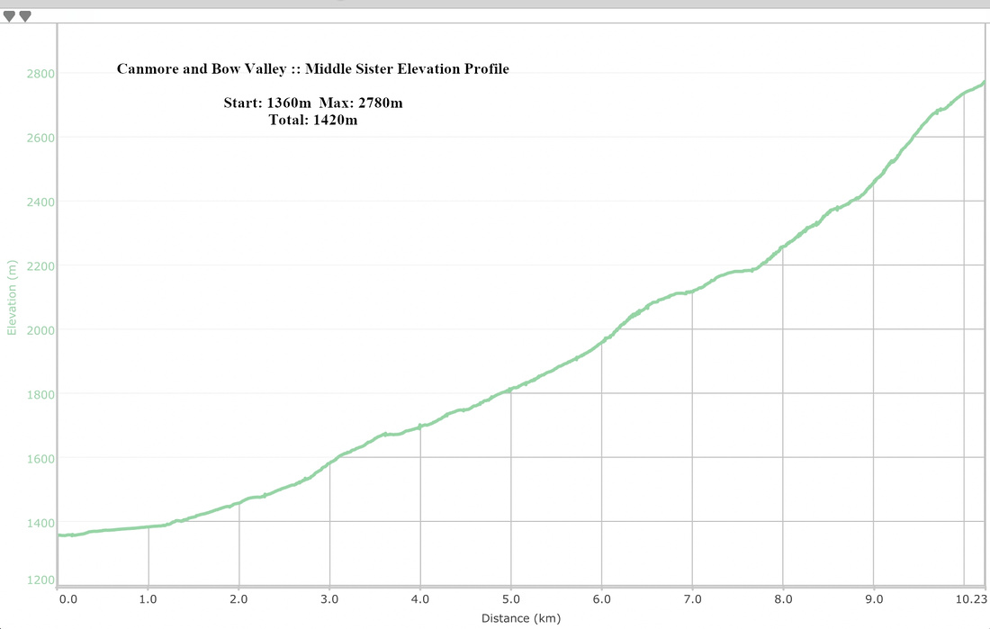 Middle Sister Elevation Profile