Google Map |
Rockies :: Canmore and Bow Valley ::Grassi Lakes / Whiteman Gap |
GPS Track |
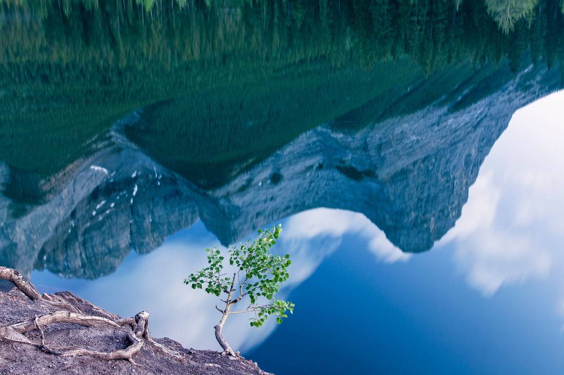 
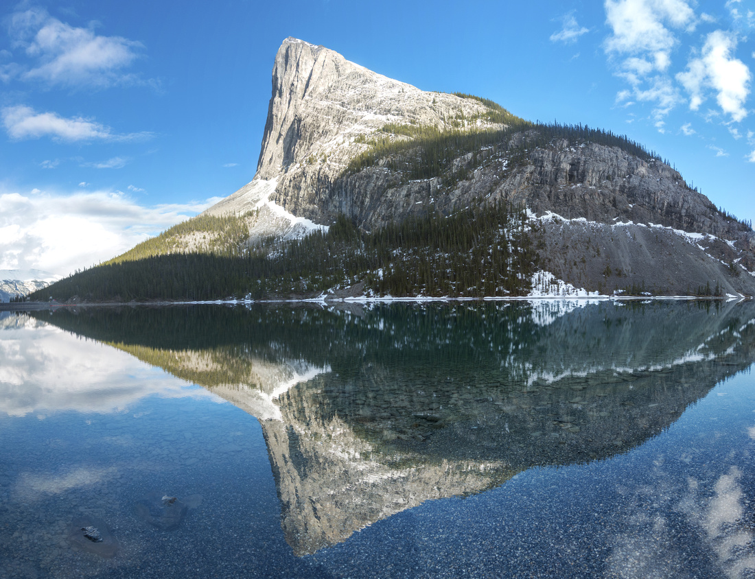
Ha Ling and Miners Peak reflected in calm water of lower Grassi Lake |
|||
| Trip Summary | |||
Multiple Dates, last Mar 11, 2024
This is an easy and very popular hike to two emerald-green lakes in the shaded cirque below Whiteman Gap. The area is very popular with rock-climbers. This provides an entertainment for hikers, but also poses rockfall danger if one ventures beyond second lake. Majority of hikers climb via lower trail which is steeper and more challenging, but also more scenic - then return via easy road-like upper trail. Pleasant extension is to continue from upper lake to Whiteman Pond, then descend via mountain-biking "Riders of Rohan" trail. For best lighting first half of the day is preferable, as sun moves behind Ha Ling/EEOR in the afternoon and creates shade. Do not expect solitude. Drive Spray Lakes road past Nordic center, then just before surface changes to gravel turn left and descend to parking lot. Trans-Alta hydro facilities are here. From trailhead hike a few minutes to junction, then take lower trail. In winter this trail is closed; if so, please obey the signs and take the upper trail. Pleasant walk for about 15-20 minutes leads to clearing and fantastic viewpoint. From here trail is bit more rough as it switchbacks up the slope; steepest part has stone staircase built in (watch for trail branching left across wet scree - it leads to the base of falls draining lower Grassi lake into Rundle forebay). Upon arriving to lower lake note the gravel ramp coming down from the pipe next to (often closed) biffy; this is where you will return on Whiteman/Riders of Rohan extension. There are trails on both sides of the lake. If doing only the Grassi lakes, turn back and descend via upper trail. For Whiteman Gap continue on man-made stairs past second lake and climb next to several climbing walls. There is real rockfall danger here; it is also likely to be slippery in winter. Trail crosses short boulder field, then continues on scree trail north end of Whiteman Gap. Cross the berm and find the trail on the other side; it climbs briefly to junction with "Riders of Rohan". Turning right leads in few minutes to east shore of Whiteman Pond, and very nice break spot. To descend back to Grassi Lakes go left and follow trail downhill. One section is bit steep and eroded; hiking pole would be an asset here. About 10-15 minutes of hiking brings you to marked junction; turn left and descend to lower Grassi lake then return via the upper trail back to the parking lot.
Update Spring 2021: Alberta Parks are introducing "Kananaskis Conservation Fee" starting June 1; annual cost is 90$. This means Grassi Lakes parking will not be free anymore, even for Canmore residents. |
|
Gallery |
|||
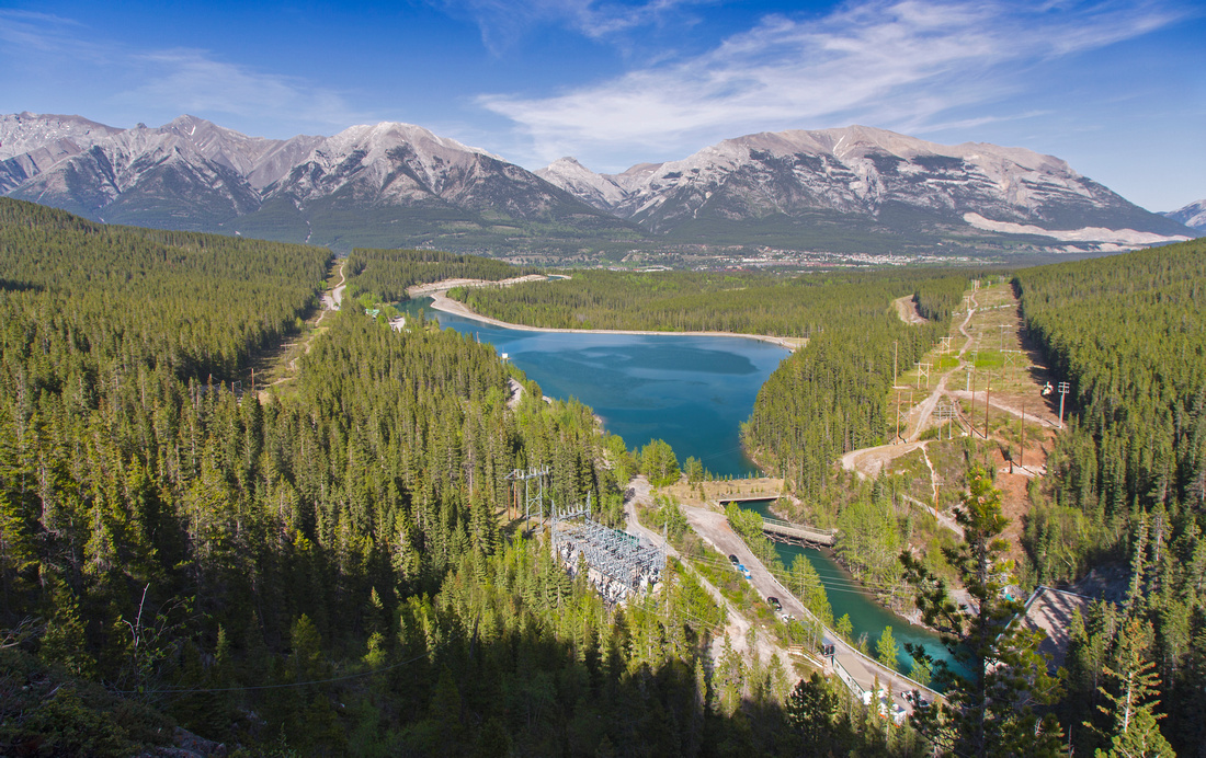
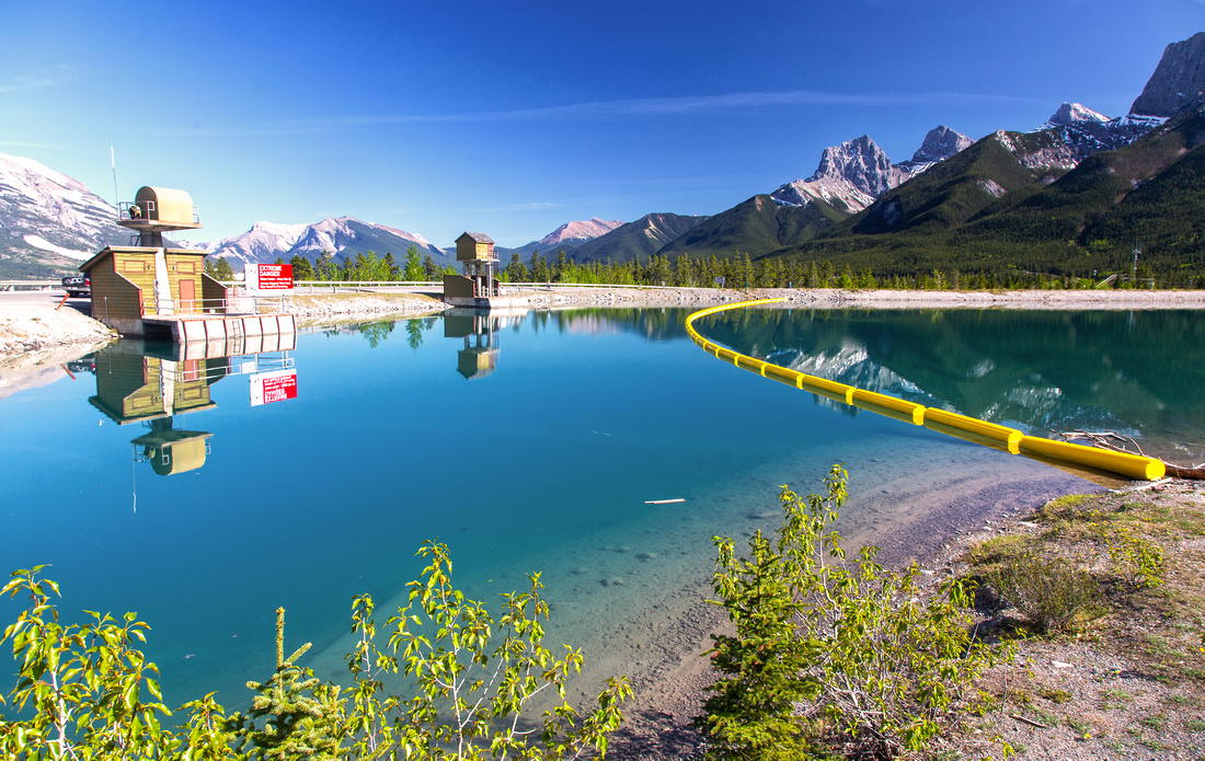 Rundle Forebay
 near Nordic Center at Spray Lakes road Rundle Forebay
Rundle Forebay near Nordic Center at Spray Lakes road |
|||
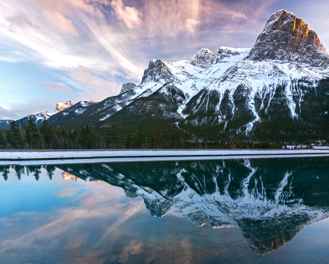
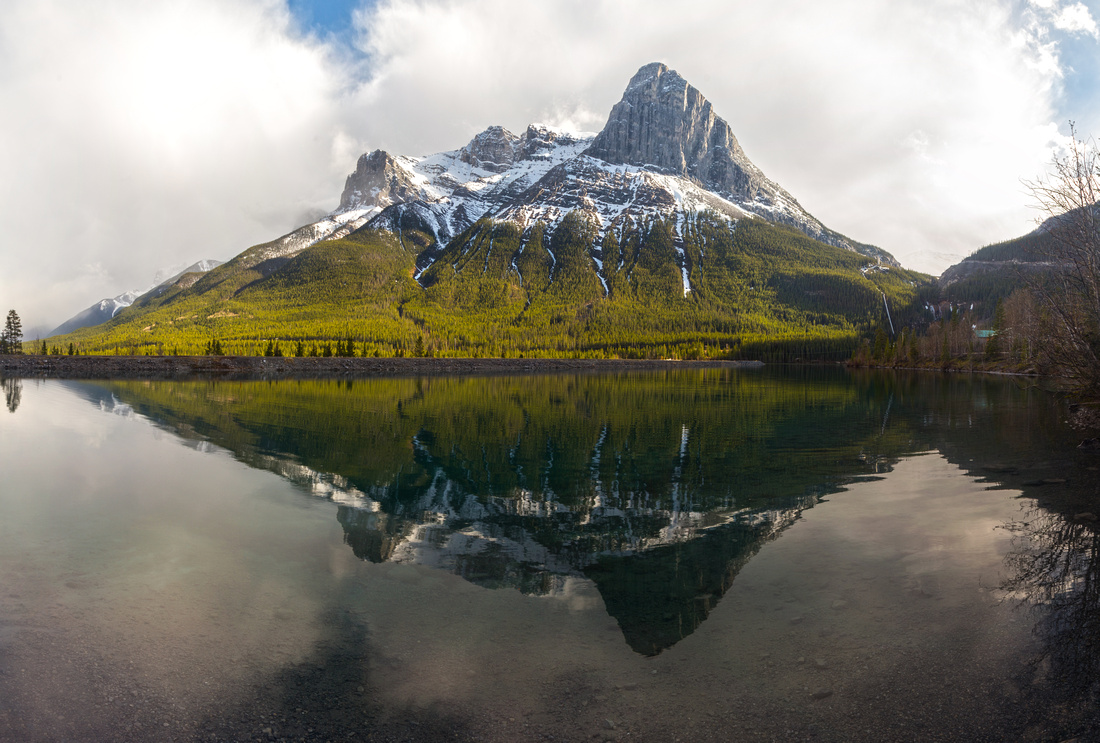 Afternoon Sunlight
Dramatic reflections of Ha Ling peak in Rundle Forebay just below Grassi Trailhead parking Afternoon Sunlight
Dramatic reflections of Ha Ling peak in Rundle Forebay just below Grassi Trailhead parking |
|||
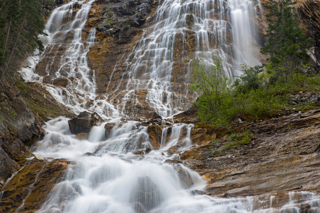
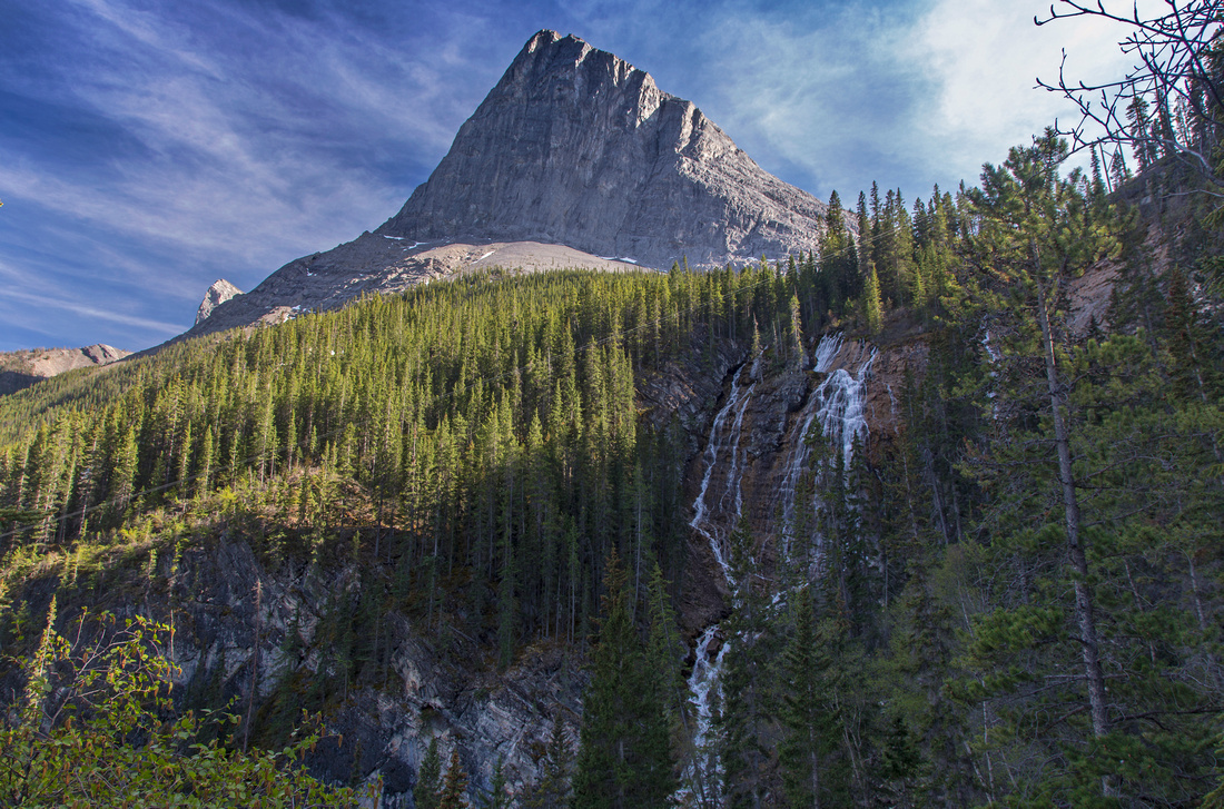 Grassi Waterfall
Spectacular waterfall draining lower Grassi Lake into Rundle Forebay from lower trail viewpoint Grassi Waterfall
Spectacular waterfall draining lower Grassi Lake into Rundle Forebay from lower trail viewpoint |
|||
 Grassi Waterfall
Grassi waterfall close-up. If not wet/icy one can scramble here from lower trail; easier is to trash up directly from far end of Rundle Forebay Grassi Waterfall
Grassi waterfall close-up. If not wet/icy one can scramble here from lower trail; easier is to trash up directly from far end of Rundle Forebay |
|||
|
|
|||
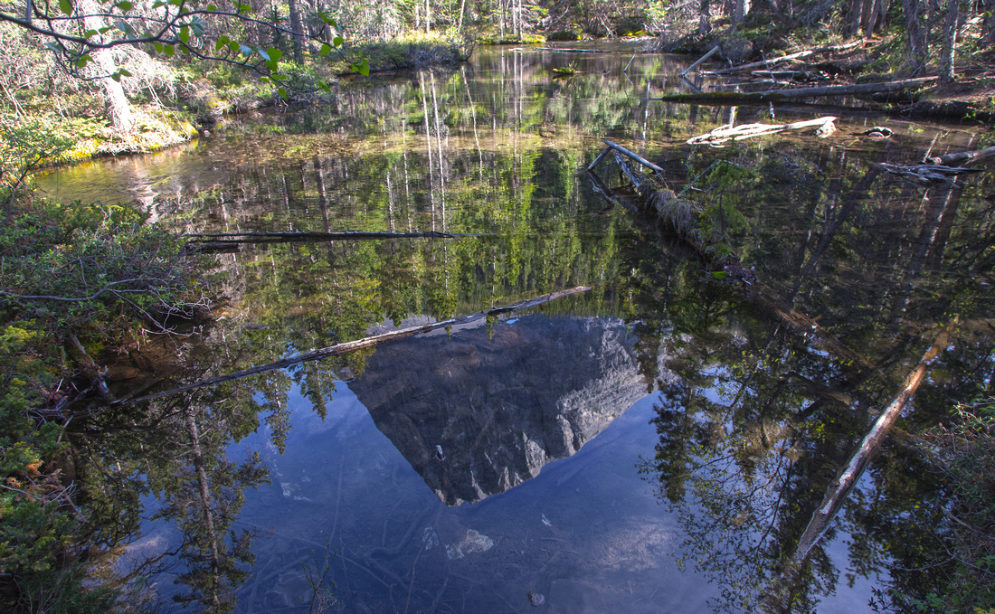 Lower Grassi Lake
Reflections of Ha Ling in lower Grassi Lake Lower Grassi Lake
Reflections of Ha Ling in lower Grassi Lake |
|||
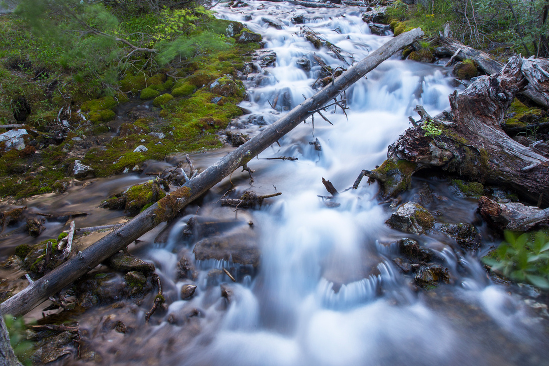 Outlet Cascades
Lovely cascades draining lower Grassi Lake Outlet Cascades
Lovely cascades draining lower Grassi Lake |
|||
 Whiteman Gap
Crossing Whiteman Gap towards Riders of Rohan Whiteman Gap
Crossing Whiteman Gap towards Riders of Rohan |
|||
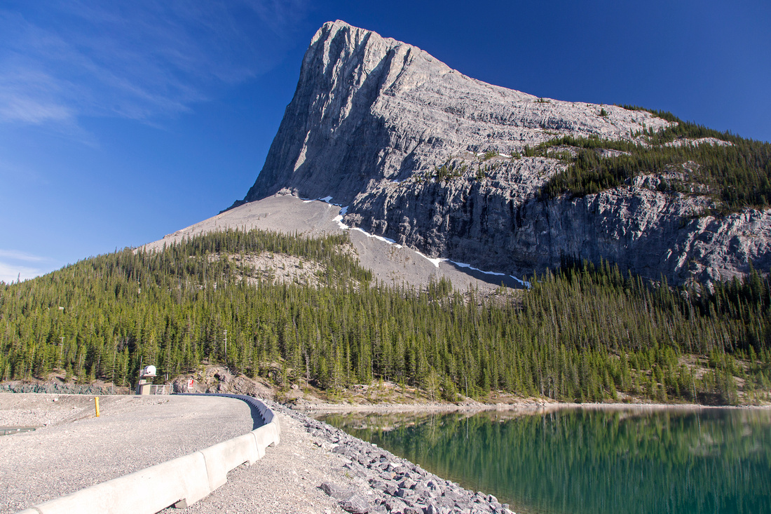
 Symmetry in Nature
Dramatic reflection of Ha Ling peak in Whiteman Gap reservoir a bit further up Spray road Symmetry in Nature
Dramatic reflection of Ha Ling peak in Whiteman Gap reservoir a bit further up Spray road |
|||
|
|
Abstract
| Overall Difficulty | D2/3 | Steep, but short switchbacks below lower lake. Rough parts and some rockfall danger (D3) on optional extension to Whiteman Pond and loop return via Riders of Rohan | |||
| Snow Factor | S3 | Lower trail closed in winter. Upper trail often very slippery and/or icy | |||
| Scenery | Emerald-blue lakes. Large waterfall in the backdrop of Ha-Ling peak. Windswept Whiteman Pond and panoramic views of Bow Valley | ||||
| Trail/Marking | Excellent | Wide and well-defined trail(s) with marked junctions. Minor bit of route-finding on Whiteman Gap extension. | |||
| Suggested Time | 2 hr | Leisurely pace. Add an hour for Whiteman Gap extension | |||
| Elevation | Start: 1350 m Max: 1710 m Total: ~350 m | Round Trip: ~5.5 km | |||
| Gear | Light hikers. Micro-spikes essential in winter | ||||
| Water | Several streams crossing lower trail. Creek draining Grassi Lakes. Carry no more than 0.5L | ||||
| Dog Friendly | Yes | No on-leash restrictions, but be courteous to others as this is very popular area | |||
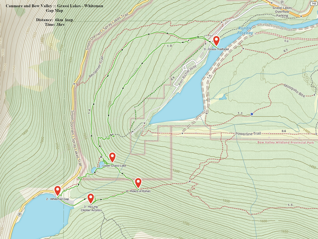 Grassi Lakes - Whiteman Gap GAIA Map
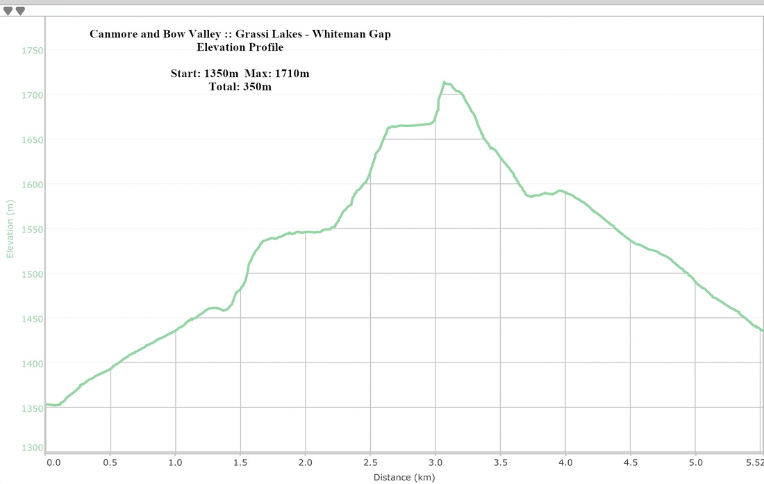 Grassi Lakes - Whiteman Gap Elevation Profile