Rockies :: Canmore and Bow Valley :: Grassi Knob |
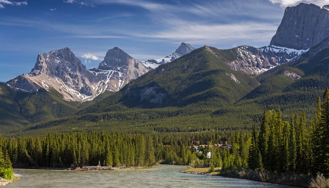 
View from Bow Bridge to Three Sisters; Grassi knob is the bump just to the right of Big Sister |
|||
|
Grassi Knob is relatively unknown Canmore hike. It appears as bump below Ship's Prow when seen from Bow Bridge. Summit affords phenomenal in-your-face view of Three Sisters, as well as panoramic vista of entire Bow valley. Although it qualifies as good after-work objective from Canmore, it is not trivial -- ascent is steep with considerable amount of elevation gain. It is possible to extend the hike for another 20-30 minutes by continuing on semi-forested slopes south to Ship's Prow. Several climbing routes start from the base. You can also study conditions on Big Sister; it should be snow free for normal Kane scramble access. It also appears feasible to follow drainage directly below Lawrence Grassi for alternate access from north side, but this route has plenty of scrambling and route finding and thus can not be recommended.
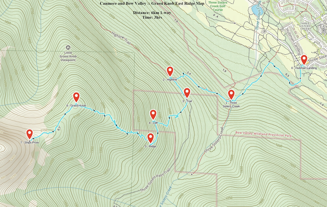
Two possible ways up exist. More commonly used is west ridge with well defined trail starting at Peaks of Grassi. Other option starts from Hubman Landing in Three Sisters. This option is more tricky and lacks established trail. Both can be combined for a loop. If you have never been on East Ridge descent is not recommended as there is little trail and many confusing junctions lower down - better to ascend this way first time around.
|
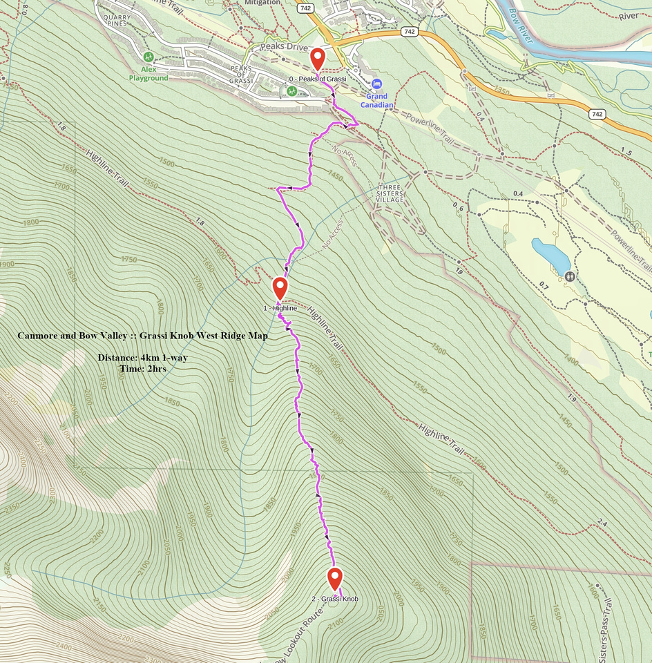
| West Ridge | GPS Track | ||
|
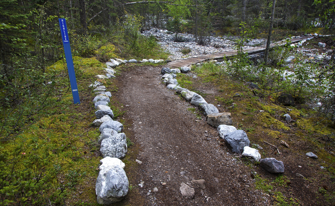
Most direct access is from Peaks of Grassi neighborhood in south Canmore; there should be enough street parking. If coming on foot, walk up standard Quarry lake trail from Bow bridge, then continue for ~1km on Powerline trail. East Highline connector climbs gently for about 30 minutes; watch for mountain bikes. Upon reaching marked junction with Highline trail turn left and cross wide drainage within a minute. This drainage provides access to forested slopes of Grassi Knob. Look for trail on east side immediately after you cross drainage; it is faint and turnoff might not be marked. This trail ascends steeply for few minutes, then descends to the creek. This is the critical point as there are 2 possible options. Good trail switchbacks to the left but soon becomes brutally steep and requires constant use of hands. Descending this way would be very awkward. Alternative is continuing up the canyon bed - it might not be feasible during spring runoffs. Going this way is not cake walk either; there are couple of steeper steps on slick rock, but they can by bypassed on the climber left. About 15 minutes from Highline leave the canyon and pick up good trail heading up on the left side. Both alternatives soon join; this junction is flagged. Rest is obvious - up, up and then some more up. Halfway there is bit of flat bench, but grade soon resumes. Section with minor deadfall is crossed in upper part where it is possible to temporarily lose the trail, but direction is obvious. Finally about 10-15 minutes before the summit trees thin out allowing good view back to Bow corridor while Ship's Prow towers on the right side. Three Sisters are hidden for now. Final summit block is bypassed on the left (north) side; odd snow patch usually lingers here till late in the spring. Upon reaching east side, trail turns sharply right and climbs final few meters to rounded summit. East Ridge route joins here as well.
Return the same way, or for a loop see East Ridge description. Eventually you would reach Highline Trail and follow west to your starting point. |
|||
 Quarry Lake
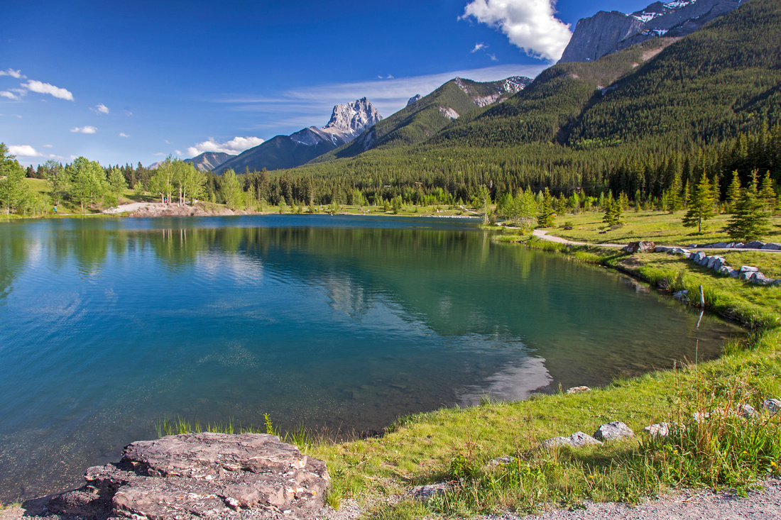
Grassi Knob (right of Big Sister) from Quarry Lake Quarry Lake
Grassi Knob (right of Big Sister) from Quarry Lake |
|||
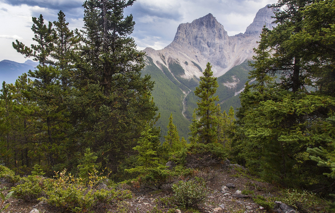
 Ship's Prow
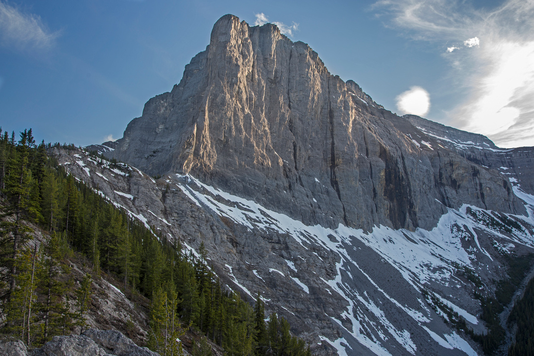
 about 15 minutes before the summit Ship's Prow
Ship's Prow about 15 minutes before the summit |
|||
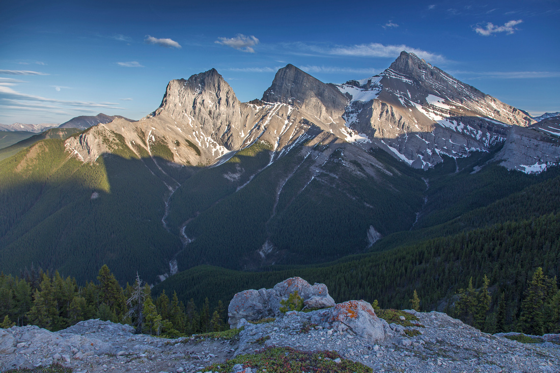 Three Sisters Three Sisters
View of Three Sisters from the summit |
|||
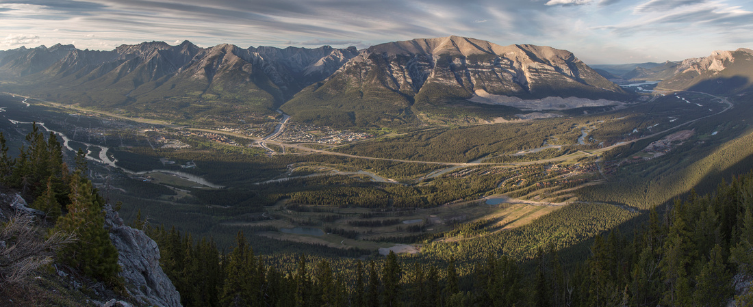 Bow Valley Panorama
Panoramic view of Bow Valley from the summit Bow Valley Panorama
Panoramic view of Bow Valley from the summit |
|||
|
|
| East Ridge | GPS Track | ||
|
East Ridge route starts from Hubman Landing at top of Three Sisters Drive (exit 93 from Trans-Canada highway). This is also east terminus of Highline Trail. Follow Highline for about 20-25 minutes to bridged crossing of Three Sisters Creek and continue for another km to junction with Old Bench Road. This will be second junction past the creek; old overgrown road joins from the left (east) - pic 2 in the gallery. Highline marker is here. Turn left into Old Bench and follow for short time only (5-10 minutes). There is some deadfall here to contend with; conditions will vary between the seasons. Bushy trail comes in from the right side - pic 3 in the gallery. Follow this trail up. It becomes less defined higher up so pay attention. Eventually it switchbacks left, then right and approaches cliff band; most overgrown part is right here. At base of cliffs look for good trail on the left side -- all route finding problems are now behind you. This trail contours east for another 10-15 minutes. When you reach set of orange flags trail vanishes; this is the beginning of east ridge route. Turn right and head up. There is no more trail, but forest is open and going straighforward; you might be able to stumble upon old faded flag or two as well. Higher up bypass bit of peeling cliff on the left side - there is cairn and good view of Little Sister above - pic 4 in gallery. Bits of trail now appear again and you join West Ridge (normal) route just below the summit.
If coming down this way, key is to watch for set of flags at start of east ridge in order to be able to pick-up trail that descends to Old Bench Road. It is also possible to trash all the way to Three Sisters Creek directly, but this is quite awkward lower down and better avoided.
|
|||
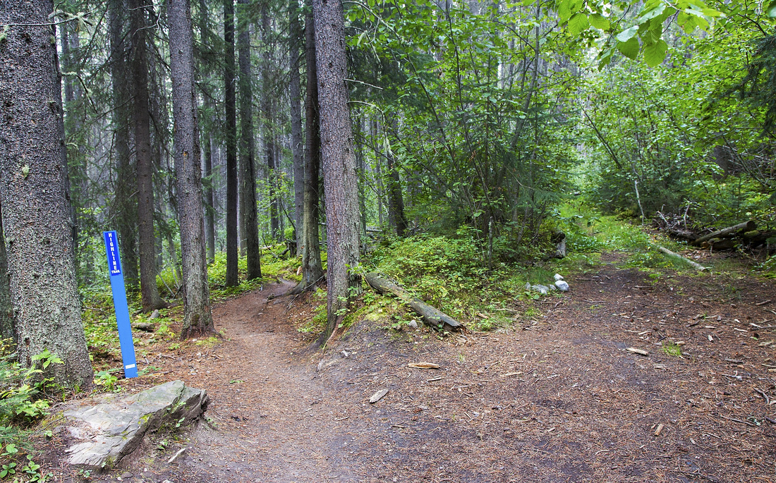
 Highline Trail
 just before crossing of Three Sisters Creek Highline Trail
Highline Trail just before crossing of Three Sisters Creek |
|||
 Old Bench Junction
Old Bench Road / Highline junction, looking back Old Bench Junction
Old Bench Road / Highline junction, looking back |
|||
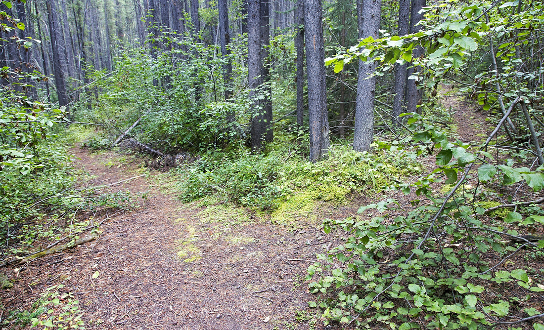 East Ridge Junction
East ridge trail branches right from Old Bench Road East Ridge Junction
East ridge trail branches right from Old Bench Road |
|||
 Ridge Clearing
View of Little Sister from clearing on East Ridge Ridge Clearing
View of Little Sister from clearing on East Ridge |
 Grassi Knob East Ridge GAIA Map
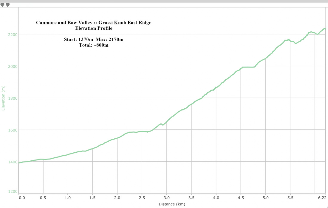 Grassi Knob East Ridge Elevation Profile
Abstract
| Overall Difficulty | D4 | Easy scrambling in drainage followed by very steep trail with several steps that requires use of hands on West Ridge. Steep off trail hiking with route-finding on East Ridge | |||
| Snow Factor | S3 | Forest enclosed slopes with low avalanche danger. Steep snowshoe objective; not feasible on skis | |||
| Scenery | Superb "in-your-face" view of Three Sisters from the summit. Good panorama of Bow Valley. Towering Wall of Canmore -- Ship's Prow, Lawrence Grassi and Ha Ling/Miner's Peak | ||||
| Trail/Marking | Good / None |
|
|||
| Suggested Time | 3-4 hr | Return time for West Ridge, similar for East Ridge. Add ~1 hour if doing the loop | |||
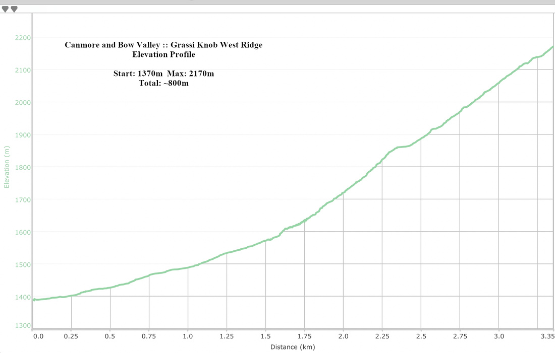
| Elevation | Start: 1370m Max: 2170m Total: ~800m | Round Trip: 4-6km, depending on option | |||
| Gear | Light hikers should be enough. Hiking poles essential for stability. Icers and/or snowshoes in winter conditions | ||||
| Water | Dry hike. Carry at least 2L | ||||
| Dog Friendly | Yes | No on-leash restrictions | |||