Google Map |
BC Coast :: Squamish to Whistler :: Coin Lake |
GPS Track |
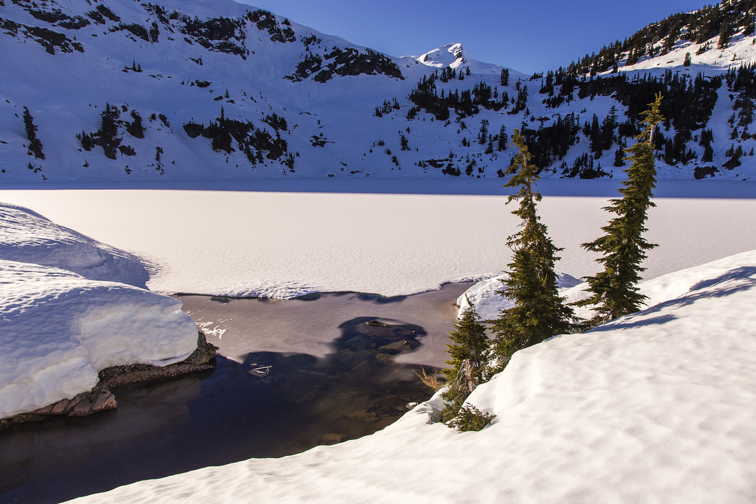 
Outlet of Coin Lake looking west towards Pokosha divide and sub-peak of Mt. Jimmy Jimmy |
|||
| Trip Summary | |||
February 21, 2015
Exploratory trip leading to rarely visited lake on north end of Tantalus range. Approach is on network of forest service roads in Ashlu creek valley, followed by BCMC maintained trail up Pokosha drainage. High-clearance vehicle will cut ~3km (each way). Steep forested slopes without trail must be ascended to the lake; there is occasional flagging but GPS will aid navigation considerably. Coin Lake plateau is very scenic and offers outstanding views SE towards Sigurd peak area including unusual angles of Ossa (BC Scrambles Book) and Pellion. Much exploration in alpine above the lake is possible, including ascent of Coin Peak (towering directly above the lake). Major mountaineering objective is Mt. Jimmy-Jimmy; entire route can be readily studied from Pokosha divide above the lake. Coin Lake has largely stayed off the radar - expect complete solitude with real sense of adventure. This is not the trip for anyone requiring established trails; good orienteering and route-finding skills are essential.
Access is via Ashlu River Road branching of Squamish Valley Road. Branch off left on A600 and reach 2WD parking some 15 minutes from last bridge over Ashlu River. Fast walk for about 20 minutes leads to A-610 branch. 4WD parking is about 1km uphill. Steady walk for 45min to an hour leads to canyon and large alder slide. Elevation here is ~900m. At far end of the slide leave trail and head up following occasional flags. Higher up angle left and cross open slopes, then finish ascending steep semi-forested ramp to SE end of Coin Basin just above 1400m |
|
Gallery |
|||
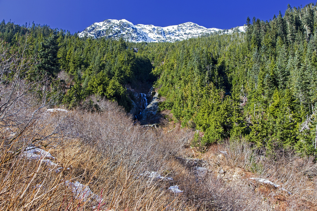 Crossing alder slide about 45 mins from 4WD parking
 |
|||
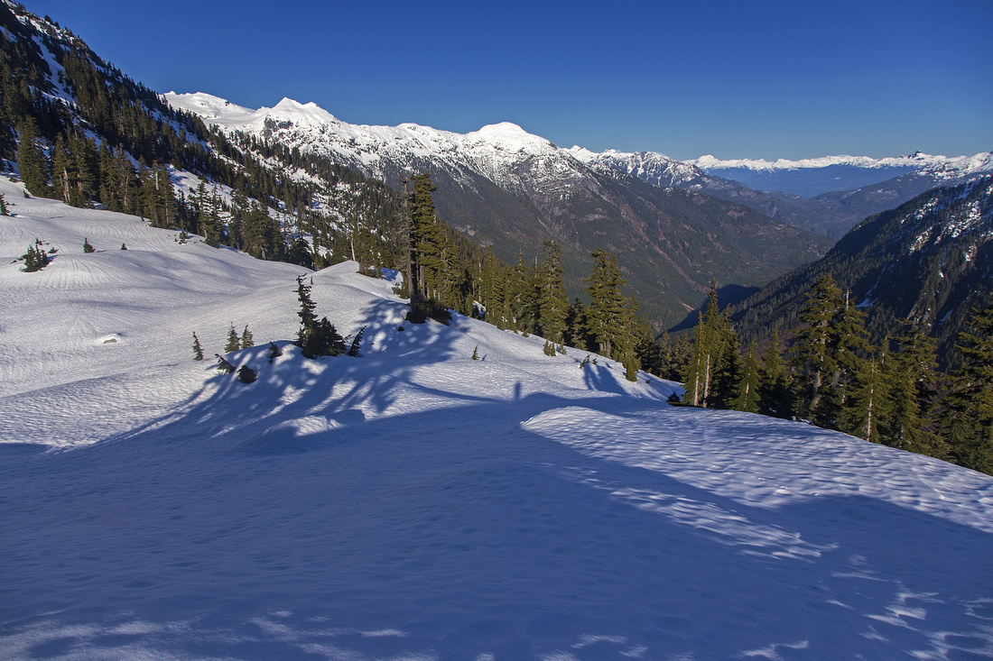 SE end of Coin Lake, 500m and 1.5-2 hrs from Pokosha Trail
 |
|||
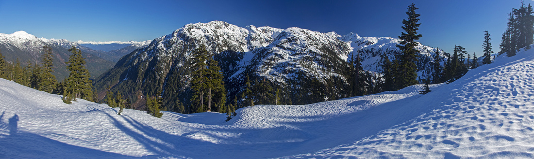
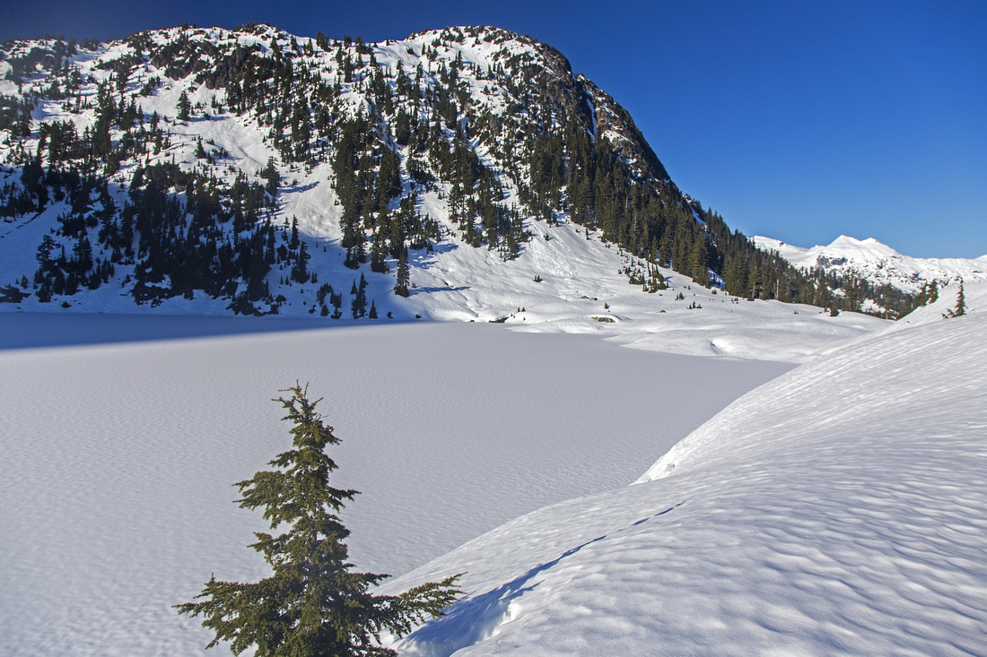 Mid-point of Coin Lake looking back to plateau at SE end
 |
|||
 Zoom on Ossa and Pellion above Sigurd Headwaters
 |
|||
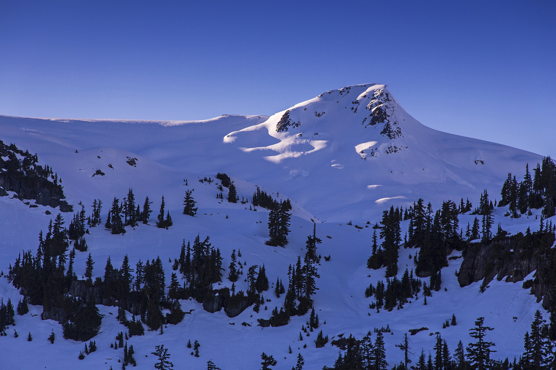 Zoom on Pokosha divide
 |
|||
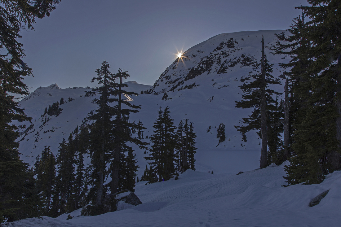 Sun setting down on Coin basin
 |
|||
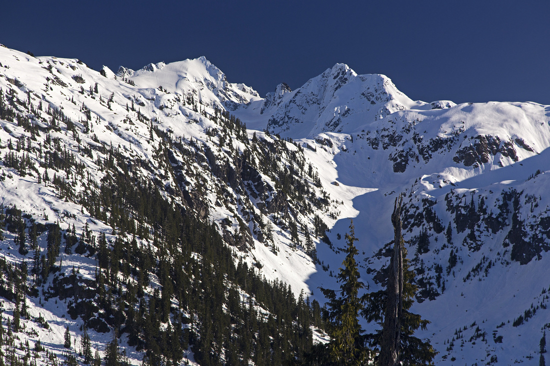
 North end of Tantalus range from Coin lake
 |
Abstract
| Overall Difficulty | D5 | Steep forested slopes with no trail and occasional flagging. Route-finding and orientation skills required. Challenging micro-terrain. Considerable elevation gain. | |||
| Snow Factor | S3 | Post-holing in soft snow traversing boulder field ~1200m. Steep slopes of hard frozen crust leading to Coin Lake. Low to moderate avalanche danger, if heading just to Coin Lake | |||
| Scenery | Pretty alpine lake with exceptional views to north end of Tantalus range. Minor waterfalls and some nice forest. | ||||
| Trail/Marking | Good/None | Pokosha trail well defined and marked. Marked route (occasional flags only) with no trailbed to Coin Lake | |||
| Suggested Time | 7hr | To Coin Lake, from 2WD parking; less with 4WD. Add ~3 hrs (return) if climbing Coin Peak | |||
| Elevation | Start: 180m (2WD) Max: 1410m (Coin Lake) Total: ~1250m | Round Trip: 18km (Coin Lake) | |||
| Gear | GPS is recommended. Full boots and Hiking poles. Gaitors are essential for off-trail ascent to Coin Lake. In winter, snowshoes or micro-spikes for steep ramp below Coin Lake that might have frozen snow. Mountaineering equipment if continuing above Coin Lake | ||||
| Water | Plenty of trail-side drainages; outlet of Coin Lake. Carry 1-2 L | ||||
| Dog Friendly | Yes | No on-leash restrictions. Terrain should pose no problems | |||
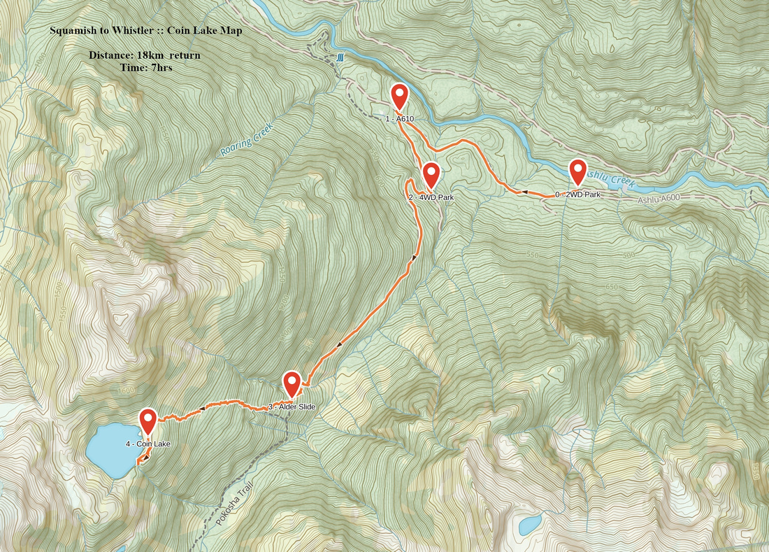 Coin Lake GAIA Map
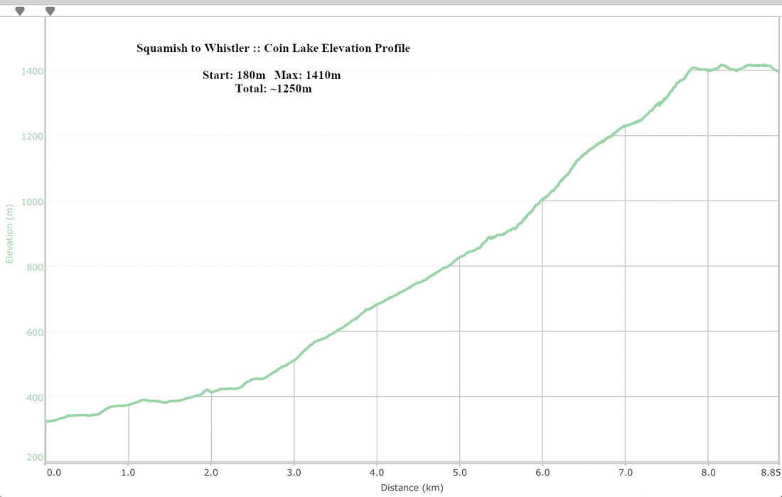 Coin Lake Elevation Profile