Google Map |
BC Coast :: Squamish to Whistler :: Sigurd Peak |
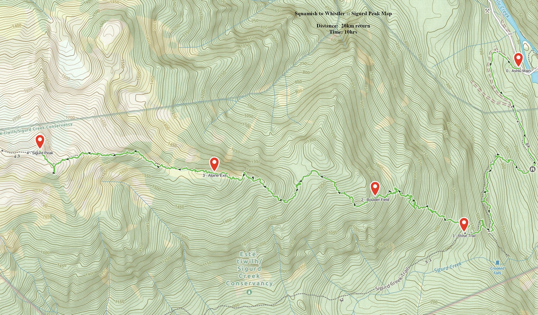
GPS Track |
|
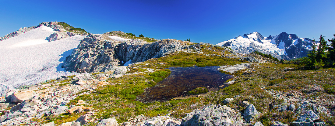
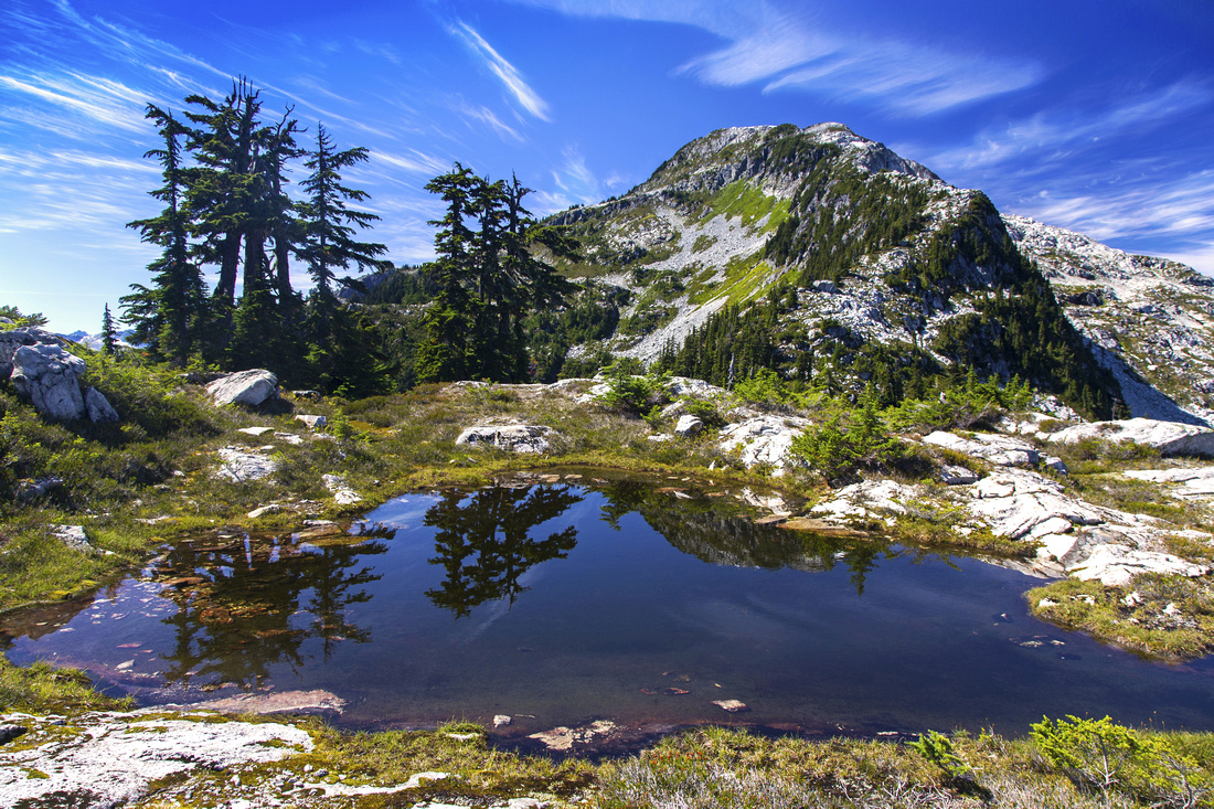
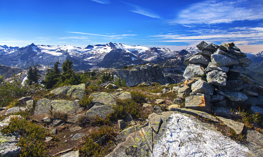
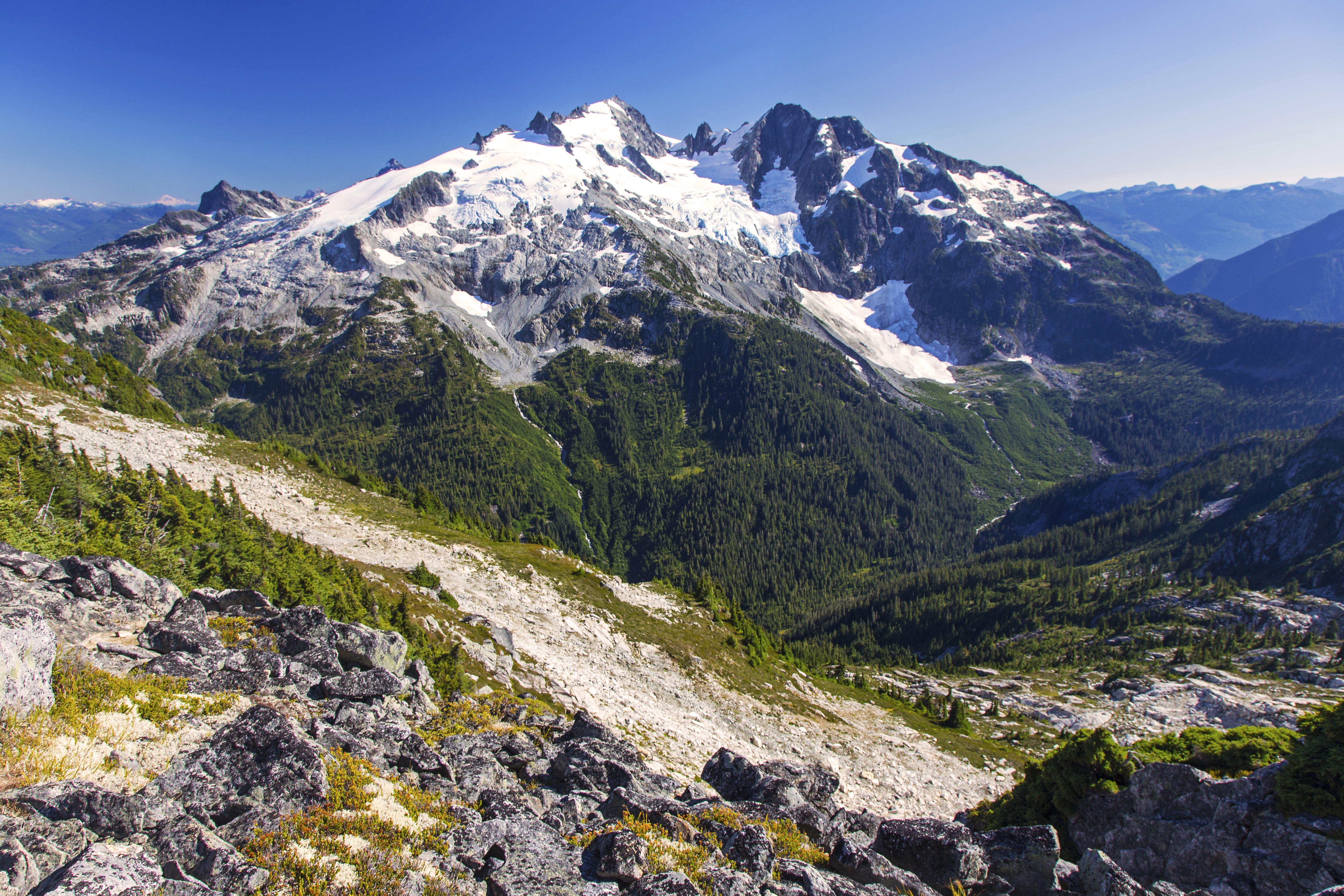
Grassy bench on Sigurd west ridge with seasonal tarn - perfect camping spot! Sigurd Peak upper center left, Ossa/Pellion right distance |
|||
| Trip Summary | |||
August 31, 2013
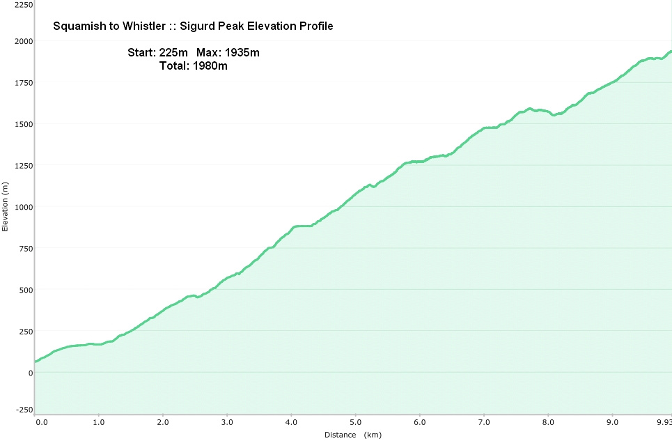
Sigurd Peak is an awesome trip at north end of Squamish valley. Benefiting from bridge across Squamish river, this part of Tantalus range is more accessible from the rest. As result better trails have developed, including main artery -- Sigurd creek trail, leading to beautiful valley between Ossa/Pelion to the south and Sigurd Peak to the north. Technically ascent is little more than hiking, but due to whopping amount of elevation gain high level of stamina is required. Starting from near sea level, almost 1500 vertical meters must be gained just to reach alpine. In the past this trail was just a flagged route, but thanks to BCMC volunteers it is now regularly brushed and solid footbed has developed. Scenic reward is however more than adequate; some of finest views BC Coast mountains can offer, including rarely seen Sigurd lake and distant peaks west of Pokosha divide. Winter trip on showshoes or skis is feasible but will require fast pace due to shorter amount of daylight.
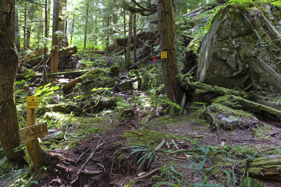
Turn off onto Squamish valley road at Alice Lake junction, about 5 minutes north of Brackendale. Follow this road for ~25km to end of pavement, then continue on gravel for few minutes to bridge over Squamish river. This is the start of Ashlu main. Turn left and cross the bridge; despite the appearance it is quite safe. Continue for few minutes to west side of the valley. After the last bridge road turns right at top of small rise. Park at the clearing. Note start of bushy and rough logging road across the parking spot; this is the way to go. With 4WD it is possible to drive this road. If you give it a shot, initial bit is the hardest. Several vehicles did get stuck at this part so it is not really worth. Past the rough bit road is better so if you made it across the initial hurdle, continue to the 2nd switchback - this is the Sigurd Creek trailhead. Being marked, it is hard to miss. On foot it will take about 20-25 minutes from 2WD parking.
Travel is initially flat for few minutes, but then ordeal begins. Relentlessly steep ascent with only occasional respite for next 3-4 hours follows. In about an hour you reach Crooked falls junction. This is worthy extension to beautiful waterfall, but it will add about 30 minutes (return). Continue along the main trail for another 15 minutes or so to next junction, and start of Sigurd (Rose) trail. About 2 hours of steep ascent through some rough sections with deadfall leads to boulder field around 1000m of altitude. Here trail temporarily disappears. Some parties have charged straight up the ridge at this point, but this is a mistake and they got cliffed out and had to backtrack. Correct way is to cross the boulder field angling left, then watch for flags at the far end where trail resumes. Less defined now, but still relatively easy to follow it gains another 400m vertical via steep switchbacks till it emerges into subalpine. Here trail disappears; direction is obvious going up, but note this spot for the return in order to be able to pick it up on descent. Soon NE ridge comes into view, and couple of tarns offer perfect spot for a break that will be well required by now as there is still about an hour to the summit.
For adventurous parties it is possible to continue to Sigurd Lake (about an hour from Sigurd summit), then bushwhack on west side down to Sigurd Headwaters -- three beautiful lakes and ultimate source of Sigurd creek. From here one can descend the valley and return via Sigurd creek trail, thus forming a loop. Good online report can be found here. It has been done as day trip, but for most people 2 day effort will be required with overnight either by Sigurd Lake or at one of lakes in Sigurd Headwaters. Good route-finding skills are required as there are no trails between Sigurd summit and Sigurd Headwaters.
|
|
Gallery |
|||
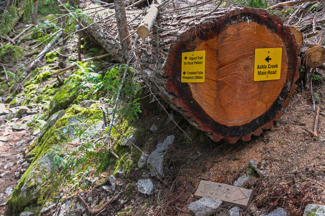 Crooked Junction Crooked Junction Crooked Falls junction ~ 1hr of fast pace from 4WD parking
 |
|||
 Rose Trail Junction
Rose (Sigurd) trail junction. Sigurd creek continues straight Rose Trail Junction
Rose (Sigurd) trail junction. Sigurd creek continues straight |
|||
 |
|||
 Sigurd Tarn
Lovely tarn below Sigurd NE ridge. Summit is ~1 hr away Sigurd Tarn
Lovely tarn below Sigurd NE ridge. Summit is ~1 hr away |
|||
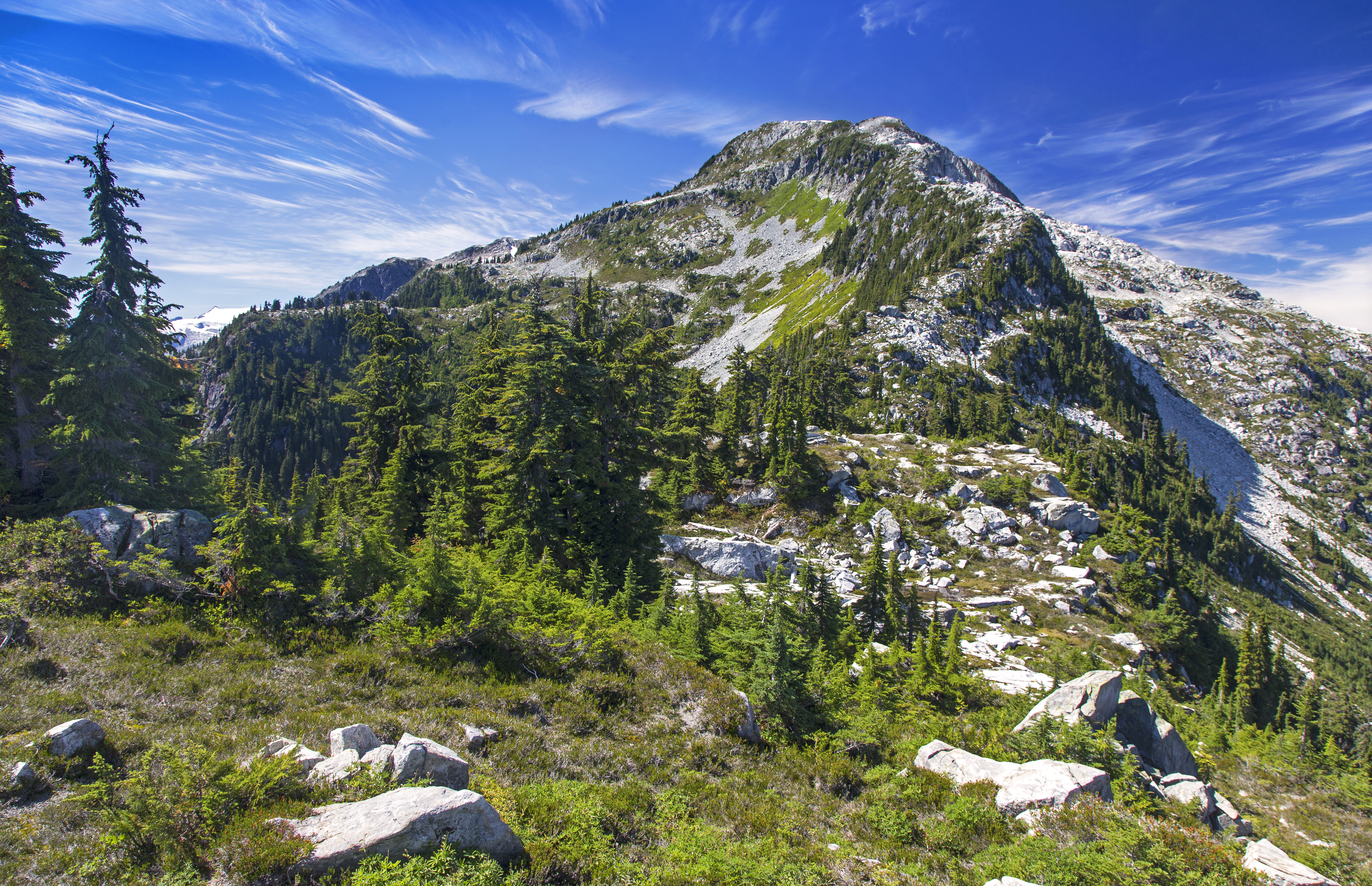
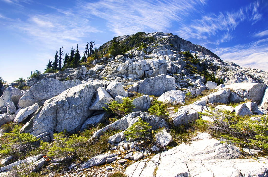 Sigurd Ridge
Easy NE ridge scrambling through boulders and short bluffs Sigurd Ridge
Easy NE ridge scrambling through boulders and short bluffs |
|||
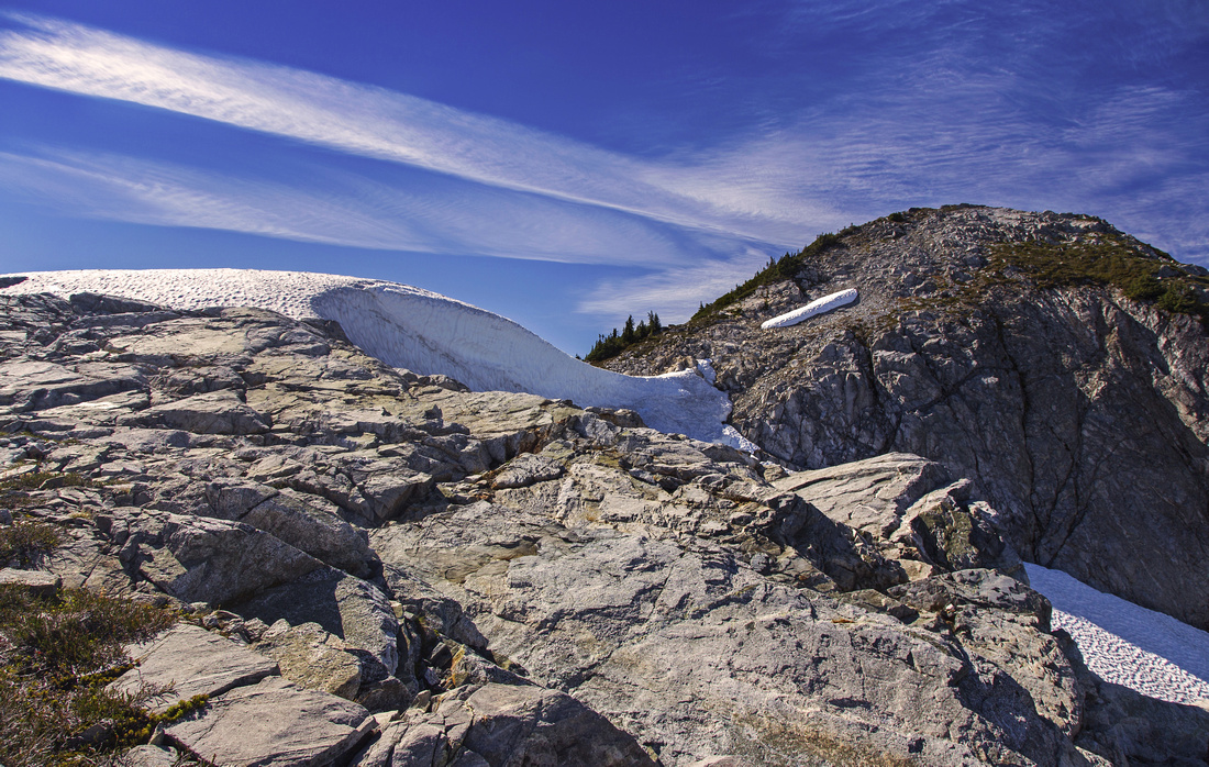 Permanent Snowpatch
Permanent snow patch below summit block Permanent Snowpatch
Permanent snow patch below summit block |
|||
 Garibaldi Group
Looking back at NE ridge. Garibaldi group on the horizon Garibaldi Group
Looking back at NE ridge. Garibaldi group on the horizon |
|||
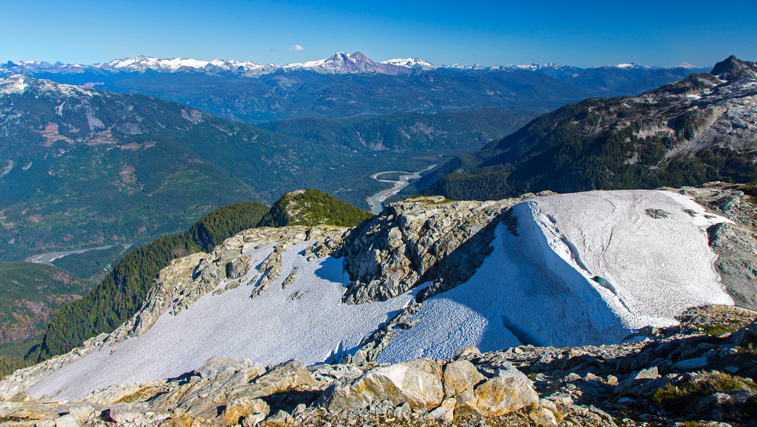
 Summit Cairn
Summit cairn with westerly views across Pokosha Divide Summit Cairn
Summit cairn with westerly views across Pokosha Divide |
|||
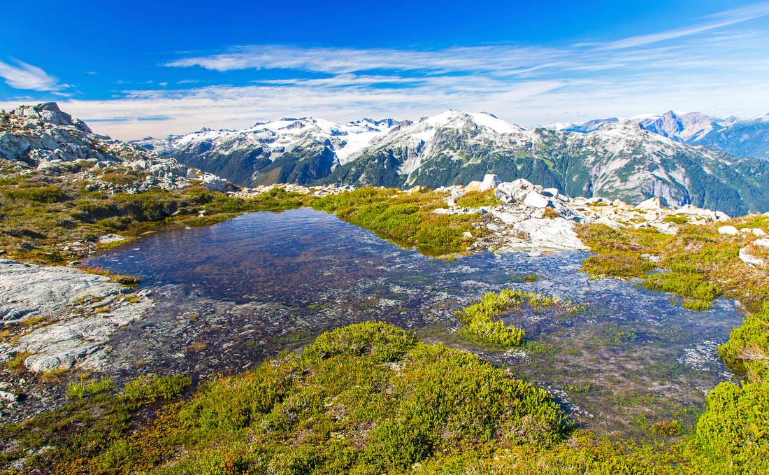 Alpine Bivouac
Beautiful tarn below Sigurd peak - perfect camping spot! Alpine Bivouac
Beautiful tarn below Sigurd peak - perfect camping spot! |
|||
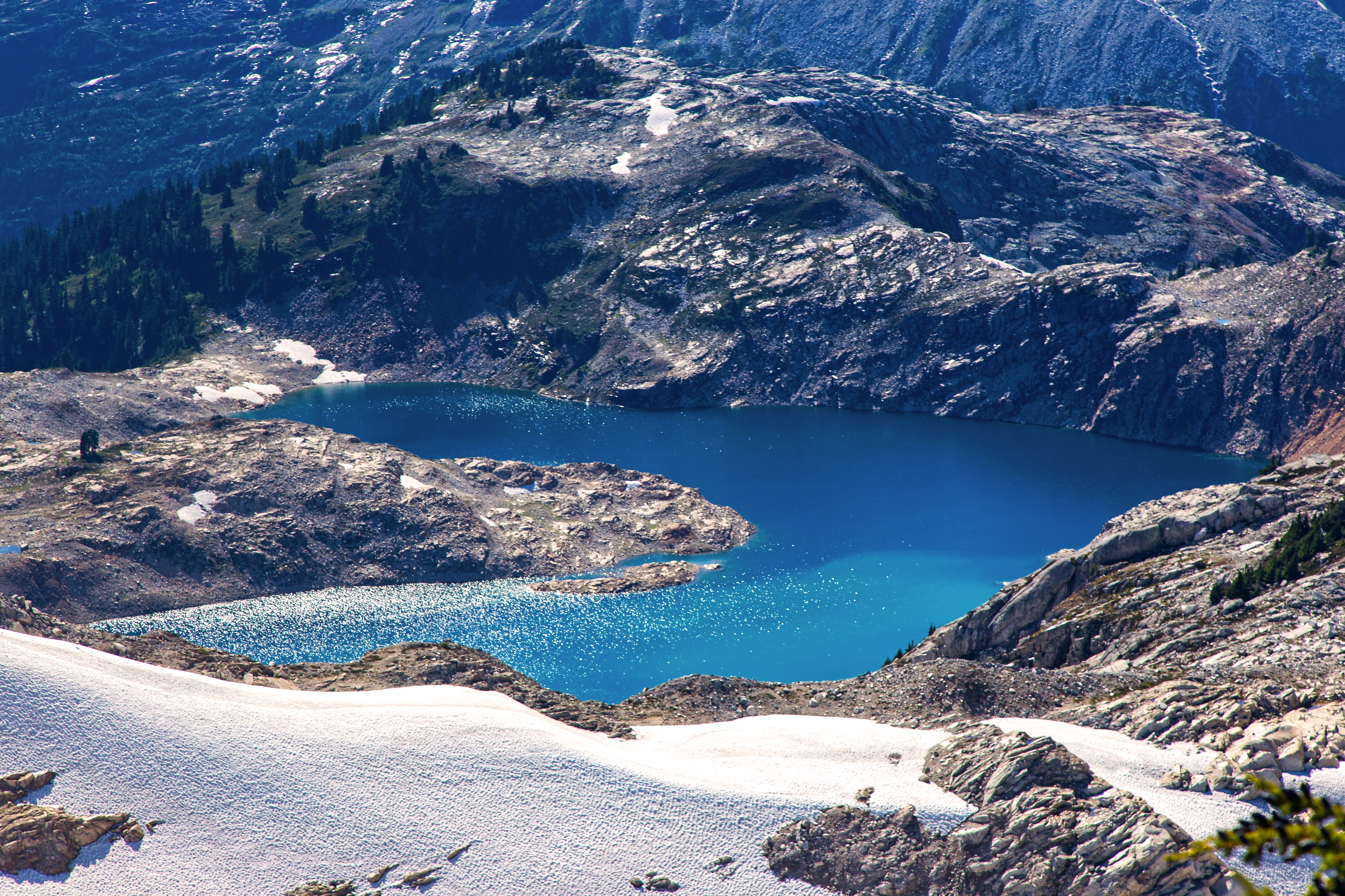
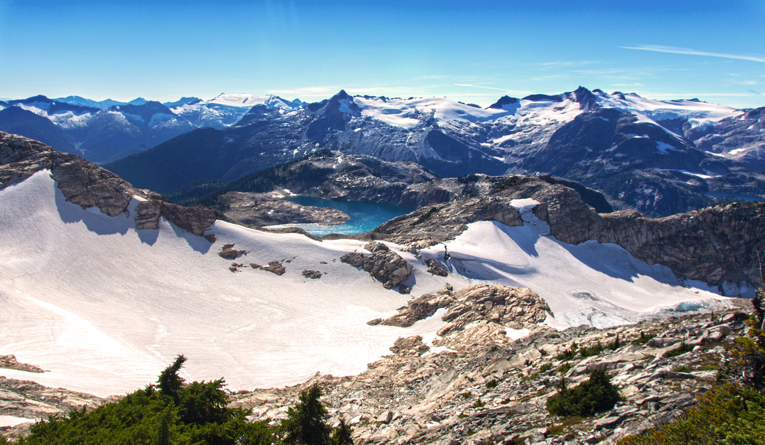 Sigurd Lake
Sigurd west ridge descending to rarely visited Sigurd Lake. Alternate descent loops down to "Sigurd Creek Headquarters" from far side of the Lake Sigurd Lake
Sigurd west ridge descending to rarely visited Sigurd Lake. Alternate descent loops down to "Sigurd Creek Headquarters" from far side of the Lake |
|||
 |
|||
 |
Abstract
| Overall Difficulty | D5 | Mainly hiking with odd easy scrambling move in final part, but whooping amount of elevation gain. Minor bushwhack. | |||
| Snow Factor | S4 | Trip is sometimes done in winter, both on skis and snowshoes. Upper ridge has avalanche potential. Some parties ski from the summit down the gullies on north side. | |||
| Scenery | Outstanding views of north end of Tantalus range and peaks across Pokosha Divide. Rarely seen Sigurd Lake. Pretty alpine with small tarns on NE ridge. Optional Crooked falls side trip in lower part. | ||||
| Trail/Marking | Good | Well traveled main Sigurd creek trail with marked junctions. Flagged Rose trail becomes less defined in upper parts. Care is required to pick it up on descent. | |||
| Suggested Time | 10hr | Return time to Sigurd Peak. Allow extra 1-2 hours if exploring west ridge and/or Sigurd Lake. Descent is much faster | |||
| Elevation | Start: 60m (2WD) Max: 1930m Total: ~2000m | Round Trip: ~20km | |||
| Gear | If dry, day hikers might be preferable to full boots. Hiking poles will greatly help stability on descent. GPS might be helpful as trail is not well defined near sub-alpine. | ||||
| Water | Seasonal tarns and snow field near the summit are not reliable enough-- carry plenty of water. 4L is not too much on a hot summer day | ||||
| Dog Friendly | Yes | Total elevation gain might tire even the 4-legged peak baggers! | |||
 Sigurd Peak GAIA Map
 Sigurd Peak Elevation Profile