Google Map |
BC Coast :: Sea to Sky :: Lighthouse Park |
GPS Track |
 
Point Atkinson Lighthouse at dusk |
|||
| Trip Summary | |||
January 19, 2013Lighthouse Park in West Vancouver is one of premier urban parks in Canada. Location at mouth of Howe Sound is simply fantastic. Everything that makes BC Coast special can be seen right here, without need to drive or hike far. It is not just a family park though; network of developed trails offers many pleasant hiking opportunities that range from half an hour stroll to watch the sunset at Juniper point to half-day trip for loop of entire park. Follow Marine drive west towards Horseshoe Bay, then turn left at signed Lighthouse Park junction. Large parking lot fills fast during the weekends. Trail maps will help you organize your day. Most people follow main artery continuing straight past the gate at south end of parking lot to Point Atkinson and the Lighthouse. If coming late in the day and you don't have much time, great option is to take Juniper Point trail heading west from the parking. Trail ends at rocky bluff over the ocean where fabulous sunsets can be enjoyed. This spot is very popular with rock climbers too. Continuing south, you can follow Shore Pine trail past several viewpoints to Point Atkinson. Best viewpoint is little beach just west of the lighthouse - it is accessed via side trail that can be rough at places. In summer park rangers offer presentation at outdoor theater in Songbird meadows. For full loop follow Arbutus trail to Eagle Point -- another fantastic viewpoint of the bay and downtown skyline. Bald eagles can often be observed here too. To visit highest point of the park, continue on Valley of the Giants and turn to Summit trail to semi open bluff with partial views. Parking lot is directly below. |
|
Gallery |
|||
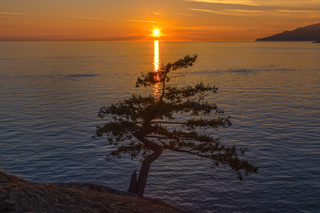 Sunset from Juniper Point
 |
|||
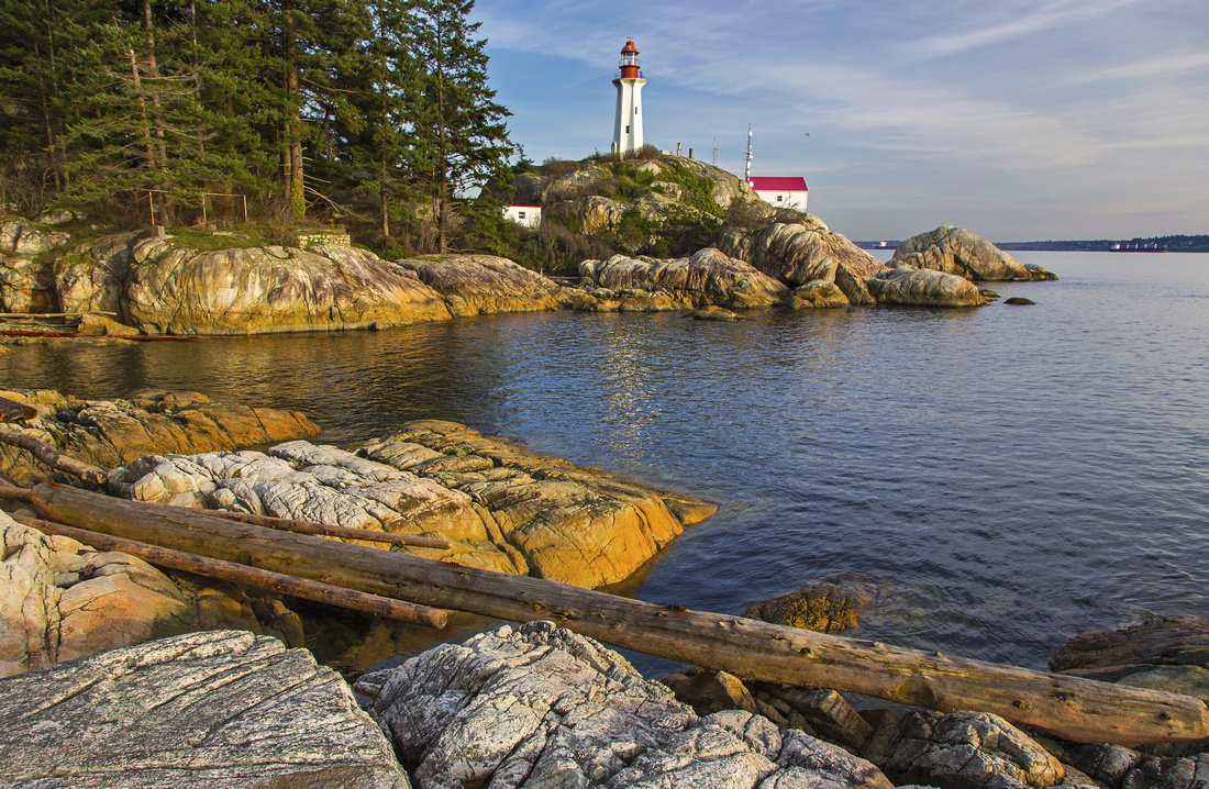 Point Atkinson Lighthouse from West Side Beach
 |
|||
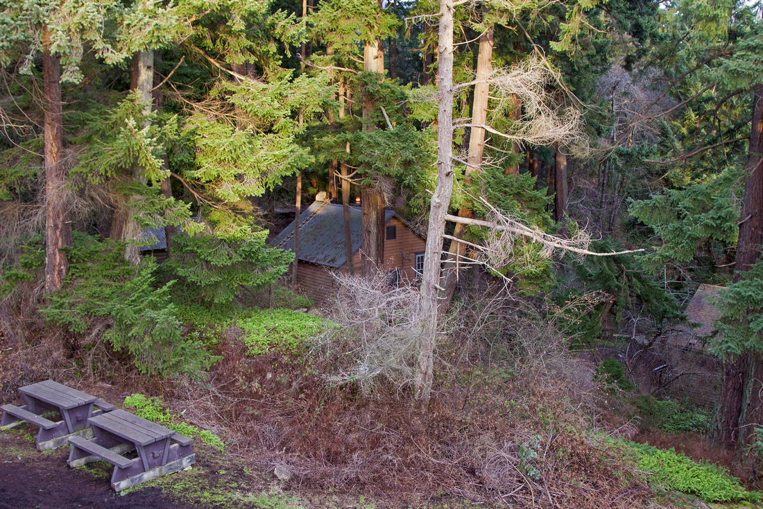 Main Visitor area in old growth hammock
 |
|||
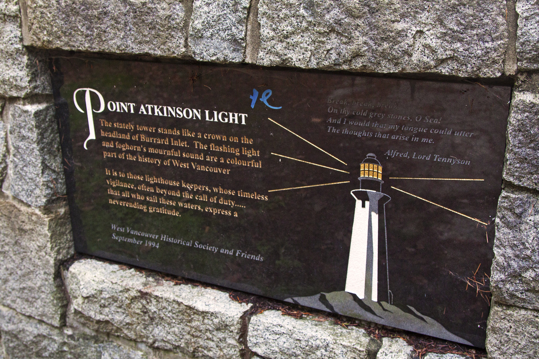 Point Atkinson plaque
 |
|||
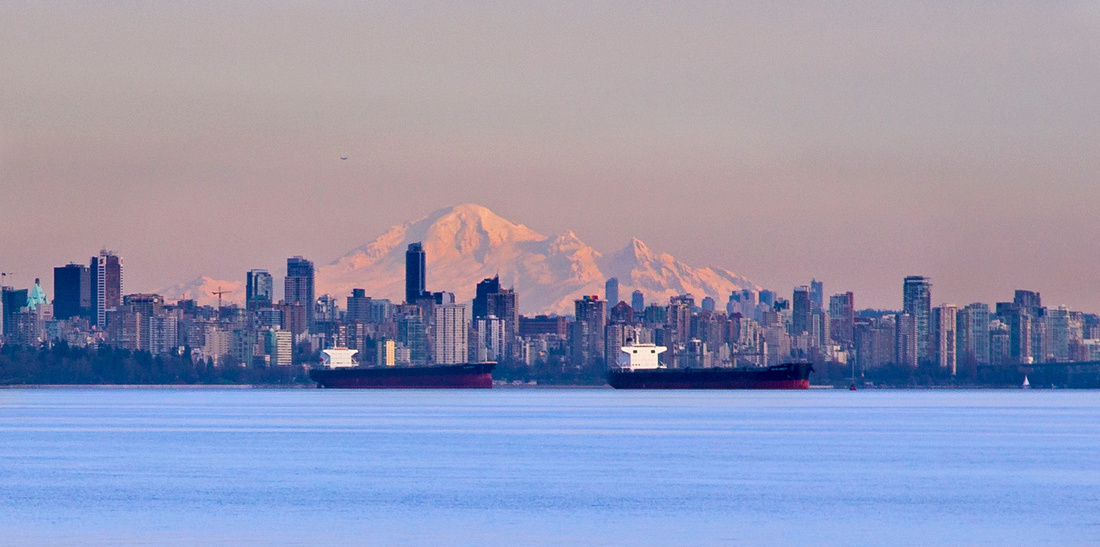 Downtown skyline and Mt. Baker
 |
Abstract
| Overall Difficulty | D2 | Mainly flat trail with some moderate ups and downs. Occasional roots and rocks | |||
| Snow Factor | S1 | Park is near sea level and snow free year round. Portions of trail might be icy and/or slippery in winter | |||
| Scenery | Spectacular views of Howe Sound and Burrard Strait. One of best places in metro Van to watch sunsets! | ||||
| Trail/Marking | Excellent | Well defined and marked network of trails with signposts | |||
| Suggested Time | 3-4 hrs | Time for full loop, as shown on GPS track. Many options exist for longer or shorter outing | |||
| Elevation | Start: 120m Max: 250m Total: ~250m (full loop) | Round Trip: 6 km | |||
| Gear | Day hikers are sufficient. | ||||
| Water | Drinking water (and restrooms) available at main park facility near Point Atkinson | ||||
| Dog Friendly | Yes | Please keep dogs on leash / under control, as this is very busy area | |||
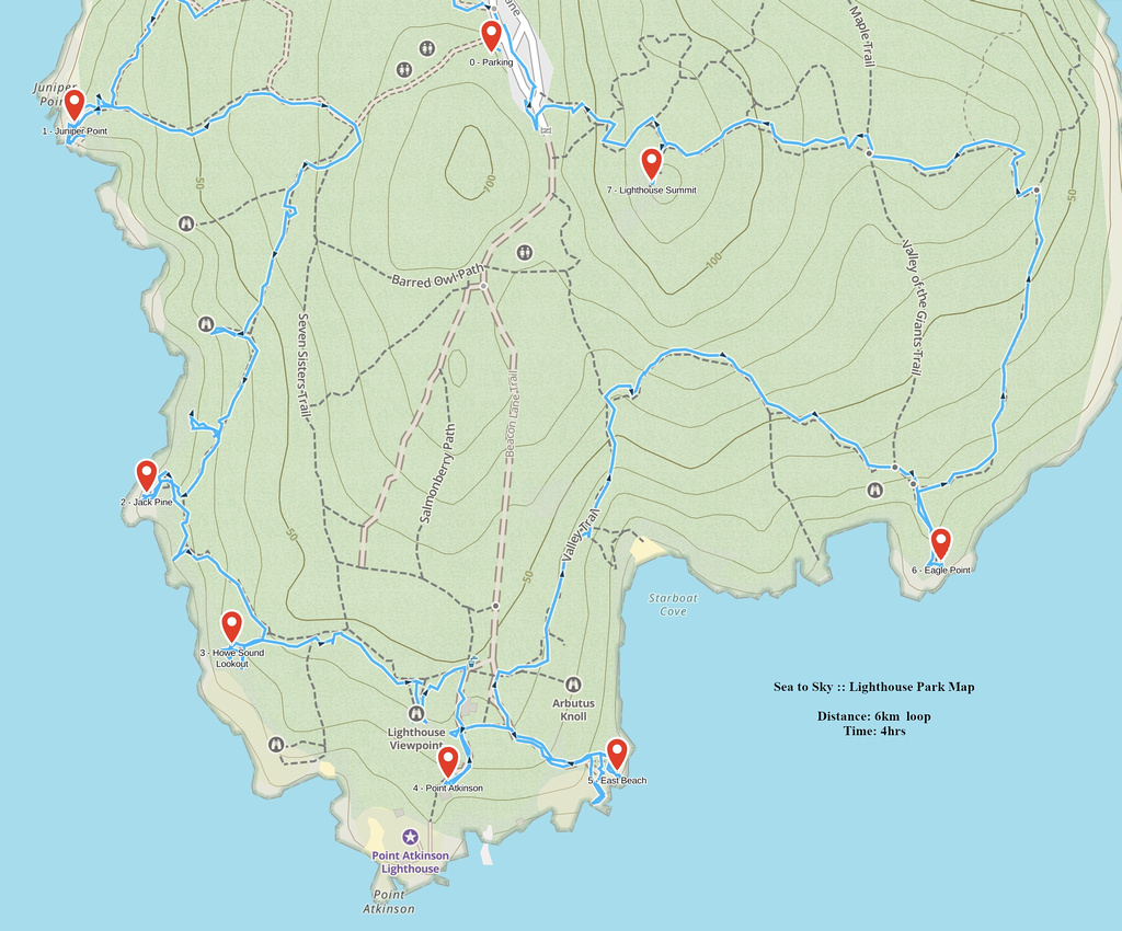 Lighthouse Park GAIA Map
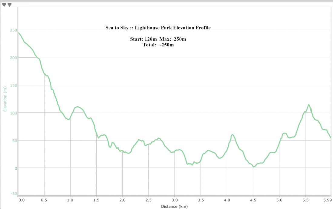 Lighthouse Park Elevation Profile