Google Map |
BC Coast :: Sea to Sky :: Mt. Harvey |
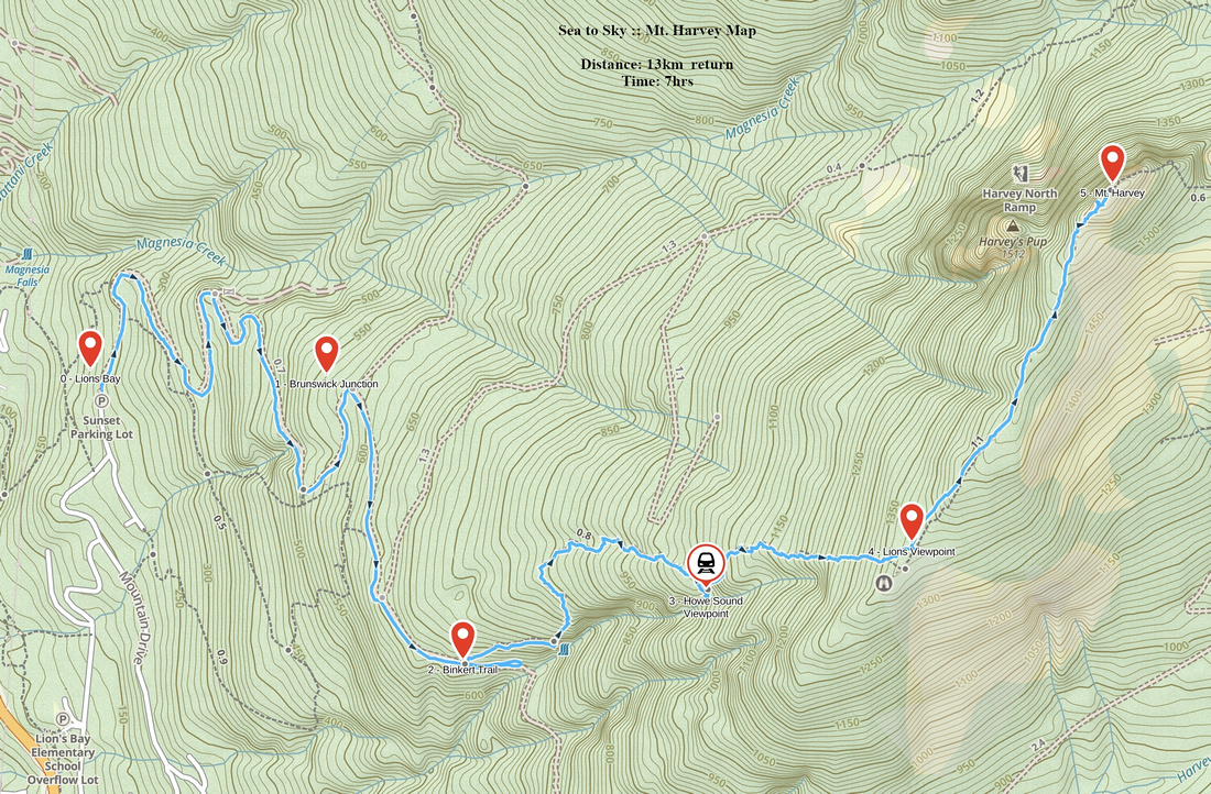
GPS Track |
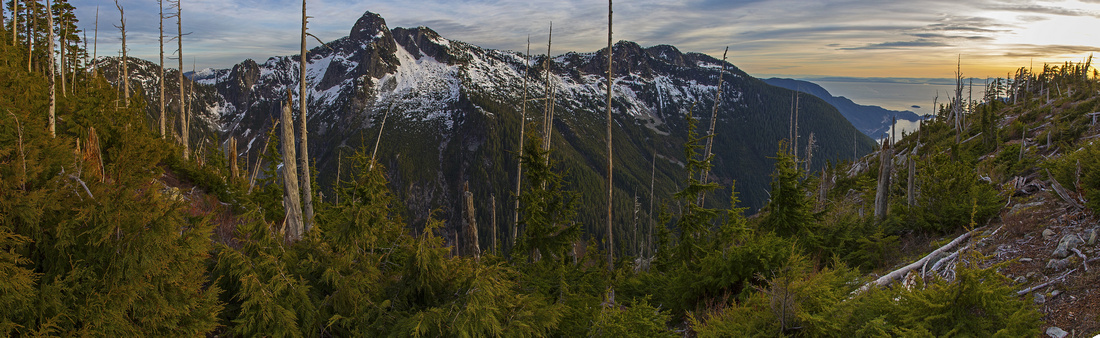 
Classic View of Howe Sound Crest between Lions and Unnecessary Mountain from south end of Harvey Ridge |
|||
| Trip Summary | |||
October 8, 2012Of all trails radiating from Lions Bay, Mt. Harvey is personal favorite. It is less busy than Binkert (Lions) Trail and offers longest time above treeline. Steep slog through forest is still unavoidable, but final hour is superb ridgewalk with some of best possible views of Howe Sound. Parties ascend Harvey in winter conditions; but steepness of final slope leading to summit might require an ice-axe and elevates the trip to mountaineering level. In most years by 2nd half of May the snow has melted enough to provide just an easy rock scramble. From standard parking at Lions Bay follow logging road keeping right at marked Brunswick/Lions junction in about 40 minutes. Harvey trail branches off on the left side just before crossing of Alberta creek ~15 min from there. Ascend steep forested slopes passing Howe Sound viewpoint around 1000m elevation (great spot for the break). At start of south ridge turn left and follow flags through sub-alpine and open ridge to the summit. |
|
Gallery |
|||
 Howe Sound Viewpoint ~1000m elevation
 |
|||
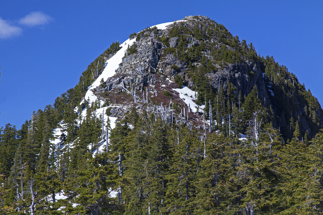
 South end of Harvey ridge ~1300m elevation
 |
|||
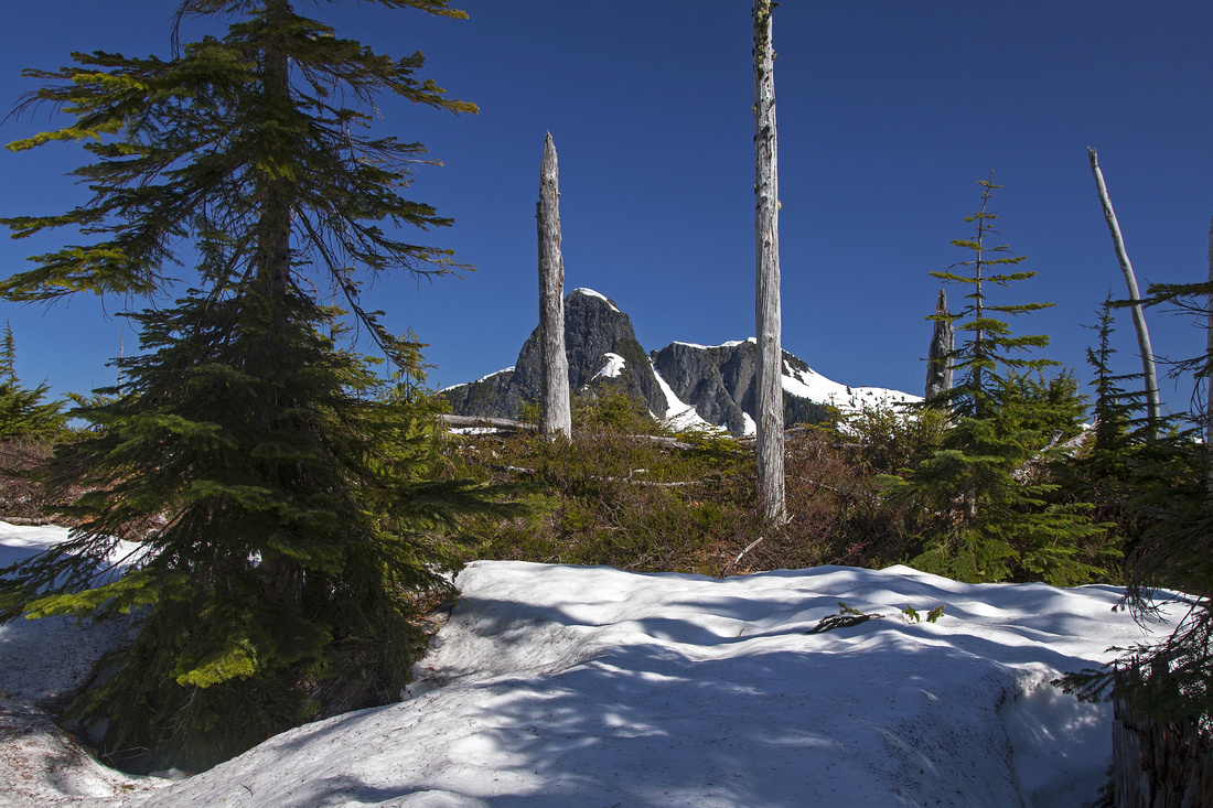
 Approaching final summit block of Mt. Harvey
 |
|||
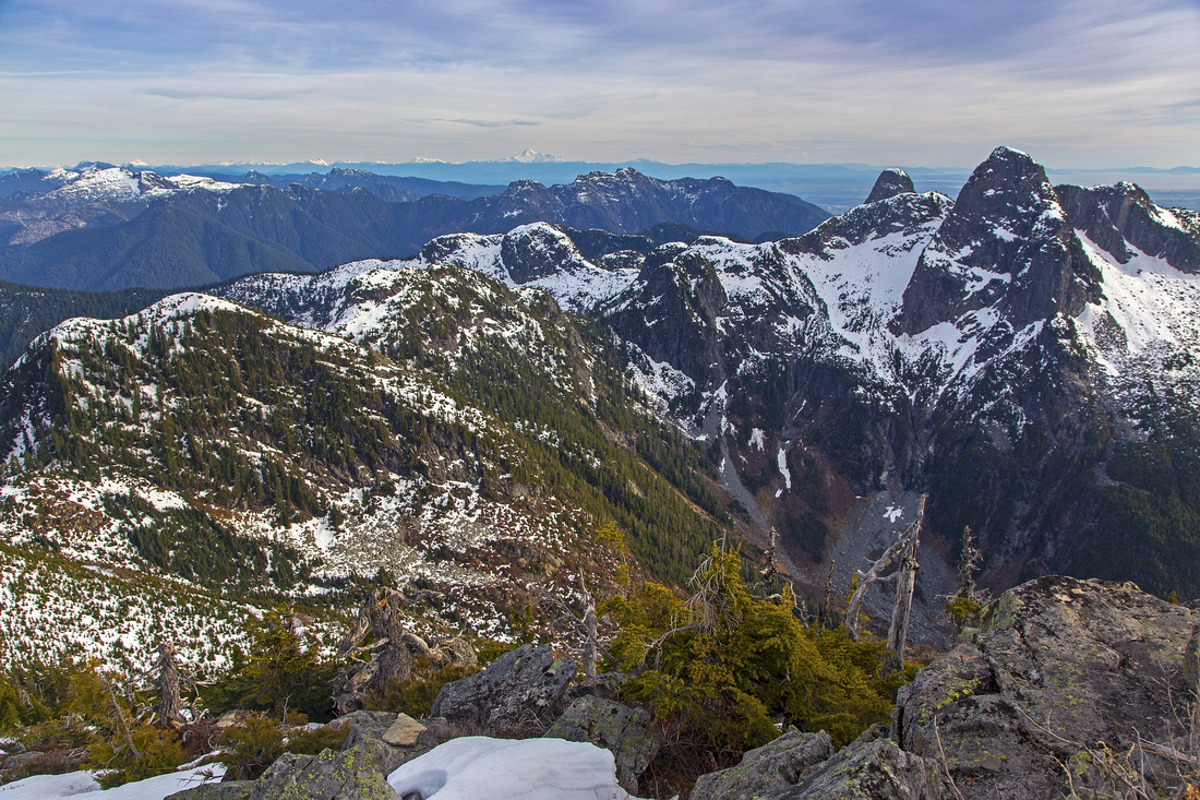 Most rugged part of Howe Sound Crest Trail (HSCT) between Lions to Harvey Pass from the summit
 |
|||
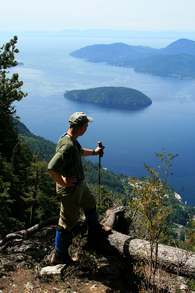
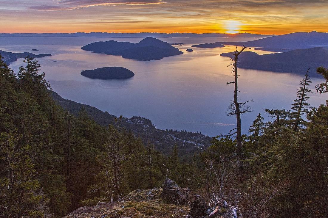 Howe Sound Sunset on descent
 |
Abstract
| Overall Difficulty | D5 | Steep trail that gains close to 1400 vertical in just over 6 km. Final summit block is an easy class 2 scramble in dry conditions | |||
| Snow Factor | S4 | Frequently done as snowshoe trip. Steep and exposed summit block. Check avalanche conditions. | |||
| Scenery | Exceptional Howe Sound panorama. Surprise Lions viewpoint at start of Harvey Ridge is among the best in Lower Mainland | ||||
| Trail/Marking | Good | Well defined and marked till upper ridge. Minor sections with roots and deadfall | |||
| Suggested Time | 7-8 hr | 3.5 - 4 hours one way, with faster descent. Allow at least 1 hour for breaks and scenery on upper ridge | |||
| Elevation | Start: 220m Max: 1640m Total: ~1400m | Round Trip: 13km | |||
| Gear | Hiking Poles are essential. In late spring hard snow in steep parts might require traction (icers or crampons). In winter conditions ice-axe is essential for final part of the ridge before the summit.. | ||||
| Water | Alberta Creek running parallel (south) to Harvey Trail. Access is difficult past split off Binkert Trail. Carry 3 L minimum | ||||
| Dog Friendly | Yes | No on-leash restrictions. Final part of the ridge might prove challenging | |||
 Mt. Harvey GAIA Map
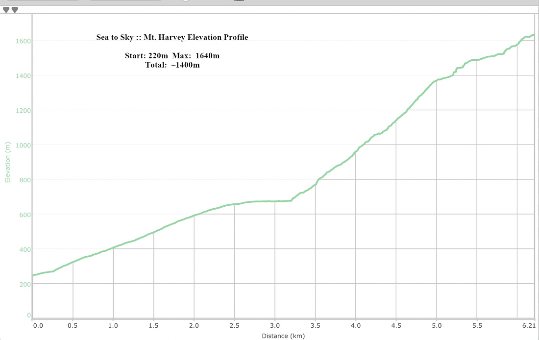 Mt. Harvey Elevation Profile