Google Map |
BC Coast :: Sea to Sky :: Al's Habrich Ridge |
GPS Track |
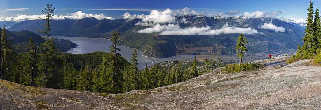 
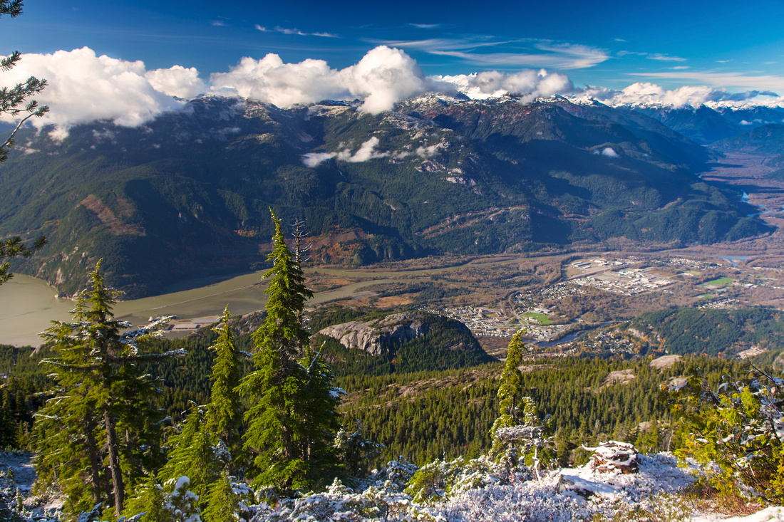
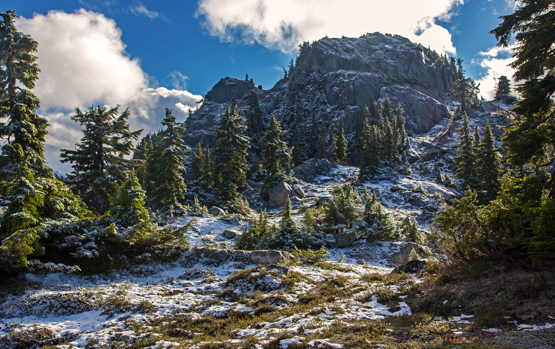
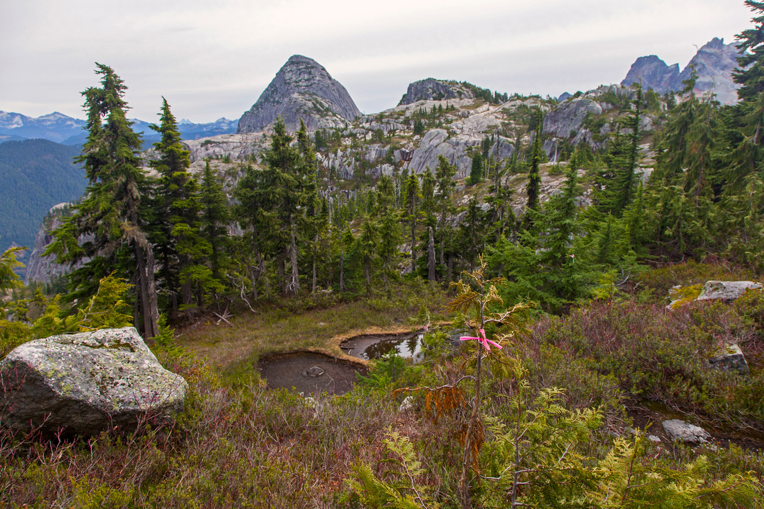
Howe Sound and misty peaks of Tantalus range from rocky platform in lower part; still on official gondola trail |
|||
| Trip Summary | |||
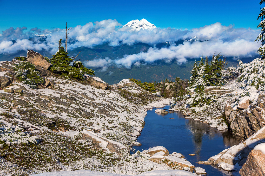
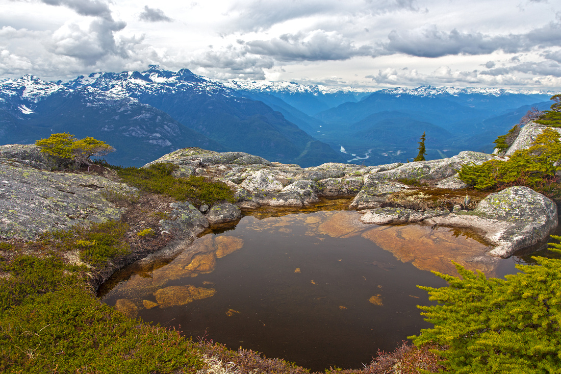
October 24, 2015Al's Habrich ridge is marketed as "flagship hiking trail" by Sea-to-Sky gondola. However, as is usually the case with all official marked trails, it stops well short of true scenic rewards. Official end of trail is at "Neverland lake" - about 1.5 hour of moderate pace from upper gondola terminal. Hike to this point is worth-while with main point of interest being rocky platform and open views of Howe sound and Tantalus range (main photo on this page). This is where hikers not comfortable with steep flagged routes and unsure in their route-finding abilities should stop. Several short extensions exist -- in early season it is worth visiting "Neverland Falls" (30-45 mins loop from main Al's trail -- watch for gondola markers). Yukos ponds are pretty set of sub-alpine tarns below great Barnar cliff; trail did not have official gondola markers in fall of 2015, but there were metal markers and blue flags (marked junction is at east side of main trail, just past marker #32). Much room for further meandering exists. Beware of black bears as Neverland area seems to be a hotspot.
Upper ridge can be accessed in 2 different ways; they can also be combined for very satisfactory loop trip. Steeper option continues past Neverland lake and rises very steeply towards 1st summit. Descending this part is quite brutal - veggie belays, sliding and hanging on roots. There have also been several reports of experienced hikers getting lost - so it is not recommended to descend this way for first outing before you are familiar with terrain. Recommended alternative is "Robins' Connector"; it branches off the Neverland Falls trail, but better way is to take Yukos ponds trail, then turn left on marked junction just past 2nd pond. Trail is flagged and has been brushed, but still is not frequently traveled and route-finding skills in sometimes challenging micro-terrain are essential. It is considerably less steep and somewhat shorter than trail above Neverland lake. It reaches "Robin's Shoulder" in about 45mins to an hour past Yukos ponds for first views of Mt. Habrich. Meadows dotted with several alpine tarns would make this an excellent overnight spot! Past Robins shoulder flags continue south towards 1st summit, that has been incorrectly labelled "Stawamus Squaw" on Google maps. This is critical point; to link with Neverland lake access continue south across boulder field, then descend past couple of lakes and scramble to bump directly west of first summit. Flags then lead down to Neverland lake.
For traverse of entire ridge towards Mt. Habrich scramble left up first prominent gully, marked with large cairn, about 10 minutes past Robin's shoulder. Trail develops after you clear boulder field and rest is obvious. First summit has cairn and spectacular 360 views. This is agreeable turnaround point in time crunch. If continuing, descend on "lovely grassy terrace" following flags, then at bottom turn left and continue generally in straight line towards Mt. Habrich. Trail now disappears and flags are far and few in between. There are several ups and downs; good route-finding skills are essential. Crux is just past 2nd summit where you must descend 6-8 m high cliff (class 3 - 4) that looks worse from above than it really is. It is possible to bypass by circling around to the right (south), but this is time consuming and not really necessary. If not traversing entire ridge towards Mt. Habrich, logical turnaround point is tarn with open views just before terrain considerably dips to the bush. It will take about 3 hours of reasonably fast pace from upper gondola terminal (via Robins connector) to here. Return the same way, or via Neverland route for the loop. More adventurous option, with enough time is to continue towards base of roped climb on Mt. Habrich west ridge, then descend (brutally steep) climber access to Sky Pilot Valley trail -- it is estimated such loop would take 8-9 hours, and is feasible only in summer with late gondola download. |
|
Gallery |
|||
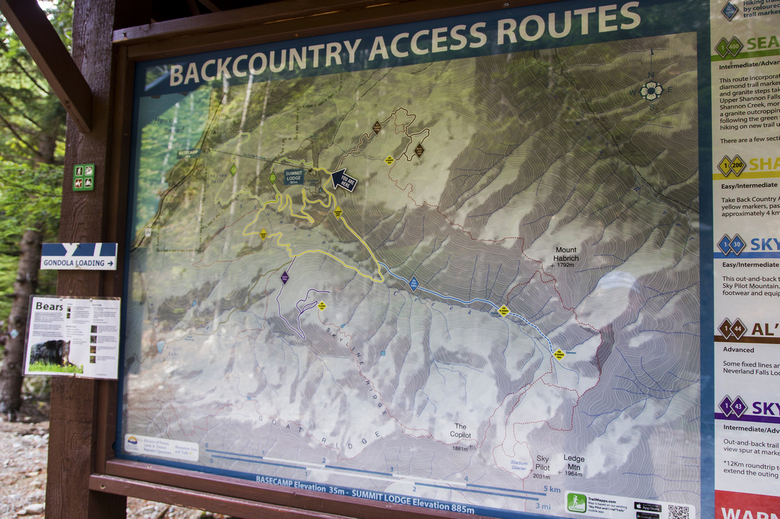 Hiking Trails Map on back-country access road
 |
|||
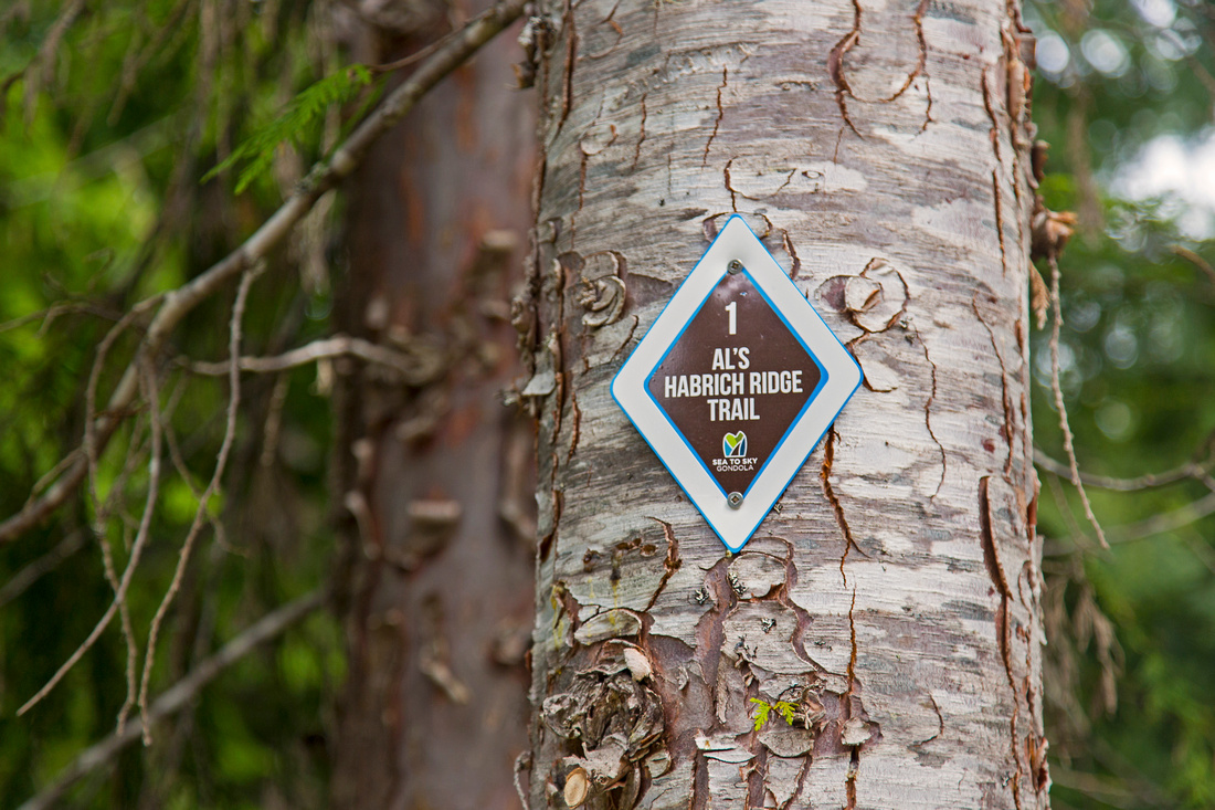 Marker #1 ~15 min from gondola terminal
 |
|||
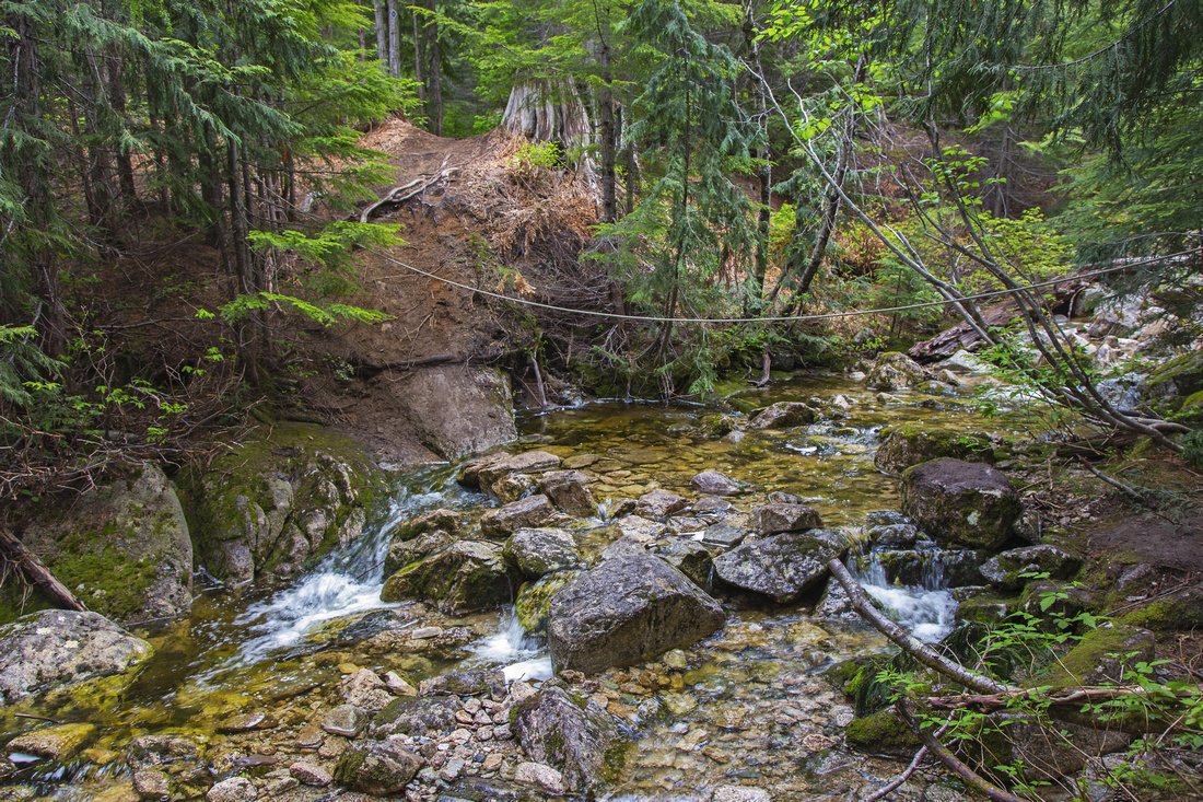 Creek crossing; handline is helpful in spring
 |
|||
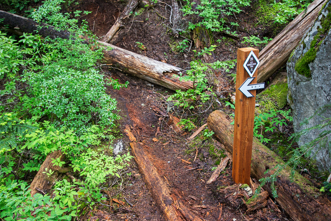 Junction ~45 mins in; original Al's trail went straight up, but was too steep and rerouted by gondola
 |
|||
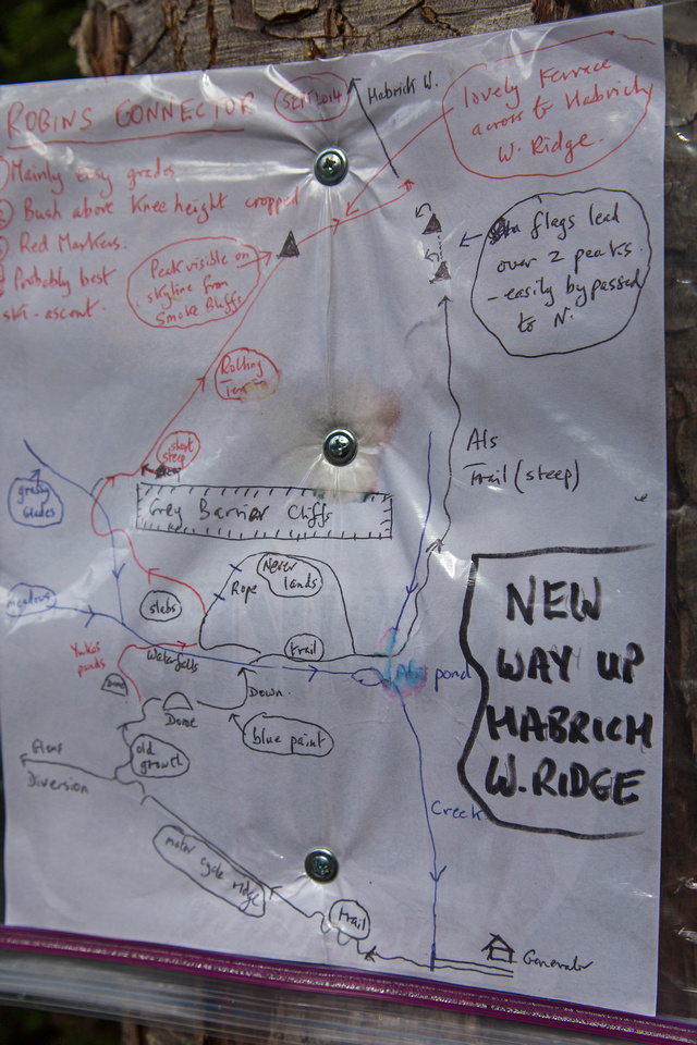 Robins connector map at one time stapled on tree at Neverland Falls Junction
 |
|||
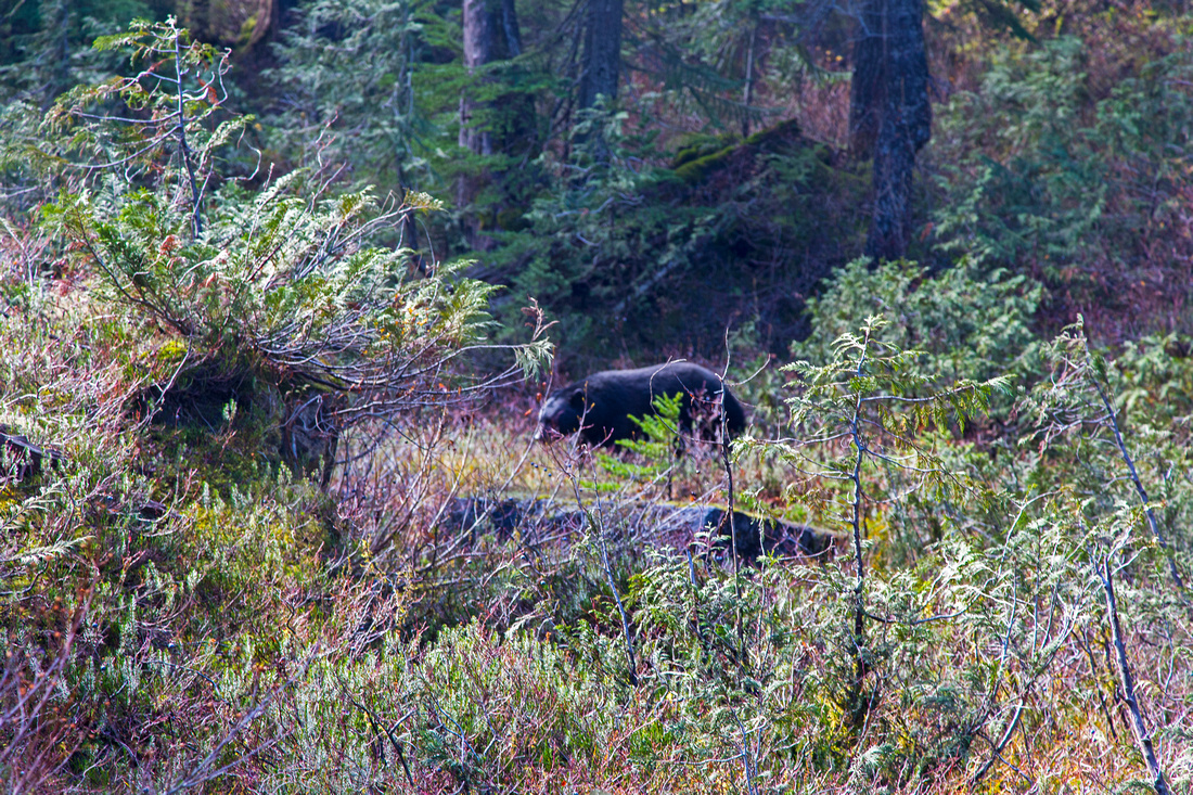 Black bear near Neverland Falls junction
 |
|||
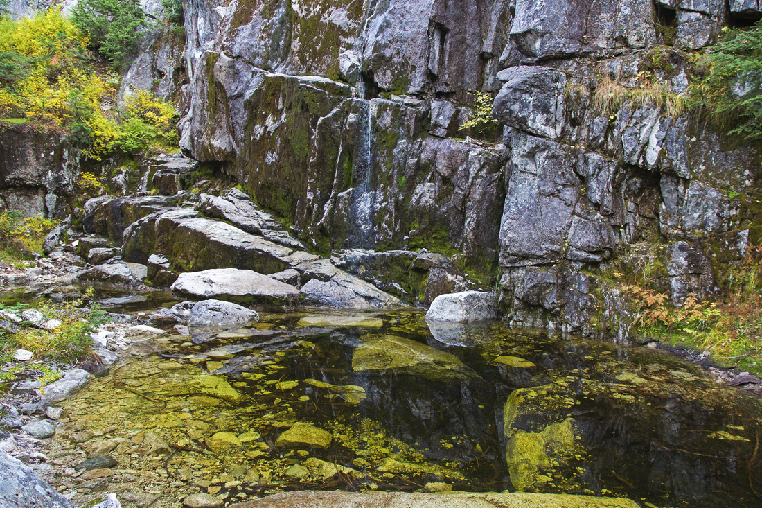 Neverland Falls - 30 min side trip from Robins trail
 |
|||
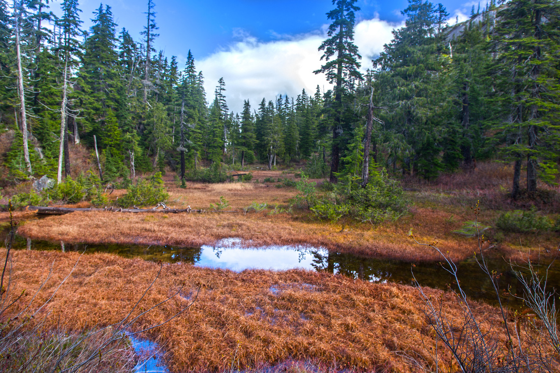 Yukos ponds - Robins connector shortcut
 |
|||
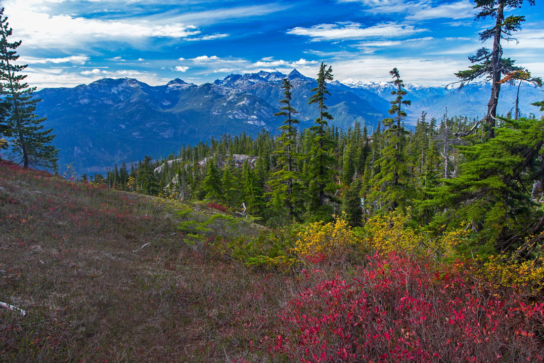 Fall colors on Robins trail; Tantalus behind
 |
|||
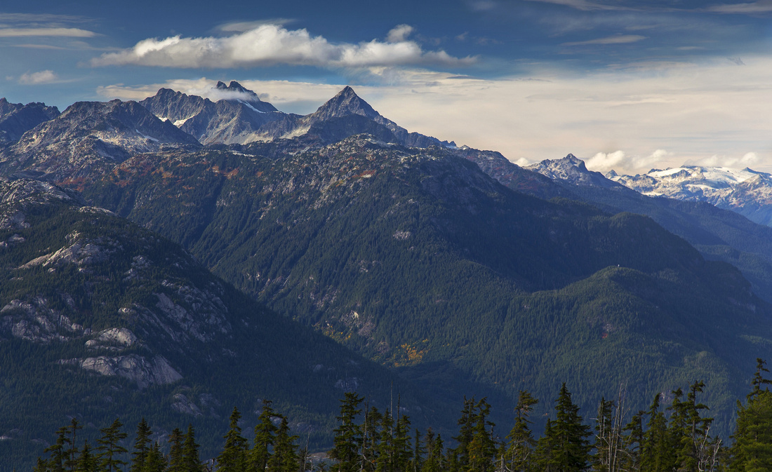
 View back to Squamish and Tantalus range from Robin's shoulder
 |
|||
 First view of Mt. Habrich from Robin's shoulder
 |
|||
 Grassy bench rising south towards first summit
 |
|||
 Water filled fissure with views to Diamond Head below first summit
 |
|||
 Tantalus range from tarn below first summit
 |
|||
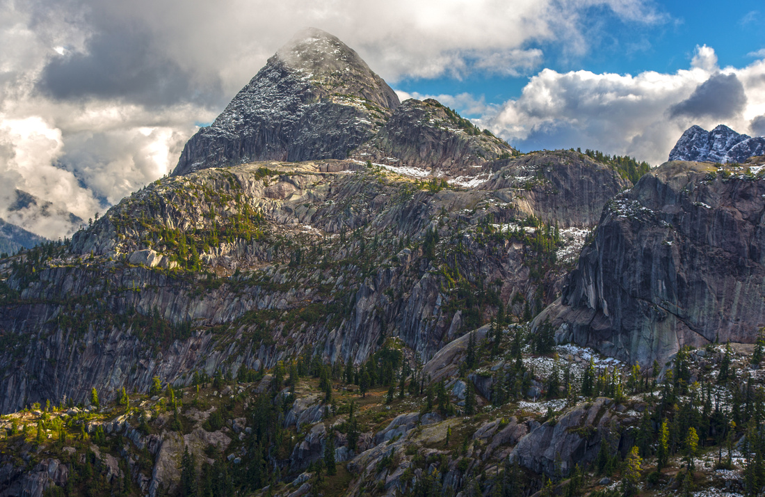
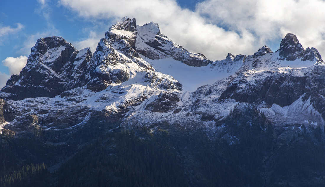
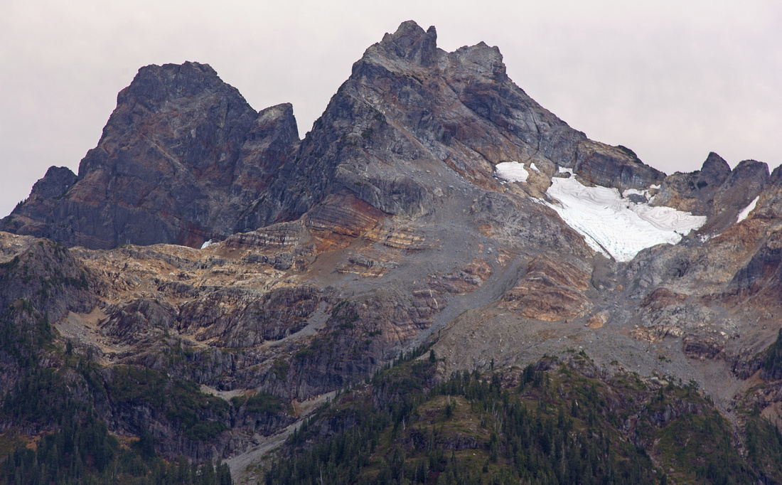 Sky Pilot group and Stadium glacier telephoto
 |
|||
 Descending "lovely terrace" below first summit
 |
|||
 Ridge mid-point past 2nd summit and good turnaround point
 |
|||
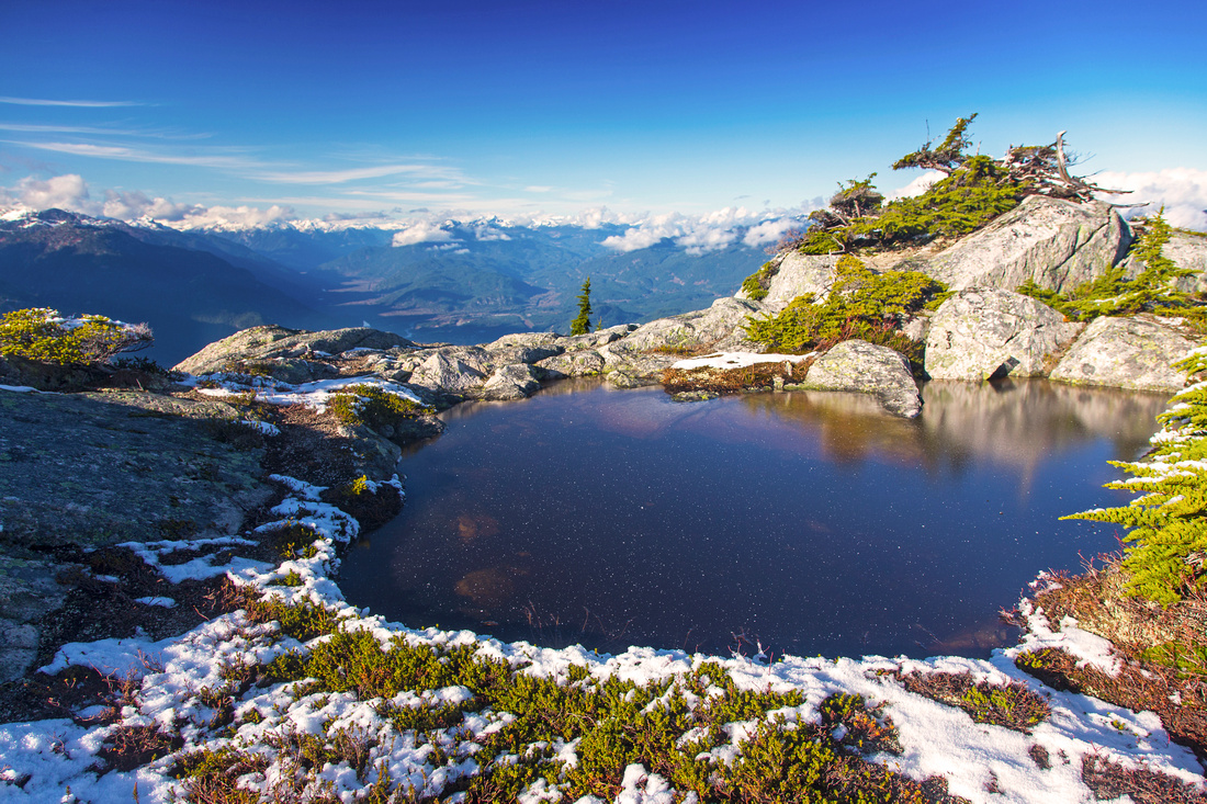
 Tarn at top of steep south ridge descent
 |
|||
 Sky Pilot group from top of alternate descent
 |
|||
 Another view of tarn at top of alternate descent
 |
|||
 Lovely fall colors on alternate descent
 |
|||
 Neverland lake and end of official gondola trail
 |
Abstract
| Overall Difficulty | D6 | Flagged route with several class 3 or 4 rock steps. Steep portions with ropes. Routefinding problems | |||
| Snow Factor | S3 | Low/moderate avalanche danger as steep parts are below treeline. Short winter hours will pose time crunch for trips to upper ridge | |||
| Scenery | Outstanding views of Howe Sound, Tantalus range, Diamond Head and Sky Pilot group. Many tarns in beautiful alpine specific for this area of the coast. Imposing Mt. Habrich viewed from different angles | ||||
| Trail/Marking | Good/Poor | Official gondola trail to Neverland lake. Brushed and occasionally flagged trail to upper ridge fades after 1st summit | |||
| Suggested Time | 6-8 hr | Return time from upper Gondola terminal to first summit. Many possibilities for exploration further towards Mt. Habrich | |||
| Elevation | Start: 900m Max: 1620m Total: ~1000m | Round Trip: 20km | |||
| Gear | Hiking boots and poles. Gaiters essential for travel in upper ridge. Icers in shoulder season. GPS is essential | ||||
| Water | Seasonal creeks and tarns, but no reliable source of water. Carry 2-3L | ||||
| Dog Friendly | Yes | No on-leash restrictions. Note that dogs are allowed only for download on Squamish gondola | |||
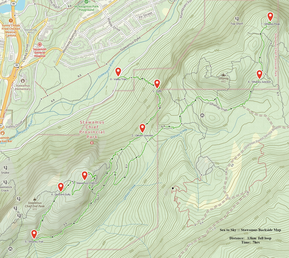 Stawamus Backside GAIA Map
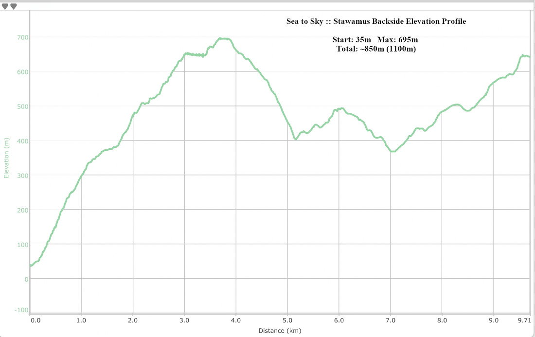 Stawamus Backside Elevation Profile