Google Map |
BC Coast :: North Shore :: Lynn Lake |
GPS Track |
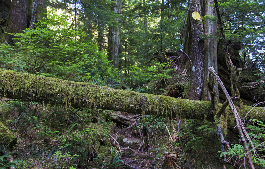
North end of Lynn Lake and trail end. Boulder slope and meadows on left side are nice spot for the break |
|||
| Trip Summary | |||
August 9, 2013
Lynn Lake trip is all about the journey. While ultimate destination is pretty and tranquil pond in deep valley under westerly ridge of Mt. Burwell, main attraction is the adventure to actually get there! Starting innocently enough on well trodden Headwaters trail conditions deteriorate significantly past Hanes junction around 8km mark. Travel is challenging, but beautiful - old growth forest, deep emerald pools of Lynn creek and rugged terrain that feels very remote right on outskirts of major metropolitan city! Hike is definitely not for beginners; terrain is demanding and route-finding skills are essential. Hikers got lost in the past and needed rescue. GPS is essential, but be ware that Lynn valley is narrow and you often lose satellite reception. Optimal time is second part of summer when water level of Lynn creek has dropped enough to make travel in upper part when you must walk in creek bed feasible. In spring this creek is often raging torrent making this part impassable and dangerous. Winter trip might be possible, but Headwaters trail is officially closed past Norvan creek bridge till spring. Trip undeservedly gets bad rap in some circles; with right set of mind it is very enjoyable excursion in the heart of North Shore wilderness.
Park at top of Lynn valley road in North Vancouver. Parking lot is small and fills fast even on weekdays - you might have to park further down the road, or even before the gate. Note posted gate closing time; if your car is left past the hours, RCMP and S&R will be notified! Voluntary registration at trailhead kiosk is good idea if venturing so deep into back-country. Follow wide Headwaters trail (initially gravel road) for 4km to 3rd Debris Chute, then transfer up and continue for ~40min to Norvan creek bridge just past Coliseum mountain junction. Norvan Falls are brief side trip but better done early in spring when there is lots of water; in summer when Lynn lake conditions are optimal, these falls will be just a trickle. Continue for another 1km to Hanes Valley junction. Lynn Lake trail continues straight and park table warns you about challenging conditions lying ahead. Very steep and rough slope must be climbed soon after the junction - this bit is quite awkward when wet, specially coming down. Flat stretch is then followed by descent to Lynn creek level. This is the crux - for next 45 minutes to an hour there is no trail and you must travel in creek bed. (Note well this spot to be able to pick-up the trail on the way back). Further up there are several braided channels, but orange flags indicate the easiest direction. Eventually the valley opens up a bit and you arrive to section with deep emerald pools that will cool you down on a hot summer day. Watch for flags near small waterfall on the right side. Leave the creek bed and find the trail heading up towards the lake. Grade is initially quite steep with several scrambly bits, but eventually it eases up and crosses bit of boulder slope and marshy meadows before arriving to south end of the lake -- about 40 minutes since you left Lynn creek. Walk to far end of the lake where trail disappears and marks the turnaround point.
Continuing past Lynn lake is possible, but is beyond realm of most people. Flagged route starts few minutes beyond the lake and eventually leads to Mt. Burwell from where it is possible to form a loop by returning via Coliseum mountain back to Headwaters trail. This is extremely long, difficult and hazardous undertaking which can not be recommended. |
|
Gallery |
|||
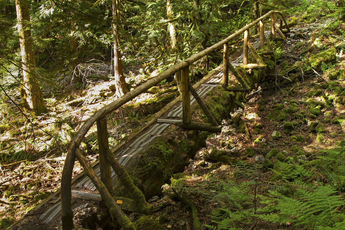 Log bridge along Headwaters Trail near 6km mark
 |
|||
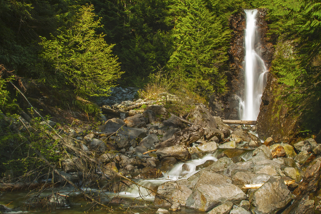 Norvan Falls just past Coliseum junction - brief side trip
 |
|||
 Hanes Valley junction. Lynn Lake trail continues straight
 |
|||
 Looking back at point where trail drops to Lynn creek
 |
|||
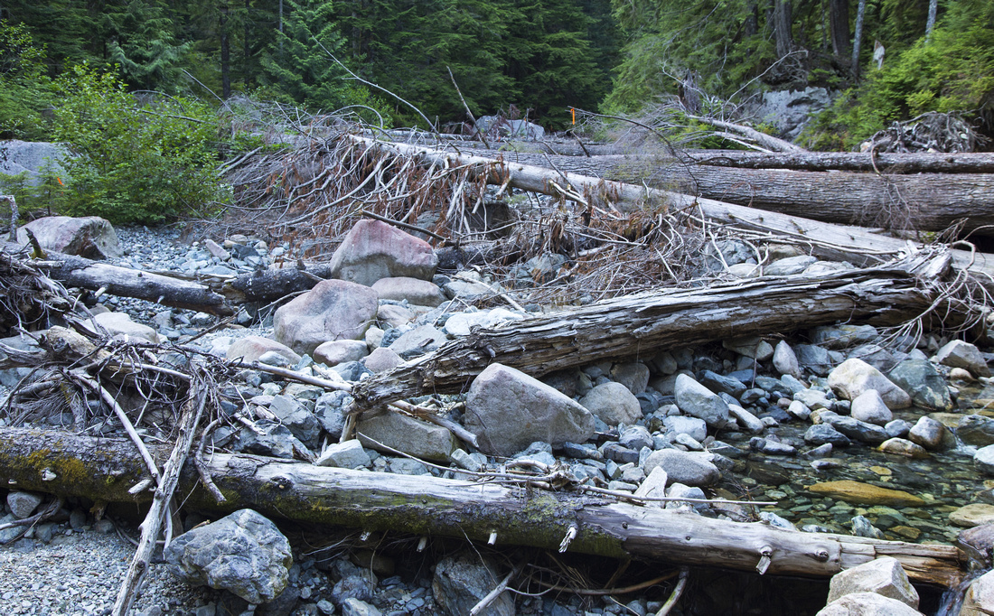 Typical travel in Lynn creek bed. Water level MUST be low
 |
|||
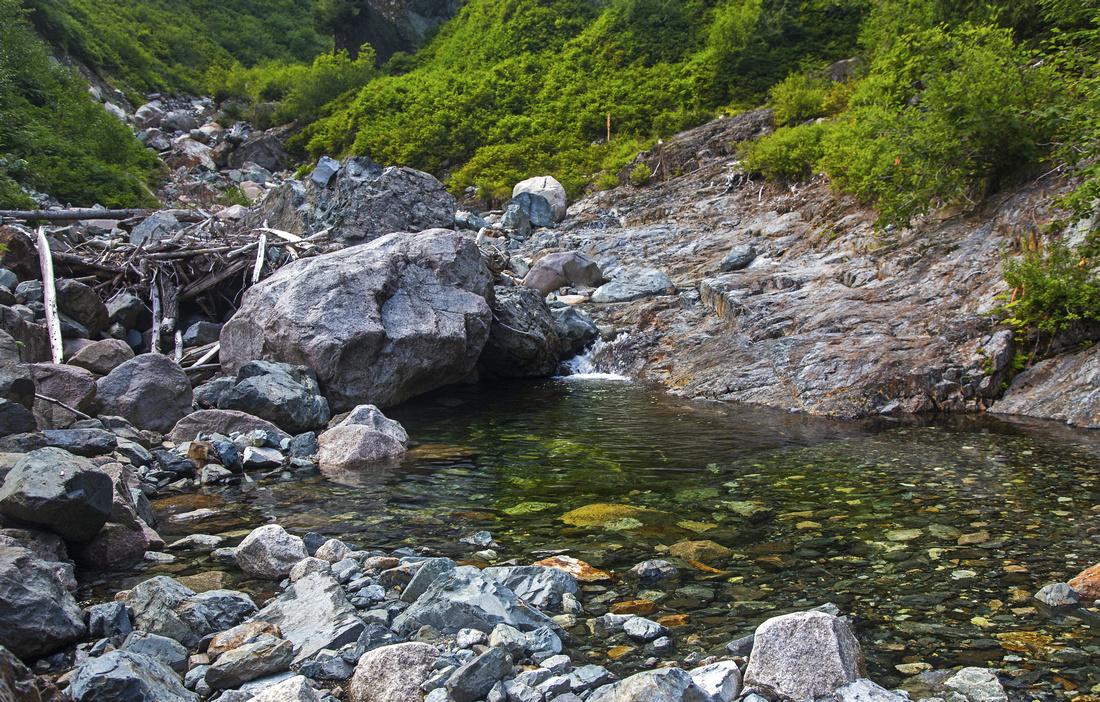 Pretty emerald pools in upper parts of Lynn Creek
 |
|||
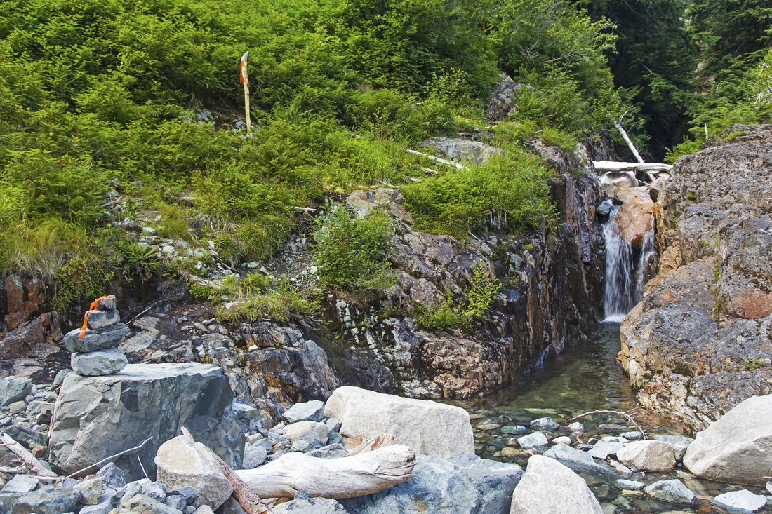 Trail resumes and leaves the creek bed by the flag
 |
|||
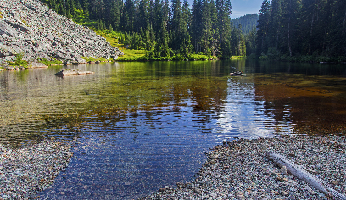
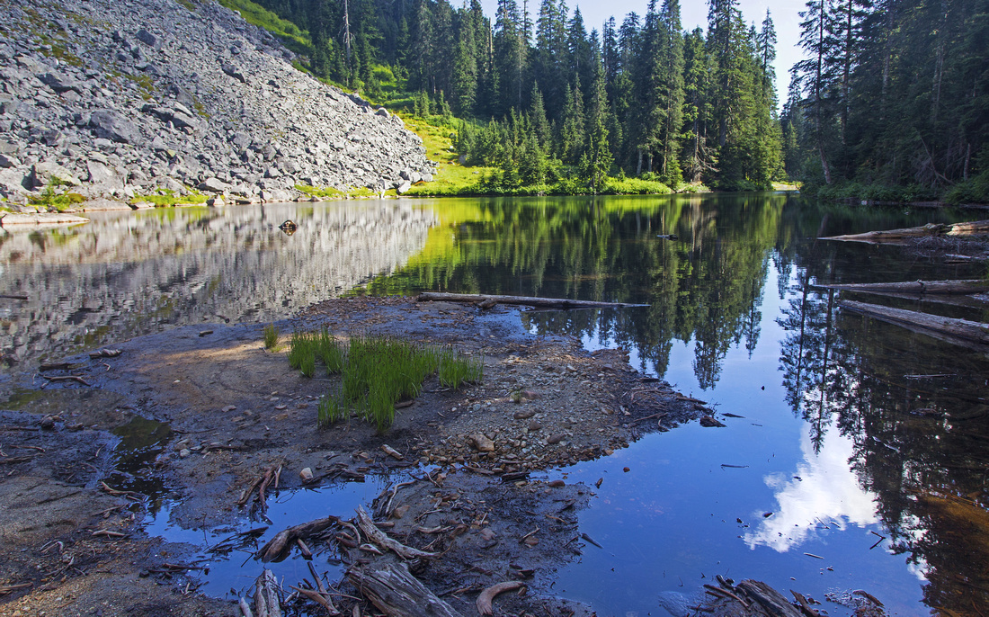 Final destination - north shore of Lynn lake
 |
Abstract
| Overall Difficulty | D6 | Rough back-country route. Very challenging travel in Lynn creek bed. Two steep sections | |||
| Snow Factor | S4 | Trail beyond Norvan Falls closed in winter. Treacherous steep slope past Hanes junction | |||
| Scenery | Pretty waterfalls and pools in Lynn creek bed. Pristine and tranquil lake. Pen-ultimate North Shore wilderness | ||||
| Trail/Marking | Poor / Good | Well defined trail to Hanes Junction, rough route afterwards. No trail in creek bed. Well marked with yellow squares and flags | |||
| Suggested Time | 8-9hrs | Return time from Lynn Headwaters, assuming low level in middle section of Lynn creek | |||
| Elevation | Start: 200m Max: 800m Total: ~800m | Round Trip: ~26 km | |||
| Gear | Full hiking boots (ankle support is important). Poles and gaiters are recommended. GPS is essential | ||||
| Water | Lynn creek and tributaries. Carry 1L | ||||
| Dog Friendly | Yes | Standard Lynn Headwaters restrictions - Dogs must be leashed and under control | |||
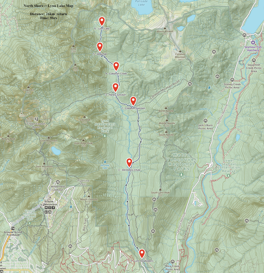 Lynn Lake GAIA Map
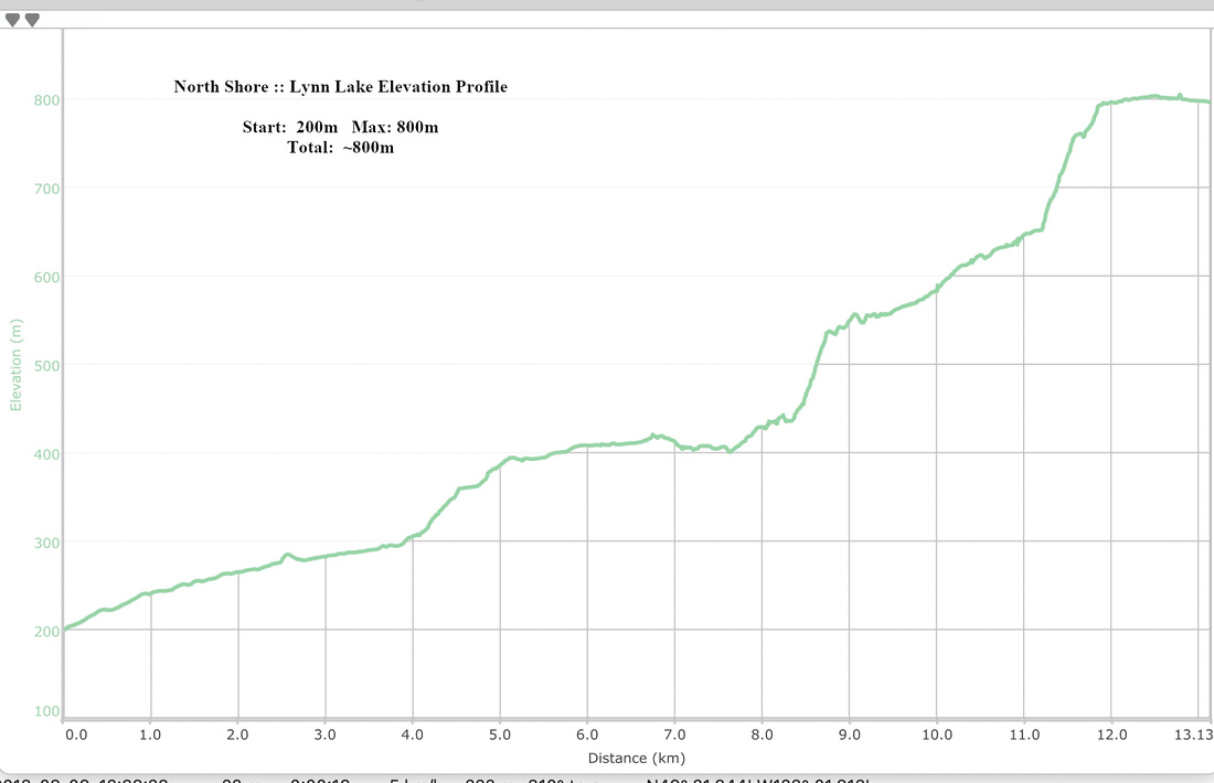 Lynn Lake Elevation Profile