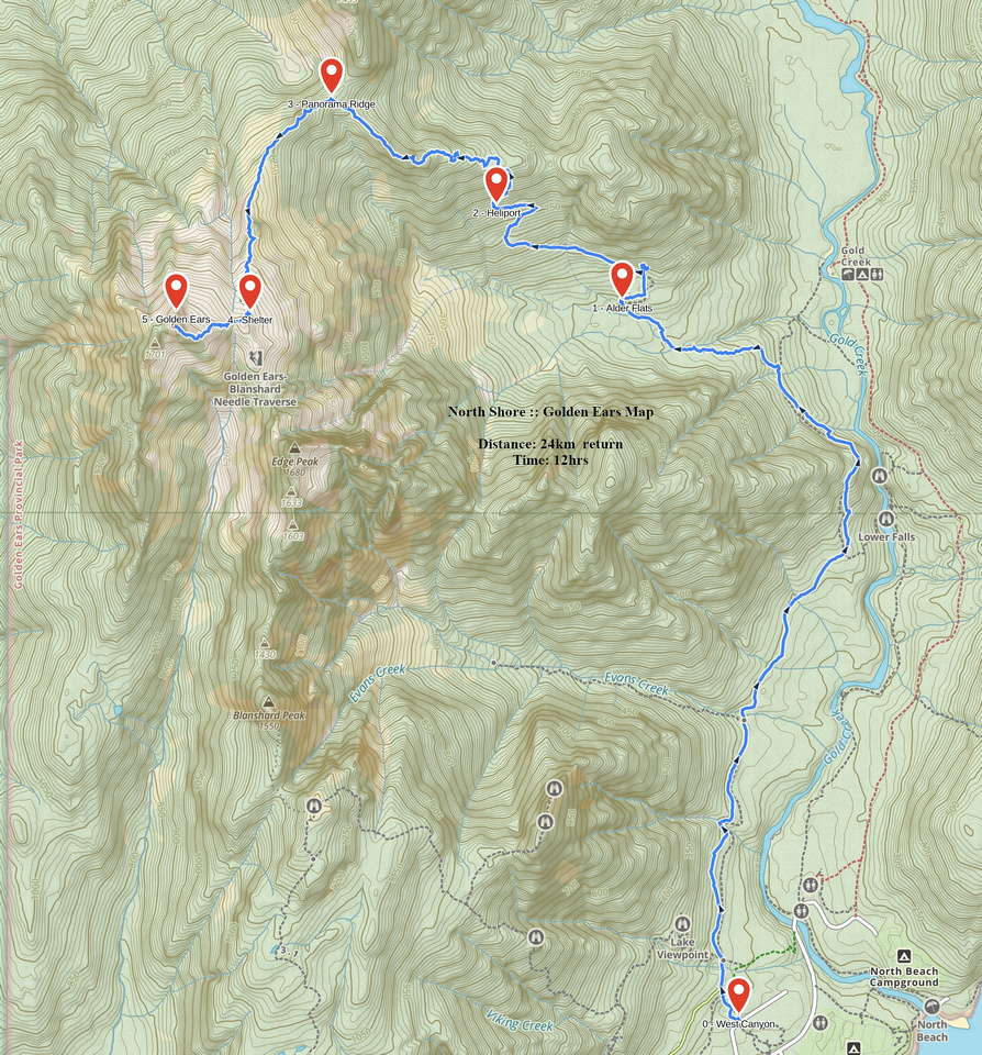
Google Map |
BC Coast :: North Shore Mountains :: Golden Ears |
GPS Track |
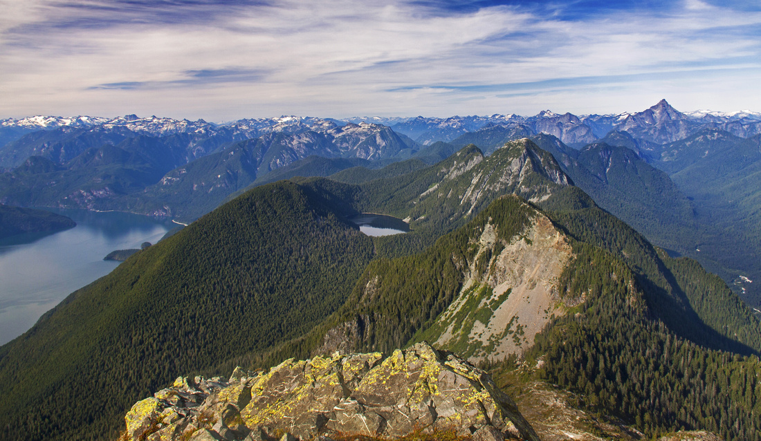 
Summit view north. Pitt lake left, Raven lake center. Gold creek leading to distant Judge Howay far right |
|||
September 3, 2010
According to statistics Golden Ears Provincial Park -- sometimes called "Golden Earies" -- is between top 4 most visited in British Columbia. Summit trail is one of the most popular in North Shore mountains. It is no surprise: Summit "ears" look spectacular when seen on a clear day driving along the Coquitlam Highway. But it is not an easy outing as overall distance and elevation gain are considerable. It is doable as day trip, but some people backpack to Alder Flats then launch summit bid the next day from there. Panorama ridge leading to base of twin summits has Emergency Shelter - but it is just what the name says, and not designed for overnight camping. This is mainly summer trip because of challenging and sometimes even dangerous winter conditions in the final part above the shelter. Besides Alder Flats there are also several other campgrounds by Alouette Lake along the main park artery. Always check the posted gate closing time heading into the park in order not to get yourself locked out.
|
| West Canyon to Alder Flats | GPS Track | |
|
First part of standard Golden Ears trail, West Canyon is sometimes hiked on its own -- either when weather conditions are not optimal for summit bid, or there is simply not enough time or energy. Some people also overnight at Alder Flats then complete the ascent the following day. Trail is reasonably short -- 6km each way -- but not entirely a cakewalk. It has 3 distinct parts:
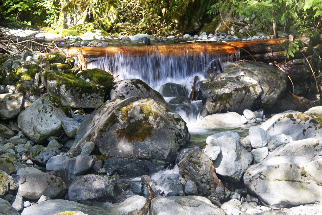
Park at West Canyon trailhead (exit on left side of main park road, shortly after surface turns from paved to gravel). Follow old logging road passing Alouette Viewpoint trail junction and crossing of Evans Creek on a good bridge near 2km mark. At 3 km mark side trail descends right to new bridge over Gold Creek. Continue straight on main trail and climb steeply over a rise then contour the shoulder to Gold Creek Viewpoint near 4km mark and descend with help of rope to the other side. Trail soon heads away from Gold Creek and enters boggy area with planks - mind your step as they might be in various states of disrepair! Final bit to the Flats includes crossing couple of creeks -- two are usually bridged, but last one might involve (easy) rock hop. Recommended extension is to continue to Edge Mountain viewpoint some 15 minutes above Alder Flats. Golden Ears trail climbs up to the right past the outhouse, then soon exits to logging road coming in from the Gold Creek. Funny table reads "Gold Creek - descent into madness", if going downhill in that direction. Viewpoint is some 5 minutes above the junction and includes good look into "White Dyke" route climbers sometimes take as approach to Edge Mountain.
Return the same way. Since construction of bridge over Gold Creek scenic option is side-trip to Upper Falls on East canyon trail. Note that if you decide to return via East Canyon trail, you will have to walk access road for 15-20 minutes back to West Canyon parking lot. |
||
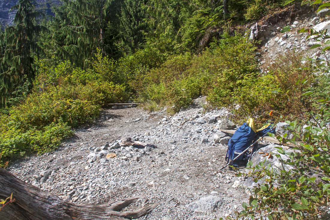
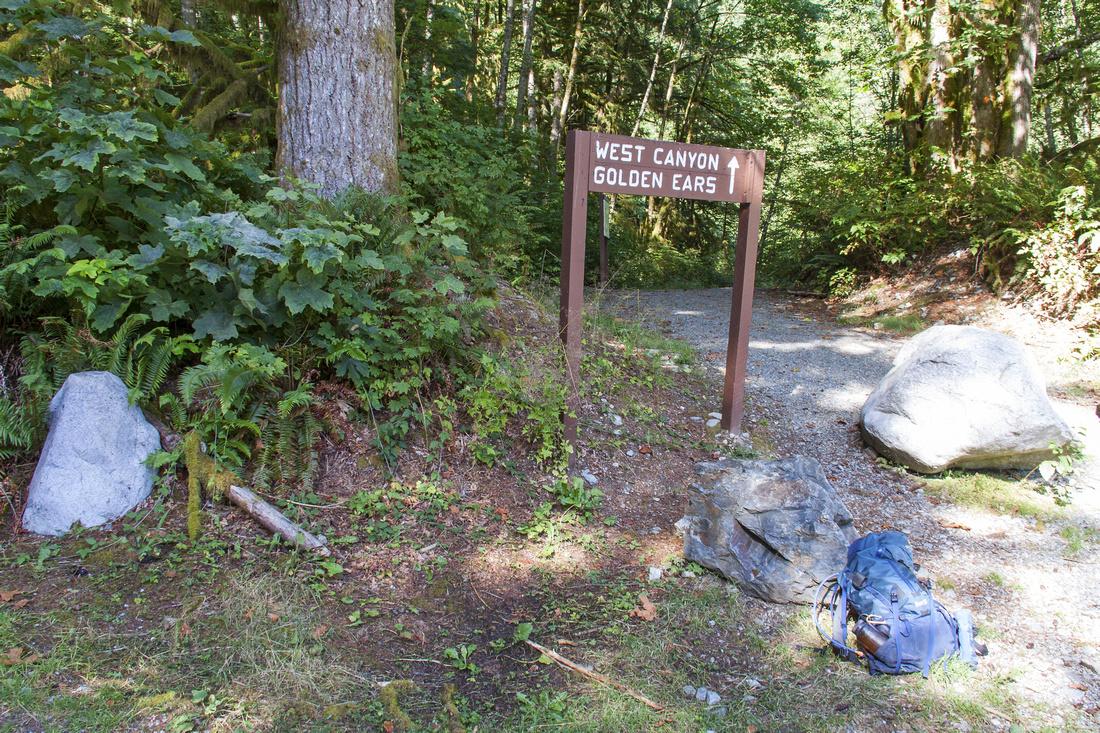 West Canyon Trailhead
 |
|||
 Evans Creek Crossing
 |
|||
|
|
|||
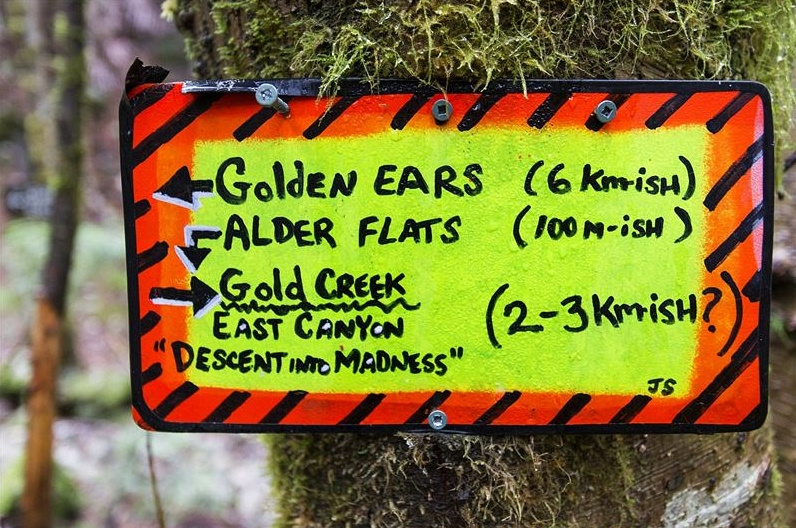 Colorful Table at junction with old logging trail coming from Gold Creek just above Alder Flats. It has been taken down in the meantime
 |
|||
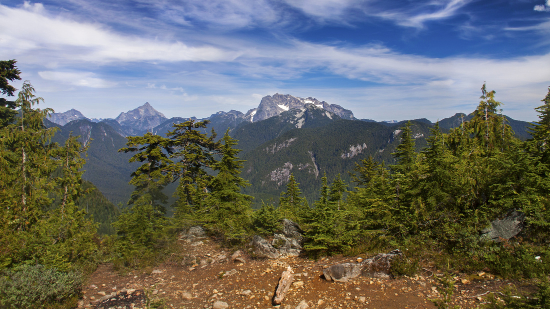
 Edge Mountain viewpoint above Alder Flats
 |
Abstract
| Overall Difficulty | D3 | Steep sections with roots and rocks, but mainly trail hiking except for one brief part near "Gold Creek Viewpoint" | |||
| Snow Factor | S2 | Due to low elevation trail will be snow free most of the year, but expect slippery/wet sections | |||
| Scenery | Gold Creek and old growth forest. Good views of Edge Mountain from the flats and viewpoint 15 minutes above | ||||
| Trail/Marking | Very Good | Well defined and marked trail. Sections with planks across the bog nearing the flats | |||
| Suggested Time | 5 hrs | Return time including extension to Edge mountain viewpoint | |||
| Elevation | Start: 150m Max: 550m Total: ~650m (return) | Round Trip: 12 km | |||
| Gear | Day hikers are sufficient. Consider hiking poles for stability on steeper sections of the trail | ||||
| Water | Gold Creek and other streams. No need to carry more than 0.5L | ||||
| Dog Friendly | Yes | Please keep dogs under control, specially around the Alder Flats campground | |||
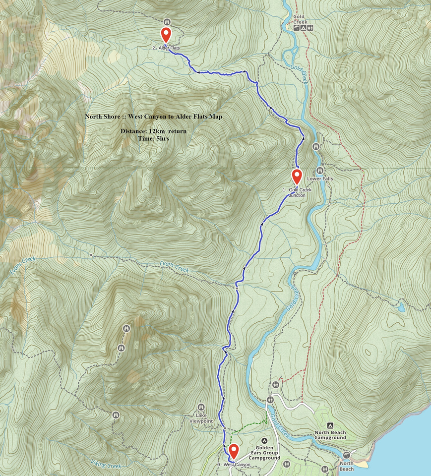 West Canyon to Alder Flats GAIA Map
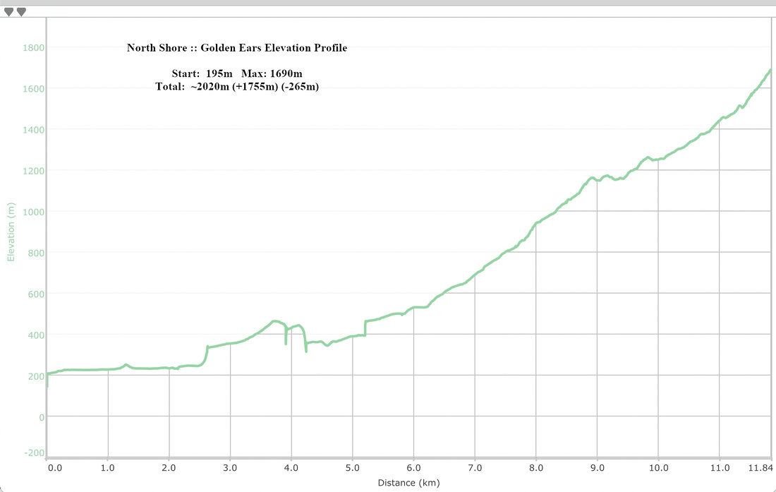
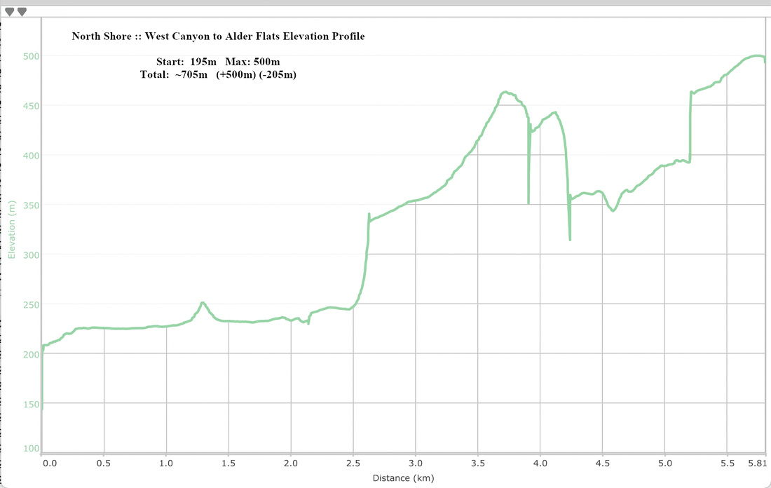 West Canyon to Alder Flats Elevation Profile
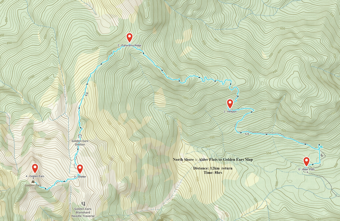
| Alder Flats to Golden Ears | GPS Track | ||
|
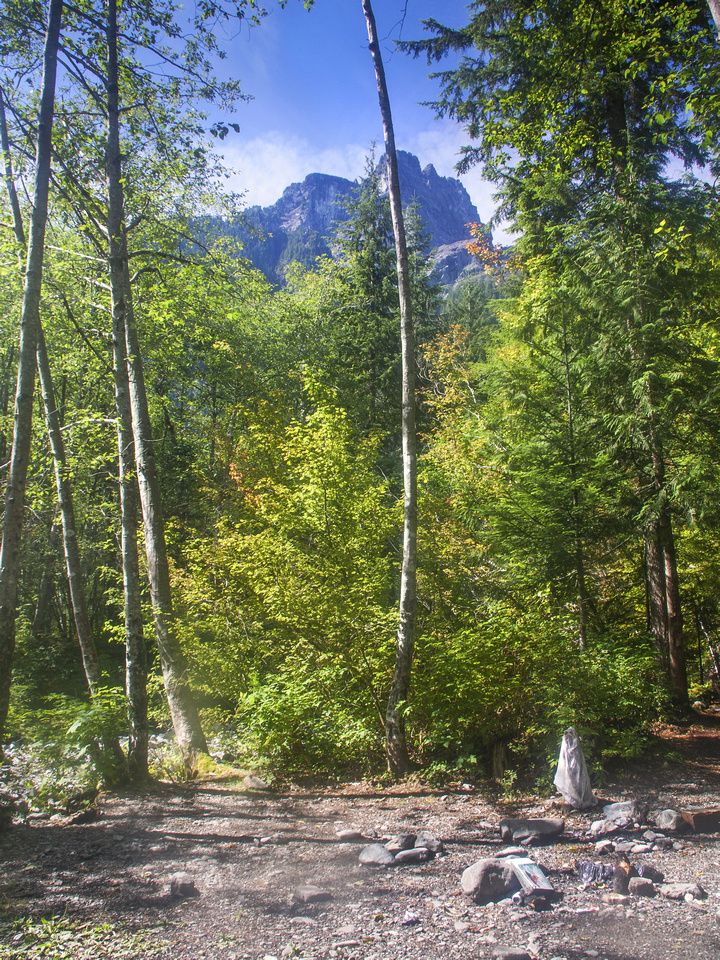
Past Edge mountain viewpoint above Alder Flats, trail continues along rough deactivated logging road / creek bed in westerly direction. Going is fairly tedious but not steep. In about 30-40 minutes past the viewpoint is the clearing and site of old helipad. This is the critical point to recognize both on ascent and return. Trail turns sharp right and ascents steeply; watch for flag, as the start is not obvious. In about five minutes is potentially confusing part - junction, with both sides equally defined. Going left might be more logical, but this branch soon deteriorates and eventually fades away. Right branch is the correct one and climbs steeply above fallen logs, rocks and roots for next hour or so to low point of Panorama Ridge. You gain about 500 vertical from the helipad in this part till grade eventually eases up.
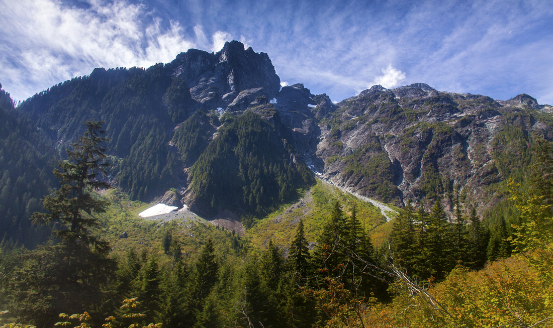
Scenic part now starts, and there are several open viewpoints with good views north towards far reaches of the park - as well south-west, towards your destination. Forest is now semi-open, and North Ear comes in the view. Going is still fairly tough as there are several short bluffs that must be navigated. At one part there is fixed wood ladder that is not entirely necessary, but sure feels welcome! Above flagged trail curls left and exits above treeline. Views of Pitt Lake and other distant peaks to the west greet you. This is an excellent point for a break, as there is still almost two hours to the summit. Trail follows spine of the ridge then climbs through short cliffs towards the shelter perched at pretty good viewpoint. Water sometimes can be found on the right (west) side -- couple of side trails lead in that direction. People sometimes bivi near the shelter which results in annual garbage clean-up by park volunteers; please practice "leave no trace" policy!
Above the shelter trail disintegrates but direction is generally obvious. Navigate short boulder field then aim in direction of permanent snow field above. Upper part is fairly steep and might require an ice-axe. Alternatively, it is possible to avoid the snow completely on the left side - although this leads to traverse of semi-exposed ledge, where fall would likely be fatal. Above the snow is the col with good excellent views of Edge mountain. It is hard to believe some people complete Blanchard Needle - Edge - Golden Ears traverse in a day! Turn right and ascend to the summit in about 15 minutes from the col. There are couple of scrambly bits, but nothing harder than class 2. Finally exit to the summit which is wide and on a clear day sports views to die for! If you day-hiked from West Canyon sobering fact will be that cumulative elevation gain was ~1900m - which you now must descend, with tired muscles! If you still have energy though, excursion to lower South Ear is worth-while. Carefully descend to the saddle between two summits then scramble up - takes about 15-20 minutes (1 way). |
|||
 Logging road end. Trail turns sharp right and heads steeply up. Note rest bench just left of center
 |
|||
 Views north to Judge Howay (L) and Robbie Reid (R)
 |
|||
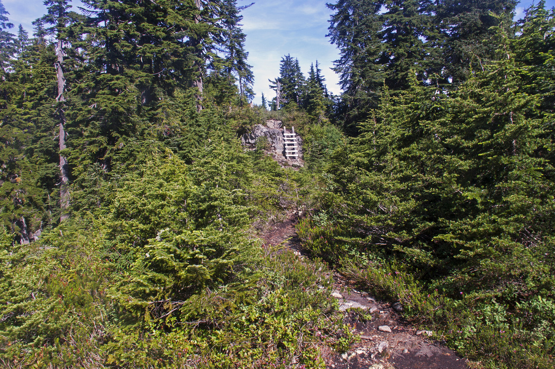 Typical section at start of Panorama Ridge. Note ladder
 |
|||
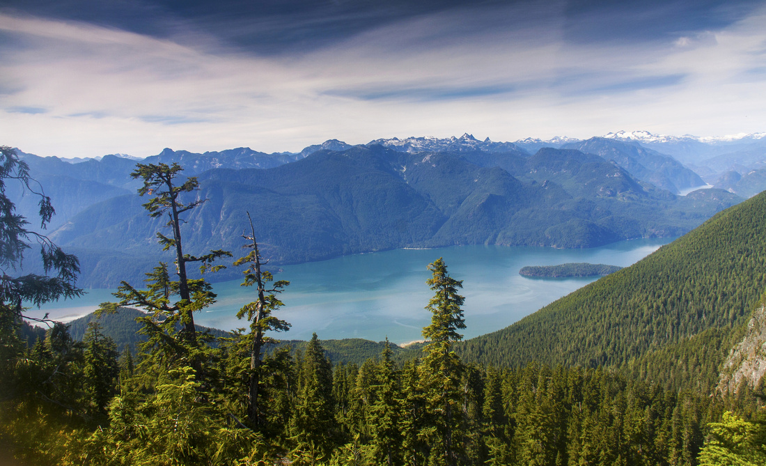 View of Pitt Lake from Panorama Ridge
 |
|||
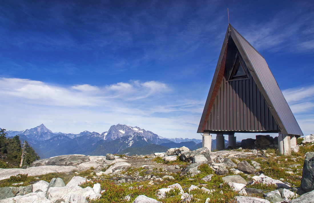 Golden Ears Emergency Shelter. Summit is ~1hr away
 |
|||
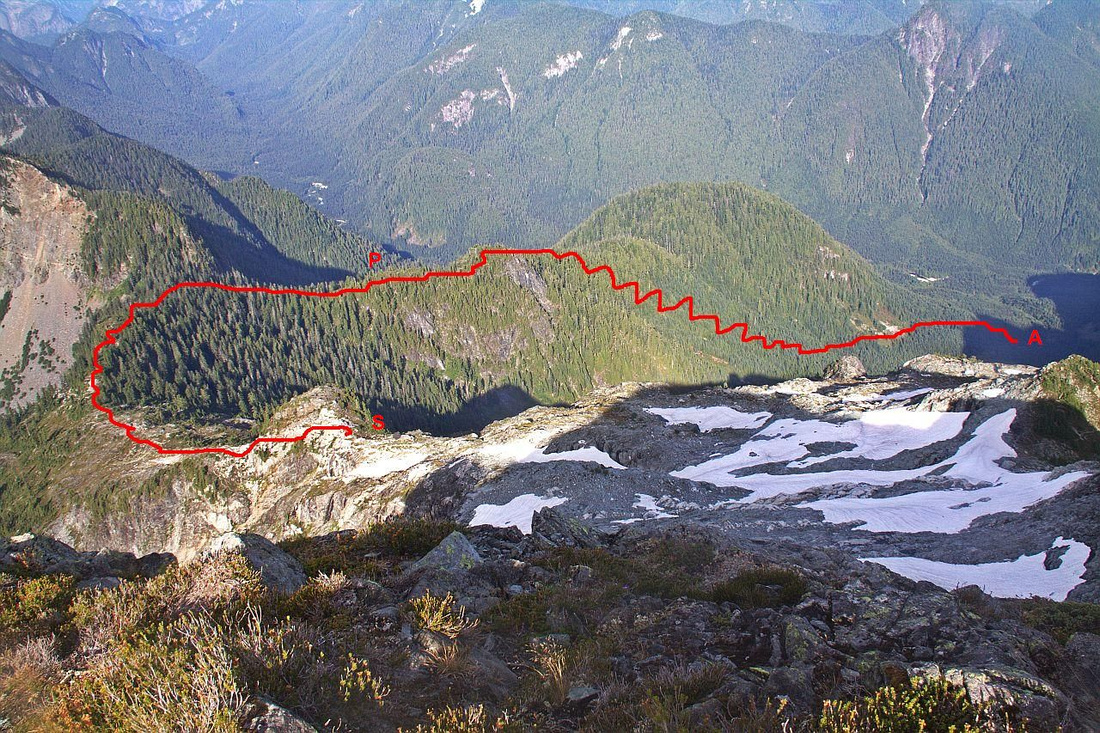 View back below Edge col. Red line indicates approximate ascent route: "A" - Alder Flats, "P" - Panorama Ridge, "S" - Emergency Shelter
 |
|||
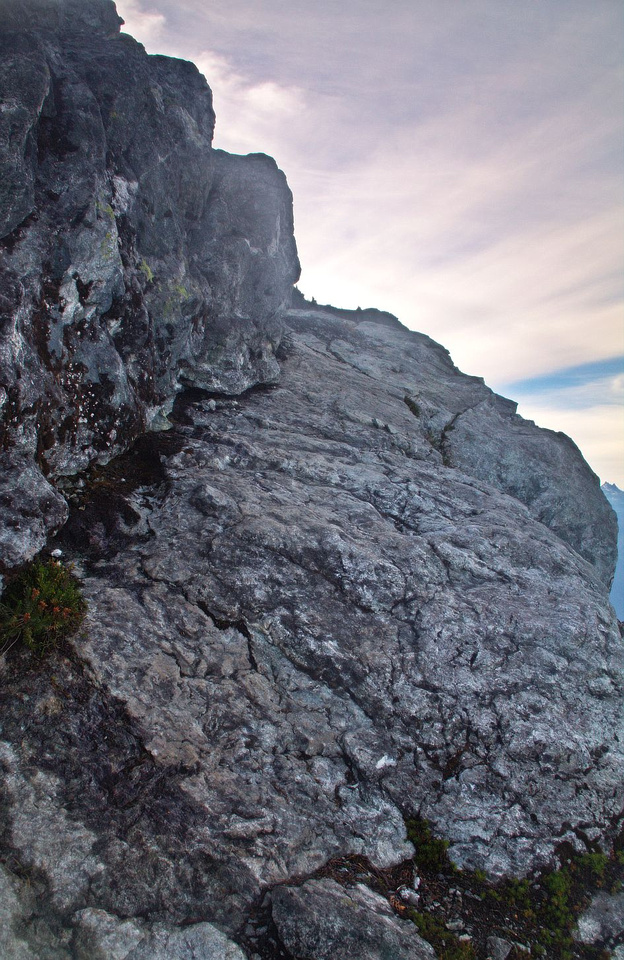 Crux corner just before the col. Ledge is quite wide, but drop on climber right is exposed
 |
|||
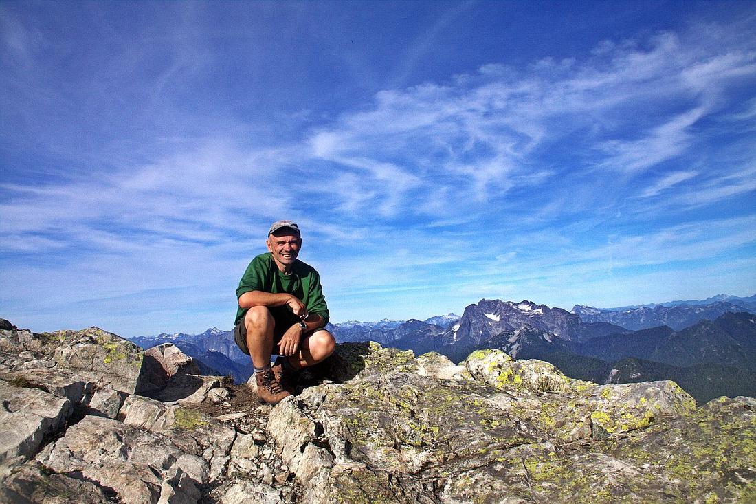 Self-timed shot on the Summit!
 |
|||
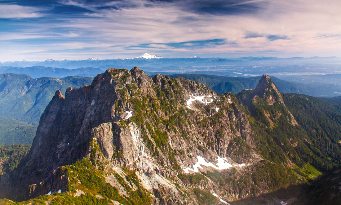 Edge Mountain and Blanchard Needle
 |
|||
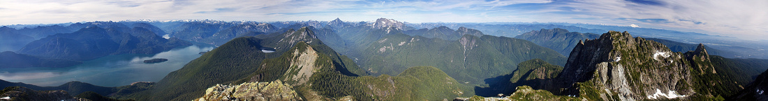 Wide Panoramic shot from the summit. Pitt Lake left, Edge/Blanchard far right
 |
|||
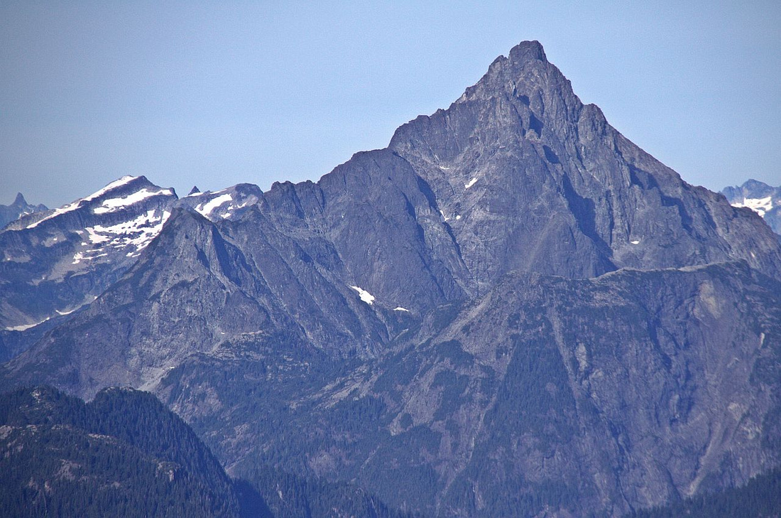 Telephoto of "unclimbable" Judge Howay
 |
|||
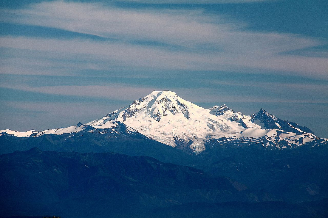 Distant Mt. Baker in Washington
 |
|||
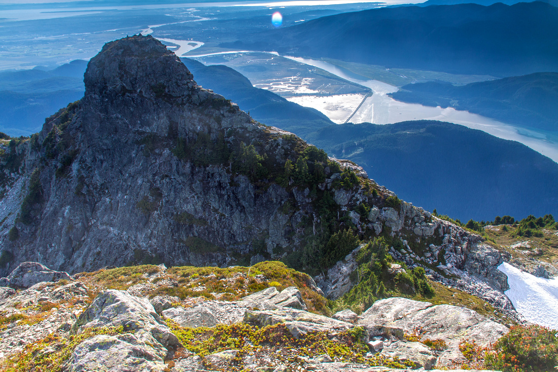 Lower South Ear from the summit is 15-20 min away
 |
Abstract
| Overall Difficulty | D6 | Very steep and rough sections with several bluffy parts. Class 2 rock scramble about Edge col to the summit of North Ear. | |||
| Snow Factor | S4 | Permanent Snowpatch above Emergency Shelter. Ice-axe suggested. Winter trip not realistic due to short daylight | |||
| Scenery | Spectacular views from Panorama Ridge. Far reaching views to north end of the park, including giants like Judge Howay. Fraser Valley and distant Mt. Baker from the summit | ||||
| Trail/Marking | Good | Reasonably well defined trail fades at Panorama Ridge; sporadically flagged route above Emergency Shelter. | |||
| Suggested Time | 7-8 hrs | Return time to Alder Flats. Add ~4 hrs for total of 12 hour day if day-hiking from West Canyon | |||
| Elevation | Start: 500m Max: 1690m Total: ~1300m | Round Trip: 12 km (24 km for West Canyon) | |||
| Gear | Full hiking boots are recommended. Hiking poles are essential. Ice axe suggested. | ||||
| Water | Mainly dry after Alder Flats, but water can sometimes be found on west side of Emergency Shelter. Snowmelt. Carry 3-4L | ||||
| Dog Friendly | Yes | Keep in mind things like bears and general lack of water source. Final bit from Edge col should not be problematic | |||
 Alder Flats to Golden Ears GAIA Map
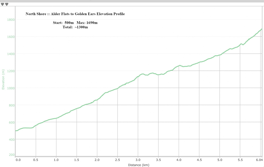 Alder Flats to Golden Ears Elevation Profile